10.7
FIETS
15.9 mi
DISTANCE
4,892 ft
GAINED
5.8 %
AVG. GRADE
FULL CLIMB STATS
Page Contributor(s): Ron Hawks, Las Vegas, NV, USA; Stacy Topping, Tacoma, WA, USA; Bruce Hamilton, LaQuinta, CA, USA
INTRO
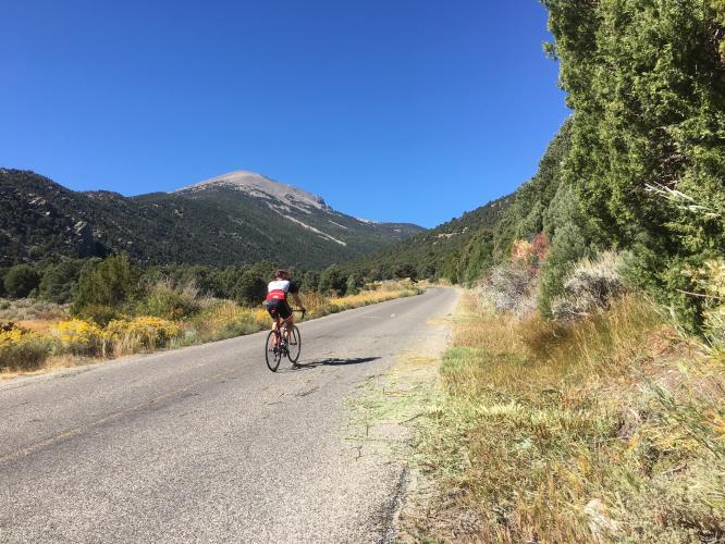
The Wheeler Peak cycling climb is in a very remote area in Great Basin National Park and starts just 4.5 miles from Nevada's border with Utah in the small town of Baker, NV (pop. 68 as of 2010). Wheeler Peak is the second tallest peak in Nevada and the tallest independent mountain in the state. This is a US 100 Top Bike Climb.
"One of the most isolated of America's great climbs, Wheeler Peak is also one of the most difficult in Nevada and perhaps its most spectacular. A very straight and shallow start greets you up this hill with excellent views of massive and usually snowcapped Wheeler Peak within isolated and unique Great Basin National Park..." (This quote is presented with the approval of John Summerson, from his book, The Complete Guide to Climbing (by Bike), 2nd Edition, pg. 194.)
Average grade of 5.8% gaining 4,880' in 16 miles - 65% of the climb is at grade 5-10%. The steepest quarter-mile is 9.9% and steepest mile 8.4%.
See more details and tools regarding this climb's grade via the “Profile Tool” button.
Roadway: The pavement is good throughout the climb but there are expansion cracks (ruts across the road) at the upper levels which can be irritating. This is a two lane road with a center stripe and no shoulder. You can check out the weather and road conditions for Great Basin National Park here.
Traffic: Minimal - this is the tenth least visited national park with a mere 131,802 in 2019 (contrast that with Great Smoky Mountains NP's 12,000,000+).
Fee: There is no fee to enter Great Basin National Park as of 2020.
Parking: In the small town of Baker at the start of the climb - Map; Street View.
Provisions: In Baker at the start of the climb, and water is available at Lehman Caves Visitor Center.
Gear and Weather: You climb from 5,000' to 10,000'+ so do consult the PJAMM "Full Forecast" feature for the time you expect to arrive at the finish to assess what clothing to bring on your ride.
Before heading out on any cycling adventure check out our Things to Bring on a Cycling Trip and use our interactive check list to ensure you don't forget anything.
Stay in Baker and visit the National Park - Things to do in Great Basin National Park.
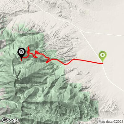
ROUTE MAP
MEMBER RATING
CURRENT WEATHER
PJAMM TRIPS ADVENTURE STARTER BUNDLES
Check out PJAMM Adventure's prepackaged (self-guided) cycling trips. They will help you plan, document and conquer your next adventure.
NEARBY CLIMBS (0) RADIAL PROXIMITY
FROM No Climbs Found
MEMBER REVIEWS & COMMENTS
Let us know what you thought of this climb. Signup for our FREE membership to write a review or post a comment.
Already have an account?
LOG IN HERE
Skotscott
July 8, 2023
From baker (92°) up to the visitors center then a short cool down decent to the Wheeler Peak rd. A nice gradual climb through gorgeous scenery and fantastic views. No steep sections but there are some moderate, stand-up sections for sure. Nice and cool at the top with a short decent to a campground with water and restrooms. Fast decent on a good road but pay attention - some dips and bumps in the tree shadows will get your attention.
jeffbeard
Definitely a "hidden gem". Relatively consistent grade made it easy to drop into a groove. The ride was challenging but not overly so, and so it was very fun. I've ridden harder climbs with lower FIETS ratings. :shrug:
Traffic was light and I had the road to myself most of the time. Drivers gave plenty of space. Road surface is good chip-n-seal.
Fall is a great time since the foliage is beautiful and temps are cooler.
Also, I wouldn't recommend this ride for agoraphobics; lots of very expansive views.
Coachstevo1
Did this one back in sept 2015, really fantastic. Aspens were gold, air was crisp to start, but hot back at base at end. Reminded me of some of the Eastside of Sierra climbs


