![Cycling Mt. Pisgah, Route 151, North Carolina Cycling Mt. Pisgah, Route 151, North Carolina - sign for "Parkway Through Pasgah National Forest, Next 48 Miles"]()
Cycling Mount Pisgah from Pisgah Highway to Blue Ridge Parkway, North Carolina
Ride 5.9 miles gaining 2,166’ at 7% average grade.
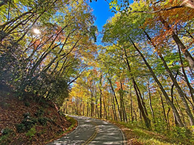
This is a two-fer -- you get two OUTSTANDING climbs in one. We cannot praise this route enough. The first 3.8 miles are on a very fun and scenic, narrow, and steep road through thick forest to the Blue Ridge Parkway. The last two miles are on the incomparable Blue Ridge Parkway. It just doesn’t get any better than this. 👍👍
![Cycling Mt. Pisgah, Route 151, North Carolina Cycling Mt. Pisgah, Route 151, North Carolina - photo collage, PJAMM Cycling logo in corner, signs for Blue Ridge Parkway, Mt. Pisgah, dense forestation]() :
:
“151 is a great and scenic climb along a steep grade through thick trees up to the Blue Ridge Parkway near Asheville, NC. Most of its route is very twisty (3.8 miles at 8%). At the Parkway turn right and climb for another 2.3 solid miles through 2 short tunnels to the Mt. Pisgah parking area.” (This quote provided with the approval of John Summerson from his book, The Complete Guide to Climbing (by Bike) in the Southeast, pg. 93.)
![Cycling Mt. Pisgah, Route 151, North Carolina Cycling Mt. Pisgah, Route 151, North Carolina - signs at climb start]()
Climb start -- Mount Pisgah Highway (Route 151).
![Cycling Mt. Pisgah, Route 151, North Carolina Cycling Mt. Pisgah, Route 151, North Carolina - PJAMM Adventure App shows climb grade and profile]()
PJAMM Adventure App at with stats at climb start.
![Cycling Mt. Pisgah, Route 151, North Carolina Cycling Mt. Pisgah, Route 151, North Carolina - looking up from a 35 MPH sign to the dense fall foliage tree cover above]()
![Cycling Mt. Pisgah, Route 151, North Carolina Cycling Mt. Pisgah, Route 151, North Carolina - photo collage,
dense fall foliage surrounding one-lane roadway, PJAMM Cycling logo in corner]()
Views on Mt. Pisgah Highway.
![Cycling Mt. Pisgah, Route 151, North Carolina Cycling Mt. Pisgah, Route 151, North Carolina - dense fall foliage surrounding two-lane roadway]()
Views along Blue Ridge Parkway.


