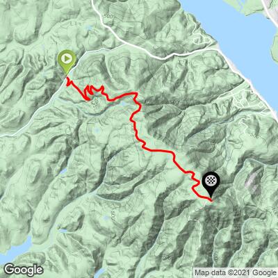
2
FIETS
4.4 mi
DISTANCE
1,267 ft
GAINED
5.2 %
AVG. GRADE
FULL CLIMB STATS
INTRO
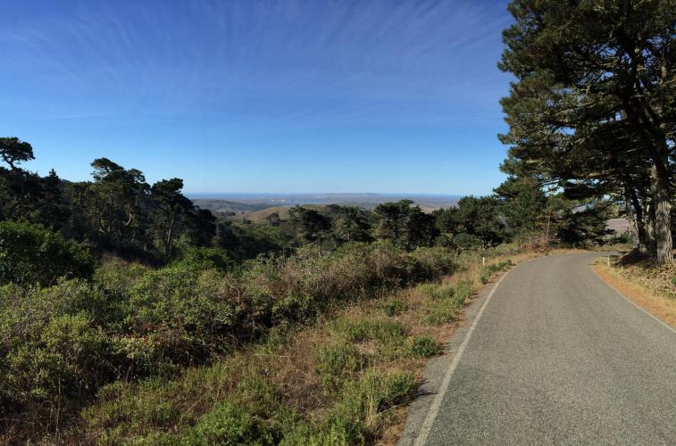
This is an "outlier" climb by Marin County standards - only 1,030 Strava segment attempts as of August 29, 2015 versus over 30,000 for climbs closer to "civilization" and the very popular Mt. Tam routes. However, this is an enjoyable and unique climb in a remote area of Marin where you are likely to encounter no one during your 4.4 trek to the top. There are great views of the Pacific Ocean and coastline to the west and one spot where we have a great view of Napa County's Mt. St. Helena some 50 miles north.
5% average grade (6.1% climb only). 13% of the route is descent, 36% is in the 0-5% grade range, 40% is at 5-10%, and 11% is at 10-15% grade. The steepest quarter-mile is 10.2%.
See more details and tools regarding this climb's grade via the “Profile Tool” button.
Roadway: One lane paved path in good condition. The last half-mile is past a cable across the road, but the path is open to walk and ride.
Traffic: 0 to minimal.
Parking: On the left side of the road 30 yards up the hill from the start (Map; Street View).
Provisions: There are many options in Point Reyes, eight miles south (Map).
Before heading out on any cycling adventure check out our Things to Bring on a Cycling Trip and use our interactive check list to ensure you don't forget anything.
This is an outlier of Marin County climbs. Do stop in Point Reyes something to eat - there are many great options in this quaint coastal tourist town (Google Map + Reviews).
Use the “Routes in Area” button on the menu bar to see other bike climbs in this area.
ROUTE MAP
MEMBER RATING
CURRENT WEATHER
PJAMM TRIPS ADVENTURE STARTER BUNDLES
Check out PJAMM Adventure's prepackaged (self-guided) cycling trips. They will help you plan, document and conquer your next adventure.
NEARBY CLIMBS (0) RADIAL PROXIMITY
FROM No Climbs Found
MEMBER REVIEWS & COMMENTS
Let us know what you thought of this climb. Signup for our FREE membership to write a review or post a comment.
Already have an account?
LOG IN HERE
lirizar1
Good luck finding this climb as there are no signs! Once you do however, the first mile has very rough road conditions but manageable. The first two miles are a series of kickers around each curve with 10-15% grade but then it levels off to around 7% to recover. Last two miles are a mild climb. Scenery is beautiful throughout with almost no cars (saw 3 cars the whole climb and decent) and it feels extremely relaxing and calming to be up there off the beaten path. Grab your gravel/ mountain bike and enjoy the views or do it on a road bike and brace for a bumpy decent!


