4.6
FIETS
11.6 mi
DISTANCE
2,930 ft
GAINED
4.7 %
AVG. GRADE
FULL CLIMB STATS
Page Contributor(s): John Summerson, The Complete Guide to Climbing (by Bike), 2nd Edition.
INTRO
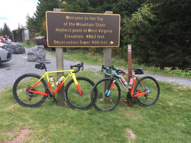
This extraordinary ride takes us to the highest paved location in West Virginia (and, with a brief hike, to the highest point in the state). At 4,863’, Spruce Knob is also the highest peak in the Allegheny subrange of the Appalachian Mountains. The Spruce Knob bicycle climb is located within the Monongahela National Forest (921,000 acres, includes much of the Potomac Highlands Region), within the Allegheny Mountains. This is also the hardest road bike climb in West Virginia.
4.7% average grade. 58% of the climb is at 0-5% and 35% at 5-10%. The steepest quarter-mile is 10% and steepest mile 9.2%.
See more details and tools regarding this climb's grade via the “Profile Tool” button.
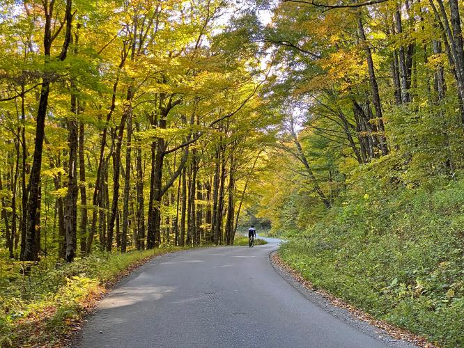
Roadway: The first 2.4 miles are on a two lane highway with no shoulder. The final and majority of the climb is along a very rural narrow two lane road with no center stripe or shoulder.
Traffic: Mild throughout the entire climb.
Parking: On the side of Highway 33 just before the start of the climb (Map; Street View).
Provisions: At Gateway Family Restaurant at the start of the climb.
Before heading out on any cycling adventure check out our Things to Bring on a Cycling Trip and use our interactive check list to ensure you don't forget anything.
Be sure not to make the mistake we did by missing out on a great hiking experience. Be sure to hike the brief distance from the parking lot at the finish of the climb to the observation tower at the highest point in West Virginia - it gets very high reviews on Trip Advisor - Spruce Knob.
Use the “Routes in Area” button on the menu bar to see other bike climbs in this area.
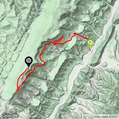
ROUTE MAP
MEMBER RATING
CURRENT WEATHER
PJAMM TRIPS ADVENTURE STARTER BUNDLES
Check out PJAMM Adventure's prepackaged (self-guided) cycling trips. They will help you plan, document and conquer your next adventure.
NEARBY CLIMBS (0) RADIAL PROXIMITY
FROM No Climbs Found
MEMBER REVIEWS & COMMENTS
Let us know what you thought of this climb. Signup for our FREE membership to write a review or post a comment.
Already have an account?
LOG IN HERE
KrisLJames262


Pristine road condition, amazing views, very little traffic. First 3 miles are VERY punchy then it levels off for the remainder of the climb until the last 1/2 mile which is 8% or so. Gorgeous fall colors over the tree lined roadway. We parked at the Riverton, WV post office which allowed for a roughly 2.5 mile warmup before the start of the official climb.


