![]()
Yes - it’s a beast!
![]()
The climb begins adjacent the church on Main Street.
![]()
Start of climb.
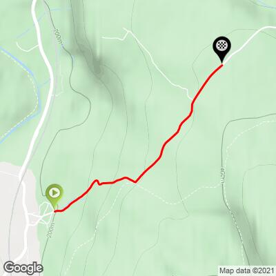
This one is a tale of two climbs. The first 1.1 km is brutal at 13% average grade followed by 700 meters at 2% and finishing with 200 meters at 7.2%. Overall the climb is 2 kilometers at 8.6% average grade.
![]()
Start of steepest ½ km (15.5%)
There are many ancient stone walls along the road and pastures bordering the road - they are very scenic.
![]()
Stones are put to good use in the pastures of North Yorkshire.
We ride through an area known as the Winskill Stones at km 2:
Plantlife bought Winskill with the help of a public appeal, to stop the extraction of rock from its limestone pavement, and to allow its varied flora to thrive. The late Geoff Hamilton, writer and TV gardener, launched the original appeal and the reserve is dedicated to his memory. There was grant support from the National Heritage Memorial Fund and the Yorkshire Dales National Park Authority, too.
![]()
As well as the small patches of limestone pavement, the reserve supports a large area of limestone pasture. In spring, cowslip and early-purple orchid flower here. A little later, the mainly yellow flowers of mountain pansy become common. Scattered in the grassland are a few plants of carline thistle, with spiny leaves and flowerheads that look like they have been dried on the plant.” Plantlife.org.uk
![]()
Entering the Winskill Stones area - km 2.
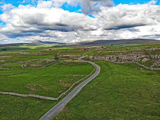
![]()
Winskill Stones area - amazing stuff - as seen from drone.
![]()
Steepest ½ kilometer begins at 200 meters (15.5%)
![]()
Langcliffe Scar is Climb #48 of Simon Warren's 100 Greatest Cycling Climbs (Great Britain) and another gorgeous climb surrounded by pastureland, lime stones and the open space of Yorkshire Dales National Park, 217,800 hectares (538,195 acres), established in 1954:
“The Yorkshire Dales National Park is a 2,178 km2 (841 sq mi) national park in England covering most of the Yorkshire Dales. The majority of the park is in North Yorkshire, with a sizeable area in Cumbria and a small part in Lancashire. The park was designated in 1954, and was extended in 2016. Over 20,000 residents live and work in the park, which attracts over eight million visitors every year. The park is 50 miles (80 km) north-east of Manchester; Leeds and Bradford lie to the south, while Kendal is to the west, Darlington to the north-east and Harrogate to the south-east. The national park does not include all of the Yorkshire Dales. Parts of the dales to the south and east of the national park are located in the Nidderdale Area of Outstanding Natural Beauty.” Wikipedia - Yorkshire Dales National Park.
Top things to see and do around Langcliffe.
![]()
The Settle Loop (to the right at 800 meters up from the start; Strava Segment for the Loop) is a very popular hiking, riding and off road biking trail (we are going to give it a go on gravel bike):
“The Settle Loop was the first section of the Pennine Bridleway to be opened in the Yorkshire Dales National Park in August 2005. It is a 10 mile (16km) circuit which takes in some stunning limestone scenery including views of the nationally important Malham Tarn, Yorkshire’s Three Peaks and Attermire Scar.
Starting in Settle, the loop climbs steeply out of this lovely town into the National Park, traverses a wonderful limestone upland, before descending back towards Settle on mixed gravel and grass trails. There are many other bridleways in the area which can be used to extend your journey by linking to Malham village and Tarn, and over into Littondale and Wharfedale.
Please note that the route is steep, tough and reasonably remote in places – riders and walkers will need to be fit. Experienced off-road cyclists could expect to complete the circuit in around two to three hours, but for walkers and horse-riders this is an all-day activity.” Settle Visitor Center Website
“The Settle Loop is not planned for walkers; it is a public bridleway designed and promoted specifically for cyclists and horse riders.” Where2Walk.co
CyclingUphill.com:
“Langcliffe Scar is a great climb in the Yorkshire Dales. If you head north from Settle on the B6479 you will go past the village of Langcliffe. If you take a right here, you will come to a steep climb built into the steep sides of the valley. From the bottom it is steep, almost from the start. It becomes steepest a the mid way point where there is a small hairpin built into the hill to make the climb manageable. After this difficult introduction to the climb, the last half eases off giving a steady climb towards the top of the hill. There are great views and the road is cut in between the limestone rocks. It is quite an atmospheric climb and there are great views in all directions. After climbing, I did a u-turn to take a photo, but I would have liked to have taken more.
I rode the climb in July – taking in many of the great climbs of this area including Park Rash, Malham Cove, Arncliffe, Black Gill Lane (out of Settle) Langcliffe Scar was climb number four of the day. It was a good climb with relatively little traffic. If you’re lucky you can get a strong south westerley to give a little assistance up the climb.” More
100HillsForGeorge.blogspot.com:
“Langcliffe Scar is just over the dale and kind of on the other side of Malham Cove. As a result, I cycled straight over and got a good look at it on the way down. Again, another really pretty little village – there was a wedding going on I think in the village hall and people were turning up in their finery. This very much was the mirror glass climb to Malham Cove – similar scenery (unsurprisingly), similar hikes in gradient and a similar challenge in many ways.
One of the things I found most amusing about this climb was the sign warning “Beware of Lambs!” There were lambs on the road (which I am sure what the sign alludes to), but my lactic acid addled brain got on to thinking about what I would do if a deadly lamb leapt out and attacked me. I was cheered/bleated up by sheep all the way. And some took the mickey by raising me up slopes. And beating me. Grrr. Pesky sheep. Think they own the road too
Nice round here though - green, lovely rocks, lots of people out walking - very pleasant!