
23.3
PDI
8.3 mi
DISTANCE
3,330 ft
GAINED
7.5 %
AVG. GRADE
FULL CLIMB STATS
INTRO
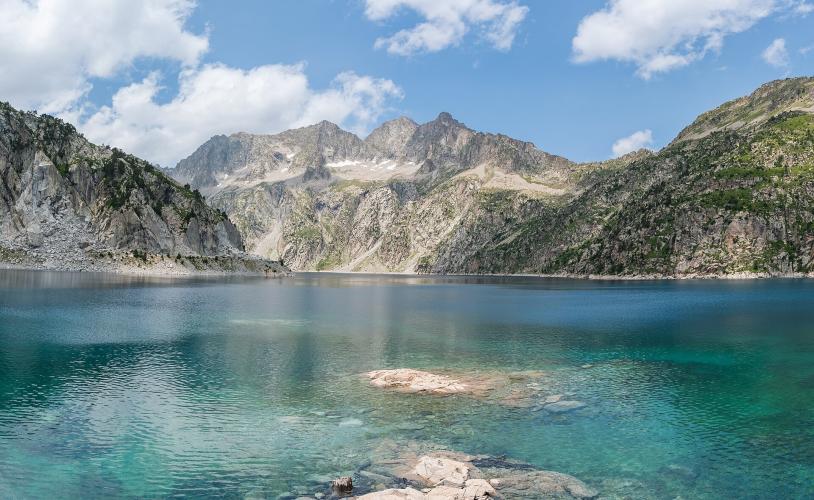
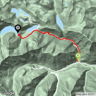
This is the business end of the climb to Lac de Cap-de-Long. Starting at Fabian, in the commune of Aragnouet, it skips the gentle valley run from Saint-Lary-Soulan and gets straight to work: 13.4 km (8.3 mi) at a 7.5% average, gaining 1015 m (3,330 ft) to finish at 2142 m (7,029 ft) beside the Cap-de-Long dam, inside the Réserve Naturelle du Néouvielle. For the full ride from town, see our Lac de Cap-de-Long (St-Lary-Soulan) page.
The gradient is remarkably steady - every kilometer from the start to km 11 sits between 6.1% and 9.2% - first through forest above Fabian, then into open granite country around Lac d'Orédon, which you reach at about km 9.5. The toughest stretch is km 9-11, at roughly 9%, before the final 2.4 km ease to around 6% on the approach to the dam, with a short kick right at the end.
The road exists because of the dam. EDF built it between 1947 and 1949 to reach the construction site, and the dam went up between 1950 and 1953: a concrete arch 101 m (331 ft) high and 275 m (902 ft) long at the crest, holding back about 67 million cubic meters of water at 2160 m. That makes Cap-de-Long the largest reservoir in the Pyrenees, and its water travels through a 10 km (6.2 mi) tunnel to the Pragnères power station in the neighboring Gavarnie valley - one lake serving two valleys.
The road is closed by snow every winter and typically reopens in late spring or early summer. In 2025, rockfall near the Estaragne stream kept the upper road closed until late June while it was cleared and resurfaced, and in 2026 the Route des Lacs reopened in early summer after spring works - check the Aragnouet mairie's road updates before an early- or late-season visit.
PLAN YOUR ROUTE
 We've partnered with Sherpa-Map.com to bring you the best route planning tool. With a PRO Membership you can use this climb as a reference when creating your route.
 From Fabian, Lac de Cap-de-Long climbs 13.4 km (8.3 mi) at a 7.5% average, gaining 1015 m (3,330 ft) from 1137 m (3,730 ft) to 2142 m (7,029 ft), with about 9 m (30 ft) of descent along the way.
Km 0-4: 6.1-7.9% per kilometer through the forest above Fabian.
Km 4-9: 7.2-8.8%, with km 4-5 the steepest of this section at 8.8%.
Km 9-11: the crux - 9.2% and 8.9% around Lac d'Orédon.
Km 11-13.4: easier at 5.8-6.5%, with a short 8.5% kick in the final 300 m to the dam.
Steepest sections: 100 yd (91 m) at 10.3%, 0.5 km at 9.8%, 1 km at 9.3%, 2 km at 9.1%, 5 km at 8.3% and 10 km at 7.9%.
Roadway: Paved all the way. Above Fabian the RD 929 is a narrow mountain road originally built for the dam works, with rougher, patched sections higher up and loose stones possible after storms - in spring 2025 a rockfall near the Estaragne stream closed the upper road until late June for clearing and resurfacing. The road is closed by snow in winter; opening dates are posted by the Aragnouet mairie.
Traffic: Light to moderate in July and August, when hikers and visitors head for Orédon and Cap-de-Long, and very quiet the rest of the season. The Néouvielle's summer shuttle system applies to the Aumar/Aubert branch, not the Cap-de-Long road, so expect some cars all the way to the dam.
Parking: Start from Fabian, or from the Pont du Moudang area just down-valley, which has a campsite and a shaded picnic ground along the Neste. The Orédon car park partway up is paid from mid-June to mid-September (first 15 minutes free, 10 € for a full day, and no sleeping in vehicles), and there's another car park at the Cap-de-Long dam at the top.
Gear: A standard compact handles the steady 7-9% grades - there are no brutal ramps here, just 11 km with almost no let-up. At 2142 m (7,029 ft) the dam can be cold and windy even in midsummer, so pack a jacket for the descent.
Provisions: There's nothing for sale on the climb itself; Saint-Lary-Soulan, about 9 km down the valley, is the place to stock up properly. In summer, the Refuge d'Orédon near Lac d'Orédon (around km 9.5) is the only place for food and drink partway up.
Before heading out on any cycling adventure check out our Things to Bring on a Cycling Trip and use our interactive check list to ensure you don't forget anything.
Aragnouet is a commune of scattered hamlets, and it rewards a slower look. Fabian's small church of Saint-Pierre-aux-Liens sits right at the start. On the road toward the Bielsa tunnel, the Chapelle des Templiers at Le Plan - actually a late-12th-century chapel and hospice of the Knights Hospitaller, despite the name - is listed by UNESCO as part of the Routes of Santiago de Compostela, and marks the spot where old trails into Spain and the Barèges country met.
Just down-valley from Fabian, the Pont du Moudang area has a picnic ground on the Neste, an adventure course suspended over the Moudang gorge and the Fabian Bike Center's mountain-bike trails - an easy rest-day option. From the dam, a lakeside trail follows Cap-de-Long's shore toward the Néouvielle peaks if you've brought shoes.
For lodging built around cycling, the Pyrenees Cycling Lodge in Saint-Savin is a well-regarded base for the wider Hautes-Pyrénées. Because you finish above 2100 m (6,890 ft), conditions at the dam can be very different from the valley - check current conditions before you go with our Weather tool.
ROUTE MAP
MEMBER RATING
CURRENT WEATHER
PJAMM TRIPS ADVENTURE STARTER BUNDLES
Check out PJAMM Adventure's prepackaged (self-guided) cycling trips. They will help you plan, document and conquer your next adventure.
NEARBY CLIMBS (0) RADIAL PROXIMITY
FROM No Climbs Found
MEMBER REVIEWS & COMMENTS
Let us know what you thought of this climb. Signup for our FREE membership to write a review or post a comment.
Already have an account?
LOG IN HERE
