![]()
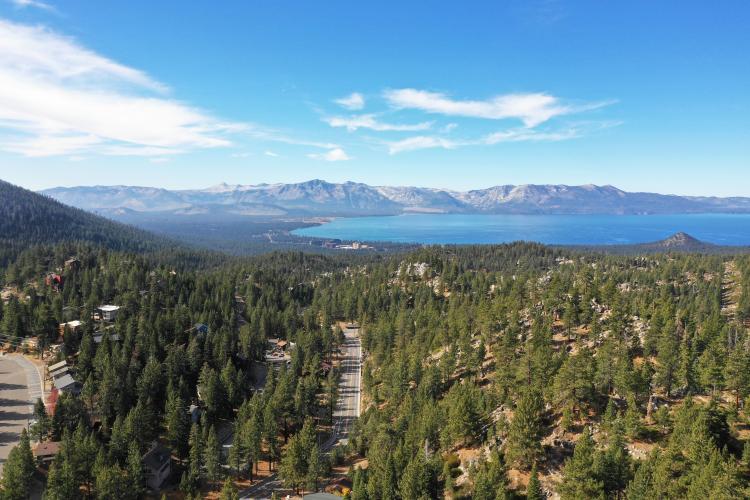
Daggett Pass connects Highway 395 (east) and South Shore Lake Tahoe (west).
Before heading to cycle Kingsbury Grade, be sure to rely on our list of Things to Bring on a Cycling Trip, and use our interactive checklist to ensure you don't forget anything.
Climb summary by PJAMM’s John Johnson.
KINGSBURY GRADE EAST
This is definitely the more difficult side of Kingsbury Grade (Daggetts Pass), at six miles and an average grade of 6.1% up to an elevation of 7,357’. While there are several brief descents along the way (129’ total descent), this is a predominantly steady 6-8% climb. The elevation profile has one brief 20% grade, but this is a false GPS reading.
![]()
Roadway Surface and Traffic Report: The roadway is in excellent condition and moderately travelled, but a good bit of the traffic are big rigs (although they are not able to race too fast up the grade). The road is in excellent condition and there is a wide shoulder the entire route.
Tramway Drive is at the top of the grade and is an access road to Heavenly Valley Ski Resort. The Pass got its name, according to the local newspaper (Record Courier) “in 1854 when C.D. Daggett acquired 640 acres at the bottom of the road and renamed it.” The name Kingsbury Grade relates to the community of Kingsbury on the western side of the pass.
![Kingsbury Grade east Sign at the start of Kingsbury Grade bike climb]()
Start just west of Gardnerville at Hwy 207/Foothill Road.
![Kingsbury Grade Fall colors on the Kingsbury Grade, Hwy 207]()
Highway 207 is plenty wide and has bike lane the entire route.
![Looking down on NV plains from Kingsbury Grade Looking down on NV plains while bicycling up the Kingsbury Grade.]()
Excellent views east of Carson Valley first three miles of climb.
![Kingsbury Grade near Daggett Pass Drone photo of Kingsbury Grade near Daggett pass while climbing by bike.]()
The grade is clearly discernible as we climb.
KINGSBURY GRADE WEST
This side of Daggett Pass is one-half the distance of the route from the east, at 3.1 miles with an elevation gain of only 1,045’ at 6.4% average grade. There are some decent views of Lake Tahoe as we descend, but none are exceptional.
Roadway Surface and Traffic Report: As with the route from the east, there is moderate traffic along the climb, although it is much heavier toward the bottom. The road is in excellent condition without any blemishes as of October 2018.
The Tahoe Rim Trail crosses our route about one mile from the top.
![Daggett Pass Steep Grade sign at Daggett Pass on Kingsbury Grade]()
The climb from the west varies from a max 10% to flatter 2% in stretches.
![Lake Tahoe from Daggett Pass Drone photo of Lake Tahoe from Daggett Pass and Kingsbury Grade.]()
This is the Lake Tahoe side of Daggett Pass.
TOUR OF CALIFORNIA - KINGSBURY GRADE![Oakville Grade Road Sign]()
Kingsbury Grade (Daggett Summit) Stage 2, 2010 Tour of California
Photo: Tahoe Daily Tribune
The Kingsbury Grade has been featured once in the Tour of California:
- Folsom to South Lake Tahoe (eastern approach)
- 122.1 miles, 18,999’
- Stage winner: Egan Bernal (COL; Strava KOM 30:02)
![Oakville Grade Road Sign Cycling Oakville Grade Road - photo of sign]()
Mark Cavendish (former world champ jersey)
Kingsbury Grade - Stage 6 2018 Tour of California
Photo by Ray Rogers

 We've partnered with Sherpa-Map.com to bring you the best route planning tool. With a PRO Membership you can use this climb as a reference when creating your route.

