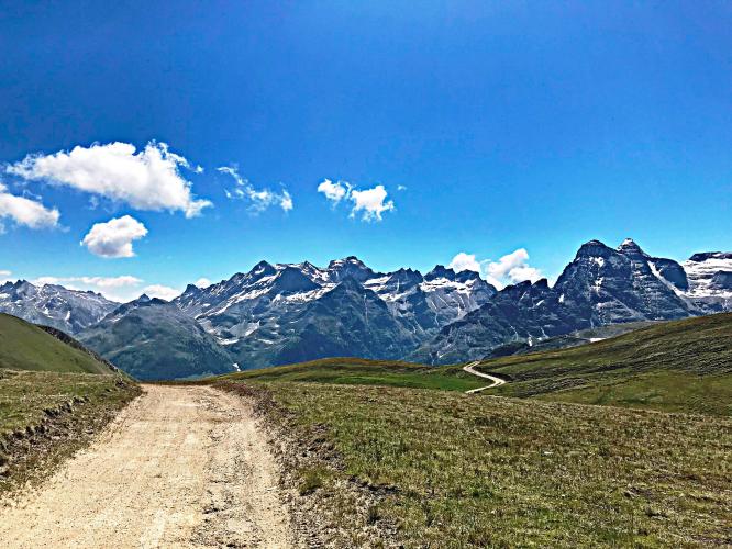
![Breithorn Bike Climb - a punishing bike climb Cycling Breithorn - mountains, gravel road, fields]()
Cycling Breithorn -- a little pavement and a lot of dirt.
Ride 13.8 km (8.6 mi) to 2,448 m, gaining 1,700 m at 11.5% average grade.
![]()
This is the eighth most difficult road bike climb in the world. As one may expect from a top world climb, this one is brutal: a mere 13.7 km but gaining an unbelievable 1,700 m, with one kilometer segment at 18.3%!
This climb gets its name from Breithorn Mountain, Switzerland. Breithorn is German for “broad horn.” Breithorn Peak is the tallest mountain of the Breithorn mountain range which is in the Pennine Alps, of the larger Alps Mountains of Europe. The Breithorn is located near the Italian border in southern Switzerland near Zermatt, in the Valais canton. Zermatt is a charming mountain resort village known for outdoor sports like skiing, hiking, and climbing. This is a car-free village, with the most common form of transportation being walking. Stroll the streets and find bars, shops, cafés, and historic houses more than 500 years old (Zermatt). Due to a cable car which takes visitors up to 3800 m, the Breithorn is said to be one of the easiest 4000 meter mountain climbs, so many novice mountaineers choose this peak for their first major summit (Zermatt Matterhorn).
We begin the ride near a scenic old railroad bridge over the Rhone River.
![Breithorn - Rhone River Bridge Climbing Breithorn by bike - bridge over Rhone River]()
After a few mild hairpins we are in gravel by kilometer 3 and stay on the soft stuff the rest of the ride. We did this climb with road tires, but gravel tires are recommended.
![Breithorn Climb Breithorn by bike - sign and gravel road]()
Gravel for 80% of the climb.
![Breithorn - logging Bicycle ride Breithorn - log pile and bike]() .
.
We used 28mm road bike tires but recommend nobbies.
![]()
![Breithorn - Gorgeous views Bicycling Breithorn - views of Rhone Valley]()
We are in forest much of the first 11 kilometers . . .
. . . but the openings offer stunning views of the Rhone Valley far below.
The climb is beautiful and there was no sign of life whatsoever for the last 10 kilometers -- it is as private and as peaceful as a double digit 13 kilometer climb can be. There are no visual obstructions to impede the distant views after climbing above tree line at about kilometer 11.
![Breithorn - Rhone River and Valley Bike climb of Breithorn - views of Rhone River and Rhone Valley]()
View near the top of the climb, looking over the Rhone Valley and Rhone River where we began.
![]()
Steepest ½ kilometer begins at km 4 (14.4%).
PJAMM contributor and Strava memer input on this ride:
Mark Hoppé: Hi Ties, I climbed the Breithorn on a CX bike, you couldn't do it on a road bike with skinny tyres. The first quarter is paved, but then the road gets worse, and the last quarter is just a rocky track. Going up was OK, but descending was tough in places, and I could have done with front suspension, or maybe better technique... A great climb, beautiful views and the top is a special place. I'll be back there next summer, this time with off road, rather than gravel, tyres, and will try the descent down the other side of the mountain. Good luck with the website. I've ridden most of the Alps, but the toughest climb I know is the Weisenstein starting in Solothurn Switzerland.
From the website Salite.com (“ascents”):
The climb starts in Grengiols; a village situated 12 km east of Brig in the Swiss Canton of Valais. It can be divided into two parts. The first 4.1 km are asphalted and only moderately steep, with one exception. After the post office in Grengiols, it is possible to go straight up to the church, and then left, on a cobbled street. The gradient exceeds 20% on this short stretch. After rejoining the main road, the climb is then relatively flat. After this first part finishes, the second part, measuring 10.8 km, begins. This is the military road built during the Second World War, and is now closed to all motorised traffic except for inhabitants. From here until the tree line at around 2000m, the road is hard earth and is in excellent condition (comparable to the unsurfaced section of the Umbrail Pass); no problem with a racing bike. Above the treeline, in particular between 12.5-14.3km, the condition is a little less good, but still quite possible with a racer (similar to the Colle di Finestre, better than Rionda, and much better than the Col de Parpaillon, for example). From the last curve to the end, the road is in better condition again. The views from the summit are spectacular: north to the Bernese Alps, south across the Saflisch valley to the mountains on the Italian border. Behind the pass, a simple road descends down to Heiligkreuz, then asphalted down the Binn valley, and back to Grengiols: the upper part was built later than the climb from Grengiols. The section down to Heiligkreuz is just about possible with a racer. This is a very difficult, but also extremely beautiful climb: highly recommended! From Michael Garrood comments on http://www.salite.ch/9902.asp

 We've partnered with Sherpa-Map.com to bring you the best route planning tool. With a PRO Membership you can use this climb as a reference when creating your route.

