23.2
PDI
10.7 mi
DISTANCE
3,720 ft
GAINED
6.5 %
AVG. GRADE
FULL CLIMB STATS
INTRO
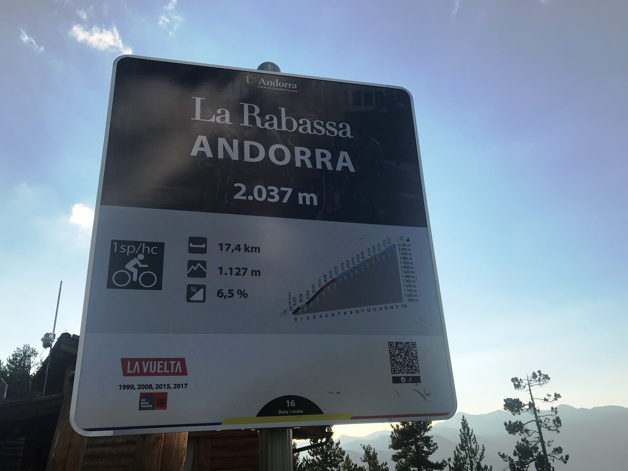
La Rabassa via Juberri is the direct road up to La Rabassa from Sant Julià de Lòria, Andorra's southernmost parish: 17.2 km (10.7 mi) at a 6.5% average, gaining 1134 m (3,720 ft) from 917 m (3,007 ft) to 2033 m (6,669 ft) on the high plateau of La Rabassa. It's one of the longest and toughest climbs in Andorra, and it doubles as the signed access road to Naturland, the mountain park at the top.
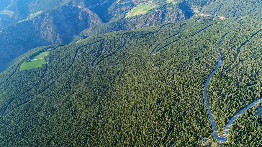
The difficulty is front-loaded. The first 7 km average about 8%, with a 2 km stretch from roughly km 2.6 to km 4.6 averaging 10.2% and a single kilometer at 11.3%. The road winds up through about ten hairpins above Sant Julià, past the terraced hillside of Auvinyà, home to Andorra's best-known vineyard, and reaches Juberri at km 4.5 (about 1290 m / 4,232 ft) - a tiny village with the Romanesque church of Sant Esteve and one of the few wide-open views on the climb.
From Juberri the road plunges into the dense Rabassa pine forest and settles into a steady 4-6% for most of the next 8 km, passing Naturland's lower Cota 1600 area around km 8-9. The Peguera road - covered on our La Rabassa (Peguera) page, along with Naturland in depth - joins about 3.8 km from the top, and the two routes share the final push to the Cota 2000 area.
La Rabassa hosted the 2018 Vuelta a España's stage 19 summit finish, won by Thibaut Pinot, and in 2017 it was the penultimate climb of stage 3 - the day Chris Froome took the leader's red jersey on his way to winning that Vuelta.
PLAN YOUR ROUTE
 We've partnered with Sherpa-Map.com to bring you the best route planning tool. With a PRO Membership you can use this climb as a reference when creating your route.
 La Rabassa via Juberri is 17.2 km (10.7 mi) long and gains 1134 m (3,720 ft) at a 6.5% average, from 917 m (3,007 ft) in Sant Julià de Lòria to 2033 m (6,669 ft) at La Rabassa, with about 18 m (58 ft) of descent along the way.
Km 0-5: the hardest part of the climb - 6.4-10.8% per kilometer up the hairpins above Sant Julià and past Auvinyà to Juberri, with a brief breather of about 350 m at around 2% near km 2.
Km 5-7: 6.6-7.9% as the road leaves Juberri and enters the forest.
Km 7-15: a long, steady 4.3-5.8% through the Rabassa forest and past Naturland's Cota 1600 area.
Km 15-17.2: 6.4-6.7% on the final push to the Cota 2000 area.
Steepest sections: 100 yd (91 m) at 19.9%, 0.5 km at 11.8%, 1 km at 11.3%, 2 km at 10.2%, 5 km at 8.8% and 10 km at 7.3%.
Roadway: Paved the entire way. As the signed access road to Naturland and its winter cross-country ski area, the Juberri road is the main route up the mountain and is kept open year-round. The lower kilometers wind through about ten hairpins between houses above Sant Julià before opening up at Juberri; above that the road runs almost entirely through dense forest. As on any Andorran mountain road, watch for gravel and small rockfalls after heavy rain.
Traffic: Busier than the Peguera side. This is how most visitors reach Naturland - the Tobotronc alpine coaster, the animal park, the bike park and winter cross-country skiing - so expect steady car traffic on summer weekends, school holidays and ski-season days. Weekday mornings outside peak season are far quieter.
Parking: Sant Julià de Lòria has public car parks and blue-zone street parking in the center, close to the start. If you'd rather skip the steep lower half, Naturland's free car park at Cota 1600 (around km 8-9) is a good place to start a shorter ride to the top.
Gear: Low gears matter most in the first 5 km, where you'll spend a sustained stretch above 10% before you've really warmed up. After Juberri it's a long, steady 4-6% grind in the shade of the forest. You finish above 2000 m (6,562 ft), so bring a layer for the 17 km (10.6 mi) descent.
Provisions: Fill bottles and pockets in Sant Julià de Lòria before you start. Naturland's restaurants at Cota 1600 and Cota 2000 are the only food and drink on the mountain.
Before heading out on any cycling adventure check out our Things to Bring on a Cycling Trip and use our interactive check list to ensure you don't forget anything.
The lower slopes of this climb are Andorra's wine country. Casa Auvinyà, on the hillside above Sant Julià, grows pinot noir, pinot gris, viognier and syrah on terraces at around 1200 m (3,937 ft), on slopes of 40-60%, and offers tastings and visits - a good post-ride stop. The hamlet of Auvinyà itself has been rebuilt around its original handful of stone houses, with a new Romanesque-style church dedicated to Sant Iu, while the small 17th-century chapel of Sant Romà d'Auvinyà sits higher up the ridge.
At km 4.5, take a minute at Juberri's church of Sant Esteve, built in the 11th and 12th centuries and the southernmost church in the Principality, perched on a knoll with a view over the whole Sant Julià valley.
For a big day, our La Rabassa + Os de Civis + Aixas + Pujada Civis route links this climb with three more - 128 km (79.5 mi) with 3830 m (12,566 ft) of climbing in full, though it's easy to pare down. See other climbs nearby, or build a custom route from here, with our Routes in the Area tool.
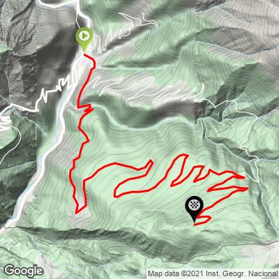
ROUTE MAP
MEMBER RATING
CURRENT WEATHER
PJAMM TRIPS ADVENTURE STARTER BUNDLES
Check out PJAMM Adventure's prepackaged (self-guided) cycling trips. They will help you plan, document and conquer your next adventure.
NEARBY CLIMBS (0) RADIAL PROXIMITY
FROM No Climbs Found
MEMBER REVIEWS & COMMENTS
Let us know what you thought of this climb. Signup for our FREE membership to write a review or post a comment.
Already have an account?
LOG IN HERE