26.7
PDI
7.4 mi
DISTANCE
3,479 ft
GAINED
8.9 %
AVG. GRADE
FULL CLIMB STATS
INTRO
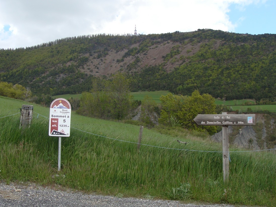
Mont Colombis is one of the toughest, most overlooked climbs in the French Alps - a dead-end summit road climbing 11.9 km (7.4 mi) and gaining 1,060 m (3,479 ft) at an 8.9% average grade from Remollon, in the Hautes-Alpes about 15 km southeast of Gap. Despite grades that regularly exceed 16%, and a reputation among French riders as harder than the Tourmalet or the Izoard, it has never once been included in the Tour de France.
The climb is brutally irregular rather than steadily hard: a gentler opening couple of kilometers gives way to a punishing mid-climb push through the village of Théus - home of locally well-known climber Serge Garnier - where the road repeatedly tips past 15%, eases briefly, then punches again through a final third that rarely lets up before the summit.
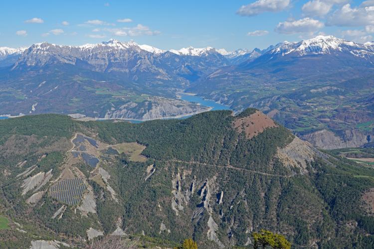
The payoff at the top is one of the best in the southern Alps: a sweeping panorama over Lac de Serre-Ponçon and the Durance and Ubaye valleys, with the high peaks of the Ecrins massif visible beyond. The summit itself is no ordinary col - it's a dead end shared by paragliders, a Météo-France weather radar, and a telecom relay, with a 1914 memorial cross (restored in 1983) marking the actual high point.
PLAN YOUR ROUTE
 We've partnered with Sherpa-Map.com to bring you the best route planning tool. With a PRO Membership you can use this climb as a reference when creating your route.
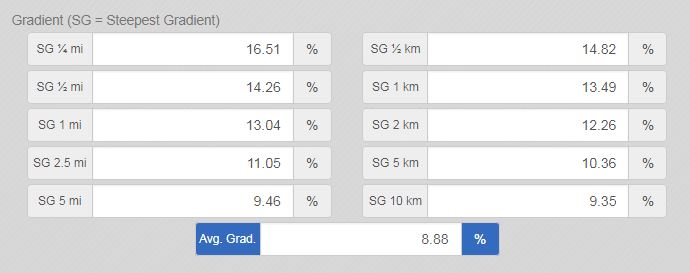
 Mont Colombis from Remollon climbs 11.9 km (7.4 mi) and gains 1,060 m (3,479 ft) at an 8.9% average grade to the summit at roughly 1,729 m (5,672 ft). The grade is unusually irregular for its length: a mild first couple of kilometers near 6% gives way to a brutal stretch through Théus in the middle of the climb, where the road repeatedly hits 15-16%, before a final third that alternates short flat breathers with more pitches in the 10-12% range.
Independent rider measurements consistently put the single steepest pitches at 16-16.5%, among the hardest sustained gradients of any climb in the Hautes-Alpes - the irregularity is what catches most riders off guard more than any one number.
Roadway: Paved the entire way, though rider reports describe the surface as rough in spots - resurfaced in places but with a coarse chip-seal finish rather than smooth asphalt, especially on the steepest pitches through Théus. We found no confirmed 2026 closures on this road, but snow has been reported lingering on the final stretch into spring; check conditions before an early-season attempt.
Traffic: Very light throughout. The road dead-ends at the summit rather than connecting anywhere else, so there's no through-traffic at all - multiple riders report seeing few or no cars beyond Théus.
Parking: Remollon is a small village with informal roadside parking near the D53/D900B junction at the climb's start, on the eastern edge of town. There's no dedicated cyclist parking or services here - just space along the road at the base.
A compact crankset or a wide-range cassette is close to mandatory - multiple experienced riders report needing gearing well below a standard 34x28 to handle the sustained 15-16% pitches through Théus and again in the final kilometers.
Fill bottles before leaving Remollon; there's nothing along the climb itself, and the summit has no services at all (just the radar and relay installations), so carry enough water and food for the full round trip, including the descent. A light layer is worth packing too - the summit's wind and occasional lingering snow make the top considerably colder than the base, even in warmer months.
Before heading out on any cycling adventure check out our Things to Bring on a Cycling Trip and use our interactive check list to ensure you don't forget anything.
Base yourself in Gap, about 15 km northwest, for the fullest range of hotels and restaurants - Remollon itself is a small village with limited services of its own.
The demoiselles coiffées (fairy chimneys) of Théus - a striking set of wind- and water-eroded rock spires on Mont Colombis's southwest slopes - are worth a stop if you have extra time; they're one of the more photographed geological formations in the Hautes-Alpes, and the village you climb straight through sits right beneath them.
Check the weather before committing to this one: the summit sees genuinely different conditions than the valley floor, with wind and, at times, lingering snow even when Remollon is warm. The Serre-Ponçon area has several other tough, lesser-known ascents worth knowing about - our Routes in the Area tool is a good way to see what else is nearby.
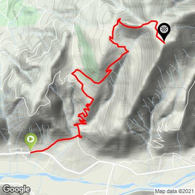
ROUTE MAP
MEMBER RATING
CURRENT WEATHER
PJAMM TRIPS ADVENTURE STARTER BUNDLES
Check out PJAMM Adventure's prepackaged (self-guided) cycling trips. They will help you plan, document and conquer your next adventure.
NEARBY CLIMBS (0) RADIAL PROXIMITY
FROM No Climbs Found
MEMBER REVIEWS & COMMENTS
Let us know what you thought of this climb. Signup for our FREE membership to write a review or post a comment.
Already have an account?
LOG IN HERE