26.9
PDI
12.7 mi
DISTANCE
4,223 ft
GAINED
6.2 %
AVG. GRADE
FULL CLIMB STATS
INTRO
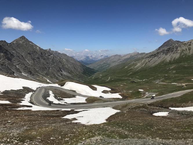
This 12.7 mile bike climb is located in Provence-Alpes-Côte d'Azur, France. The average gradient is 6.2% and there is a total elevation gain of 4,223 ft, finishing at 8,702 ft.
Use the profile tool, route map, and weather forecast to conquer this cycling climb.
Use the profile tool, route map, and weather forecast to conquer this cycling climb.
PLAN YOUR ROUTE
See more details and tools regarding this climb's grade via our interactive Profile Tool.
Information Not Available
If you have any information regarding this climb, we'd like to hear from you. Click the CONTRIBUTE button to share your thoughts with us.
Information Not Available
If you have any information regarding this climb, we'd like to hear from you. Click the CONTRIBUTE button to share your thoughts with us.
Before heading out on any cycling adventure check out our Things to Bring on a Cycling Trip and use our interactive check list to ensure you don't forget anything.
Information Not Available
If you have any information regarding this climb, we'd like to hear from you. Click the CONTRIBUTE button to share your thoughts with us.
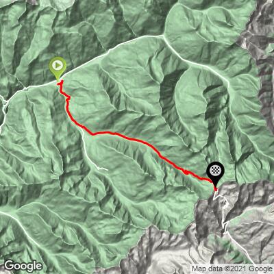
ROUTE MAP
MEMBER RATING
CURRENT WEATHER
PJAMM TRIPS ADVENTURE STARTER BUNDLES
Check out PJAMM Adventure's prepackaged (self-guided) cycling trips. They will help you plan, document and conquer your next adventure.
NEARBY CLIMBS (0) RADIAL PROXIMITY
FROM No Climbs Found
MEMBER REVIEWS & COMMENTS
Let us know what you thought of this climb. Signup for our FREE membership to write a review or post a comment.
Already have an account?
LOG IN HERE
carlinguernsey
This climb is a difficult test buried deep in the French Alps. The gradient is very uneven so that there are some steep ramps mixed in with flat sections and even short descents. On a sunny day, the views from the top are exceptional. There is water available in some of the small villages along the route. It might have been the conditions on the day that I did the climb, but it was by far the most flies that I have seen on any climb.