
18.2
PDI
14.1 mi
DISTANCE
3,772 ft
GAINED
4.5 %
AVG. GRADE
FULL CLIMB STATS
INTRO
The Grand Ballon is the highest summit in the Vosges at 1424 m (4672 ft), and the climb from Cernay is its longest road approach: 22.8 km (14.1 mi) with 1150 m (3772 ft) of climbing, from 305 m (1001 ft) on the edge of the Alsace plain to 1321 m (4335 ft) on the Route des Crêtes just below the top. The 4.5% overall average is misleading - it includes a flat middle and a 3 km (1.9 mi) dip, and the climbing itself runs at 6-9%. It is currently ranked #1192 in the world in our database.
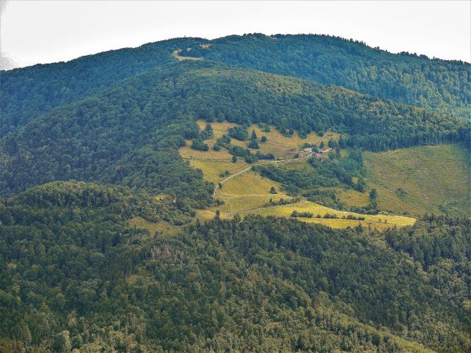
This side is really two climbs. The first rises through forest hairpins on the D431, the southern end of the 89 km (55 mi) Route des Crêtes, the ridge road the French army built behind the front line during the First World War. It tops out at the Col du Silberloch beside the Vieil Armand (Hartmannswillerkopf) battlefield at about 906 m (2972 ft). From there the road rolls and descends to the Col Amic, where it meets the roads from Soultz and Willer-sur-Thur, and the second climb begins: 6.5 km (4 mi) that never drop much below 7%, with the forest opening up to wide views over the Alsace plain and, on clear days, the Black Forest and the Alps.
The Tour de France came this way in July 2026, when Stage 14 crossed the Grand Ballon from neighboring Wattwiller and shared this side's final climb from the Col Amic. Note that the Route des Crêtes closes above Uffholtz in winter, usually from mid-November to early April.
PLAN YOUR ROUTE
 We've partnered with Sherpa-Map.com to bring you the best route planning tool. With a PRO Membership you can use this climb as a reference when creating your route.
The Grand Ballon from Cernay is 22.8 km (14.1 mi) long, with 1150 m (3772 ft) of climbing and 134 m (438 ft) of descending along the way, from 305 m (1001 ft) to 1321 m (4335 ft) - a 4.5% overall average. The steepest 1 km averages 8.9%, the steepest 2 km (1.2 mi) 8.5% and the hardest 5 km (3.1 mi) 8.0%. The steepest 100 yards (91 m) reach only 11.5%, so this is about sustained effort rather than walls.
The first 2 km (1.2 mi) through Cernay and Uffholtz are flat to false flat. Then the forest hairpins of the D431 begin at 5-8% and hold that for about 7 km (4.3 mi) before a nearly flat stretch past the Col du Herrenfluh. A final ramp reaches the Col du Silberloch and the Vieil Armand at about 14 km (8.7 mi).
Next comes roughly 3 km (1.9 mi) of rolling road and descent to the Col Amic, around 830 m (2723 ft) - enjoy it, because the last 6.5 km (4 mi) are the hardest part of the climb, at 7-8.7% with long straights and little relief until the ridge.
Roadway: The road is paved the entire way, and riders consistently describe the surface as very good on most of the climb. The exception is a handful of cobbled bends on either side of the Col Amic, including on the descent from the Vieil Armand, which are rough on skinny tires. The D431 above Uffholtz is part of the Route des Crêtes and closes in winter along with the rest of the ridge road - in 2025 the closure ran from 17 November to early April - so this is a spring-to-autumn climb.
Traffic: Busy on weekends. The D431 is the southern gateway to the Route des Crêtes and the Vieil Armand memorial, so it draws sightseeing cars and especially motorcyclists on Sundays and summer afternoons. Riders recommend weekdays or early mornings for a quieter climb.
Parking: Cernay is a town, so park in town near the start and ride north toward Uffholtz. It also has an SNCF station in the town center, which makes arriving by train an easy alternative.
Provisions: Fill up in Cernay before you leave - there is no reliable water on the open road until the farm inns higher up. The Ferme-Auberge du Freundstein, just off the road between the Vieil Armand and the Col Amic, serves a traditional farm meal on a big terrace facing the Grand Ballon, and there are more food options on the Route des Crêtes near the summit.
Gear: The climb is long rather than steep, so pacing matters more than gearing, but a compact chainring makes the final 6.5 km (4 mi) from the Col Amic more comfortable. The top sits more than 1000 m (3281 ft) above the Alsace plain, and riders regularly find it cold, windy or in cloud while Cernay is warm, especially in spring - carry a wind jacket and something warm for the long descent.
Before heading out on any cycling adventure check out our Things to Bring on a Cycling Trip and use our interactive check list to ensure you don't forget anything.
Cernay calls itself the "cité des cigognes" and is one of Alsace's stork villages, with a stork park in town. The Musée de la Porte de Thann occupies part of a surviving medieval town gate, and on Sundays and holidays from June to September (plus Wednesdays in July and August) the heritage Train Thur Doller Alsace runs steam and diesel trains 13.6 km (8.5 mi) from Cernay-Saint-André station to Sentheim - a relaxed rest-day outing at the foot of the climb.
Up on the route, the Vieil Armand (Hartmannswillerkopf) memorial and its national cemetery at the Col du Silberloch are an essential stop - our Grand Ballon (Soultz) page covers the battlefield's history and visiting hours. Just beyond, the ruins of the Château de Freundstein, first recorded in 1297 and a listed monument since 1922, stand close to the road toward the Col Amic, near the farm inn of the same name, run for many years by the Luttringer family and known for its summer blueberry tart. Riders looking for extra climbing recommend the detour up the Molkenrain, which touches 11%. Conditions at the summit can be very different from the plain, so check our Weather tool before you set out.
ROUTE MAP

MEMBER RATING
CURRENT WEATHER
PJAMM TRIPS ADVENTURE STARTER BUNDLES
Check out PJAMM Adventure's prepackaged (self-guided) cycling trips. They will help you plan, document and conquer your next adventure.
NEARBY CLIMBS (0) RADIAL PROXIMITY
FROM No Climbs Found
MEMBER REVIEWS & COMMENTS
Let us know what you thought of this climb. Signup for our FREE membership to write a review or post a comment.
Already have an account?
LOG IN HERE
