
19.8
PDI
11.7 mi
DISTANCE
3,615 ft
GAINED
5.6 %
AVG. GRADE
FULL CLIMB STATS
INTRO
The Grand Ballon is the highest summit in the Vosges at 1,424 m (4,672 ft), and the climb from Soultz-Haut-Rhin is one of its longest and gentlest approaches. It covers 18.8 km (11.7 mi) and gains 1,101.9 m (3,615 ft), from 277.4 m (910 ft) to 1,333.8 m (4,376 ft), at a 5.6% average, finishing on the Route des Crêtes just below the top. It ranks #1,017 on our list of the world's hardest climbs.
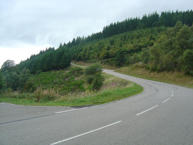
The climb is really two climbs. For the first 11 km (6.8 mi) a narrow, winding forest road holds a steady 5-6% in shade, with almost no traffic and good asphalt, up to Col Amic at about 828 m (2,717 ft). There you join the road coming up from Cernay and the character changes: the last 7 km (4.3 mi) run closer to 8%, fully exposed to wind and sun, and share the road with motorcycles and sports cars, especially on Sundays. In the last few kilometers the trees open out to wide views over the Alsace plain and, on clear days, the Alps or the Black Forest.
The Grand Ballon was also on the Tour de France route in 2026: it was the first classified climb (category 1) of Stage 14, from Mulhouse to Le Markstein on 18 July, with Valentin Paret-Peintre first over the top.
PLAN YOUR ROUTE
 We've partnered with Sherpa-Map.com to bring you the best route planning tool. With a PRO Membership you can use this climb as a reference when creating your route.
The Grand Ballon from Soultz averages 5.6% over 18.8 km (11.7 mi), gaining 1,101.9 m (3,615 ft) from 277.4 m (910 ft) in Soultz-Haut-Rhin to 1,333.8 m (4,376 ft) on the Route des Crêtes.
The numbers split in two around Col Amic. The first 11 km (6.8 mi) are steady at roughly 5-6%, a long warm-up on the forest road. After the col the final 7 km (4.3 mi) run at about 8%. The steepest 0.5 km (0.3 mi) averages 10.1%, the steepest kilometer 9.0%, the steepest 2 km (1.2 mi) 8.4% and the steepest 5 km (3.1 mi) 8.0%, while the steepest 10 km (6.2 mi) average 6.9%. Save something for the upper half, where the road is also fully exposed to the wind.
Roadway: The road is paved the entire way. The lower section to Col Amic is a narrow, winding, shaded forest road that has been resurfaced, and riders describe the asphalt as excellent. Above the col the road is the wider Cernay approach, and riders have reported a couple of short cobbled patches on the upper hairpins. In winter the Route des Crêtes toward the Col de la Schlucht is closed, so this is a spring-to-autumn ride.
Traffic: Very light on the forest section, where you are more likely to meet other cyclists than cars. After Col Amic it is much busier, with motorcycles and sports cars especially on Sundays and in good weather.
Parking: Soultz-Haut-Rhin is a town, so park on the streets near the start and be considerate of residents. If you would rather start from Guebwiller, the area's Toit de l'Alsace cycling circuit (51.4 km, with this climb) starts from the Place de l'Hôtel de Ville there.
Provisions: The forest road below Col Amic is quiet and shaded, so fill your bottles in Soultz before you start. A farm inn serves food on the Route des Crêtes, and a restaurant or bar is reported close to the top.
Gear: The upper half is exposed, so riders have found it cold and windy at the top in spring and hot in summer. Pack a wind layer for the descent, and keep a low gear for the final 7 km (4.3 mi) at about 8%.
Before heading out on any cycling adventure check out our Things to Bring on a Cycling Trip and use our interactive check list to ensure you don't forget anything.
Col Amic is also your gateway to the area's First World War history. The Hartmannswillerkopf (956 m / 3,136 ft), close to the col above Wattwiller, was one of the war's bloodiest battlefields: about 30,000 French and German soldiers died there and the summit changed hands four times in 1915 alone. Its national monument and crypt are open daily from 9:30 to 12:30 and 13:30 to 17:30, and the site can be reached by car except in winter. The Ferme-Auberge du Kohlschlag near Col Amic serves traditional food but needs a reservation.
At the summit, the Diables Bleus monument honors mountain infantry who died in the First World War, and a civil aviation radar designed by Claude Vasconi (1997) crowns the top, with an orientation table below the radome. Just off the Route des Crêtes on the Willer-sur-Thur side, the Ferme-auberge Grand Ballon serves a traditional mountain meal, but it is closed from 11 November to Christmas and opens only on weekends and holidays in winter. In nearby Jungholtz, the Thierenbach basilica is worth a detour. Our Grand Ballon (Moosch) page covers the Col du Haag side of the mountain and the Saint-Amarin valley, and you can see other climbs nearby with our Routes in the Area tool.
ROUTE MAP

MEMBER RATING
CURRENT WEATHER
PJAMM TRIPS ADVENTURE STARTER BUNDLES
Check out PJAMM Adventure's prepackaged (self-guided) cycling trips. They will help you plan, document and conquer your next adventure.
NEARBY CLIMBS (0) RADIAL PROXIMITY
FROM No Climbs Found
MEMBER REVIEWS & COMMENTS
Let us know what you thought of this climb. Signup for our FREE membership to write a review or post a comment.
Already have an account?
LOG IN HERE
