20
PDI
9.9 mi
DISTANCE
3,289 ft
GAINED
6.2 %
AVG. GRADE
FULL CLIMB STATS
INTRO
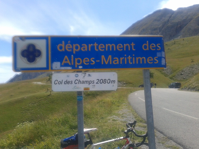
Col des Champs from Saint-Martin-d'Entraunes is the middle of the Cayolle-Champs-Allos Trois Cols loop and the longer, gentler way up the pass. The climb covers 15.9 km (9.9 mi) and gains 1,002 m (3,289 ft) at a 6.2% average, rising from about 1,068 m (3,505 ft) in the upper Var valley to roughly 2,054 m (6,738 ft) at the end of our route. The col itself is commonly quoted at 2,087 m (6,847 ft) and sits on the border of the Alpes-Maritimes and Alpes-de-Haute-Provence departments.
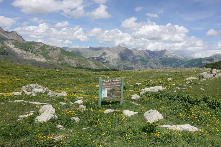
The opening kilometers are easy, then the road tightens into a series of switchbacks through larch forest. The steepest kilometer averages 9.8% and the steepest mile (1.6 km) averages 9.2%, and riders report a short ramp of about 11% near Val Pelens and pitches of 12-13% in the last kilometer. Above the trees the road crosses open alpine pasture and tops out on a broad grassy saddle beneath the Dent du Lièvre (2,667 m / 8,750 ft). The surface is good and traffic is light, but the summit has no services, so arrive with food and water.
PLAN YOUR ROUTE
 We've partnered with Sherpa-Map.com to bring you the best route planning tool. With a PRO Membership you can use this climb as a reference when creating your route.
Col des Champs from Saint-Martin-d'Entraunes averages 6.2% over 15.9 km (9.9 mi), gaining 1,002 m (3,289 ft) from about 1,068 m (3,505 ft) to roughly 2,054 m (6,738 ft). The average hides an uneven profile: the opening stretch is gentle at about 5-6%, and the hardest sections come once the switchbacks begin higher up.
The steepest 100 m (110 yd) reaches 10.5%, the steepest kilometer averages 9.8%, and the steepest mile (1.6 km) averages 9.2%. Over longer stretches it eases: the steepest 2 km (1.2 mi) averages 9.0%, the steepest 5 km (3.1 mi) averages 7.2%, and the steepest 10 km (6.2 mi) averages 6.3%. Riders also report a short ramp of about 11% near Val Pelens at around 1,600 m (5,250 ft) and steeper pitches of 12-13% in the final kilometer. Kilometer signs along the road show the distance remaining to the summit, which makes pacing easy.
Roadway: Paved the whole way, with generally good asphalt and newer surfacing on the upper section; riders report the road has improved on both sides of the pass through 2025. The road is narrow, with about a dozen switchbacks through the larch forest. At about 2 km (1.2 mi) it splits into two near-equal branches of about 4.5 km (2.8 mi) that rejoin higher up, one of them through the hamlets of Sussis and Le Mounard - follow the signposted route to the right. Kilometer signs mark the distance to the summit, but there are no cyclist-specific signs. The pass is closed by snow in winter, so check conditions before an early- or late-season ride.
Traffic: Light. This is a minor road linking the Var and Verdon valleys rather than a through route, so expect a few cars and motorbikes in summer and the occasional rider on the Trois Cols loop.
Parking: Saint-Martin-d'Entraunes has only roadside parking, shared with the Col de la Cayolle climb from the same village - our Cayolle page covers it. The summit has a parking area and a commemorative stele but no restaurant or other facilities, so do not plan on resupplying there.
Provisions: There is no shop, cafe or water point at the summit, so fill your bottles in Saint-Martin-d'Entraunes and carry food for the whole climb and descent. Val Pelens, about 1,600 m (5,250 ft) up, is mainly a ski area, so do not count on finding refreshments open there.
Gear: A compact crankset with a 30- to 34-tooth rear cog is comfortable on the 9-10% sections. The col sits above 2,000 m (6,560 ft) and mountain weather changes fast above the treeline, so carry a windproof layer for the descent. The road is narrow, so keep your speed in check on the way down.
Before heading out on any cycling adventure check out our Things to Bring on a Cycling Trip and use our interactive check list to ensure you don't forget anything.
Two places on the way up are worth knowing about. Val Pelens, at about 1,600 m (5,250 ft), is a small family ski area set in larch forest beneath the Aiguilles de Pelens, and it belongs to the commune of Saint-Martin-d'Entraunes along with the hamlets of Sussis and Pra Pelet. In summer, marked trails lead from the plateau and from the col to the Pointe de la Figulière above the Var valley, and the Puy du Pas Roubinous (2,516 m / 8,255 ft) is reached from Sussis. Higher up, the Cabane de Voya is a landmark before the open pastures, where the Cime de Voya comes into view, and at the top the Dent du Lièvre rises beside the pass.
The village itself, its Romanesque church and the Relais at Estenc are covered on our Col de la Cayolle page, and the fortified village of Colmars on the other side of this pass is on our Col des Champs, Colmars page, so this page stays up on the mountain. To see other climbs around the upper Var and Verdon valleys, or build a custom route from here, try our Routes in the Area tool.
ROUTE MAP

MEMBER RATING
CURRENT WEATHER
PJAMM TRIPS ADVENTURE STARTER BUNDLES
Check out PJAMM Adventure's prepackaged (self-guided) cycling trips. They will help you plan, document and conquer your next adventure.
NEARBY CLIMBS (0) RADIAL PROXIMITY
FROM No Climbs Found
MEMBER REVIEWS & COMMENTS
Let us know what you thought of this climb. Signup for our FREE membership to write a review or post a comment.
Already have an account?
LOG IN HERE