
15.9
PDI
4.9 mi
DISTANCE
2,215 ft
GAINED
8.6 %
AVG. GRADE
FULL CLIMB STATS
INTRO
Of the three paved roads up Monte Serra, this is the one in the trees. The Calci side gets the sea; the road from Pieve di Compito spends almost all of its length in thick woods on the Lucca side of the mountain, a narrow lane folded into hairpins with hardly anywhere to stop and look out. On a hot morning in July that's exactly what you want.
It's short and it's steep: 7.9 km (4.9 mi) and 675 m (2215 ft) of climbing at 8.6%. The first two kilometers through Pieve and Sant'Andrea di Compito are the warm-up, at 5.8% and then 8.1%. After that the road settles into a rhythm and stays there - km 2 to km 6 go 10.1%, 10.4%, 10.2% and 10.3%, four kilometers with no let-up while the hairpins stack up through the woods. Km 6-7 eases to 8.8%, and once you join the SP56 the last 900 m are an easy 4% to the junction.
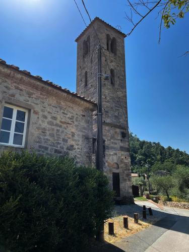
The bottom of the climb is the "Borgo delle Camelie": every March, Pieve and Sant'Andrea di Compito hold the Antiche Camelie della Lucchesia show, and the Camelietum Compitese - a park of around 1000 historic camellias - sits on the way up toward the mountain. At the top you're at the junction shared by all three Monte Serra roads. The 917 m summit, with its RAI transmitters, is a little higher, at the end of a road that stops at the RAI gate.
PLAN YOUR ROUTE
 We've partnered with Sherpa-Map.com to bring you the best route planning tool. With a PRO Membership you can use this climb as a reference when creating your route.
Overall: 7.9 km (4.9 mi) with 675 m (2215 ft) of climbing at an 8.6% average, from 107 m (352 ft) in Pieve di Compito to 782 m (2567 ft) at the SP56 junction.
Km 0-2: 5.8%, then 8.1%, through Pieve and Sant'Andrea di Compito.
Km 2-6: the climb proper - 10.1%, 10.4%, 10.2% and 10.3%, with most of the hairpins.
Km 6-7.9: 8.8% for a kilometer, then about 4% on the SP56 to the finish.
Steepest sections: 500 m at 11.8%, 1 km at 11.1%, 2 km at 10.7%, 5 km at 10.1%.
Roadway: Tarmac from bottom to top. Once it leaves Sant'Andrea, Via del Cantiere is a single-lane road with guardrails on the drop side, heavy shade and a fair amount of leaf litter, so it stays damp long after rain. Riders rate the surface mostly good, with a few rough patches. The last kilometer is on the wider SP56 del Monte Serra.
Traffic: Light - locals from the Compito villages, the odd delivery van and other cyclists. The SP56 at the top is a bit busier because the Calci and Buti roads feed into it. Coming down, the hairpins in the woods arrive quickly and you can't see far around them, so keep your speed in check.
Parking: There's no car park at the start. Find a legal spot in Pieve di Compito where you won't block a driveway (start point on Google Maps), or ride out from Lucca - it's flat all the way to the foot of the climb.
Gear: Gear for the four kilometers over 10% in the middle, not the average. A 34x32 or 34x34 keeps most riders turning over; strong climbers will manage with a 30. The tree cover keeps this side cool, which makes it the Monte Serra road to pick on a summer afternoon.
Provisions: Pieve and Sant'Andrea di Compito are the only villages on the route, and both are in the first two kilometers - fill your bottles before the hairpins start. Plan on nothing at the junction; Calci and Buti both have bars if you're descending another side.
Before heading out on any cycling adventure check out our Things to Bring on a Cycling Trip and use our interactive check list to ensure you don't forget anything.
Lucca is the natural base. Its 16th-century walls carry a tree-lined path all the way around the old town, a nice easy spin on a rest day, and the flat roads across the plain get you to Pieve di Compito with no climbing at all. If you're here in March, time the ride with the Antiche Camelie della Lucchesia: Pieve and Sant'Andrea open private gardens and the Camelietum, and the visit can include the tea plantation at Antica Chiusa Borrini, billed as the only one in Italy. A smaller autumn camellia show runs in October.
All three Monte Serra roads meet at the same junction, so it's easy to make a double of it - drop down to Calci or Buti and come back over this way. Our Monte Serra (Calci) and Monte Serra (Buti) pages cover those sides.
ROUTE MAP

MEMBER RATING
CURRENT WEATHER
PJAMM TRIPS ADVENTURE STARTER BUNDLES
Check out PJAMM Adventure's prepackaged (self-guided) cycling trips. They will help you plan, document and conquer your next adventure.
NEARBY CLIMBS (0) RADIAL PROXIMITY
FROM No Climbs Found
MEMBER REVIEWS & COMMENTS
Let us know what you thought of this climb. Signup for our FREE membership to write a review or post a comment.
Already have an account?
LOG IN HERE
