
17.8
PDI
13.1 mi
DISTANCE
3,606 ft
GAINED
4.6 %
AVG. GRADE
FULL CLIMB STATS
INTRO
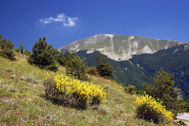
Monte Catria (Grumale) climbs 21.1 km (13.1 mi) from Acquaviva, just outside Cagli, to the Madonna degli Scout saddle at 1346 m (4415 ft), on the shoulder of Monte Catria (1701 m / 5581 ft), the highest peak of the Catria-Acuto massif in the northern Marche Apennines. It gains 1099 m (3606 ft) from a start at 367 m (1203 ft), for a 4.6% average.
That average is deceptive. The first 12.9 km (8.0 mi) are a long, steady grind at 6.5% up the wooded northern flank, with the steepest kilometer at 9.5%. The road then crests at about 1220 m (4003 ft) and drops roughly 108 m (354 ft) over 2.4 km (1.5 mi) before climbing again for 3.4 km (2.1 mi) at 6.4%, crossing the ski slopes to Rifugio La Cotaline. The last 2.1 km (1.3 mi) run almost flat along the mountainside to the saddle, where the Madonna degli Scout monument stands and the hiking trails toward the summit begin.
This side has been rebuilt since the September 2022 flood hit the roads around Catria hard. In 2026 the road from Acquaviva was resurfaced, with local residents describing fresh, very good asphalt by August and the final surface layer and signage scheduled from September - read the Roadway tab before you go.
That average is deceptive. The first 12.9 km (8.0 mi) are a long, steady grind at 6.5% up the wooded northern flank, with the steepest kilometer at 9.5%. The road then crests at about 1220 m (4003 ft) and drops roughly 108 m (354 ft) over 2.4 km (1.5 mi) before climbing again for 3.4 km (2.1 mi) at 6.4%, crossing the ski slopes to Rifugio La Cotaline. The last 2.1 km (1.3 mi) run almost flat along the mountainside to the saddle, where the Madonna degli Scout monument stands and the hiking trails toward the summit begin.
This side has been rebuilt since the September 2022 flood hit the roads around Catria hard. In 2026 the road from Acquaviva was resurfaced, with local residents describing fresh, very good asphalt by August and the final surface layer and signage scheduled from September - read the Roadway tab before you go.
PLAN YOUR ROUTE
 We've partnered with Sherpa-Map.com to bring you the best route planning tool. With a PRO Membership you can use this climb as a reference when creating your route.
Monte Catria (Grumale) is 21.1 km (13.1 mi) long and gains 1099 m (3606 ft) at a 4.6% average, but most of the work comes in one long block.
Acquaviva to the first crest: The first 12.9 km (8.0 mi) gain 843 m (2766 ft) at 6.5%. Individual kilometers sit between 5.4% and 8.3% almost all the way, so there's no real place to recover. The steepest 500 m averages 10.4%, the steepest kilometer 9.5%, the steepest 2 km 8.1% and the steepest 5 km 7.6%.
The dip and the ski slopes: After cresting at about 1220 m (4003 ft), the road loses roughly 108 m (354 ft) over 2.4 km (1.5 mi), then climbs 215 m (705 ft) in 3.4 km (2.1 mi) at 6.4%, with one kilometer at 8.4%, to Rifugio La Cotaline.
To the saddle: The final 2.1 km (1.3 mi) are close to flat, finishing at the Madonna degli Scout saddle at 1346 m (4415 ft).
Acquaviva to the first crest: The first 12.9 km (8.0 mi) gain 843 m (2766 ft) at 6.5%. Individual kilometers sit between 5.4% and 8.3% almost all the way, so there's no real place to recover. The steepest 500 m averages 10.4%, the steepest kilometer 9.5%, the steepest 2 km 8.1% and the steepest 5 km 7.6%.
The dip and the ski slopes: After cresting at about 1220 m (4003 ft), the road loses roughly 108 m (354 ft) over 2.4 km (1.5 mi), then climbs 215 m (705 ft) in 3.4 km (2.1 mi) at 6.4%, with one kilometer at 8.4%, to Rifugio La Cotaline.
To the saddle: The final 2.1 km (1.3 mi) are close to flat, finishing at the Madonna degli Scout saddle at 1346 m (4415 ft).
Roadway: Paved. The road from Acquaviva is the main access to Rifugio La Cotaline, the ski area and the trailheads on Catria's north side, and it has been rebuilt as part of the repairs after the September 2022 flood. In August 2026 residents described it as in very good condition with freshly laid asphalt, and the final asphalt layer and road signage were scheduled for completion from September 2026. Before these works, riders reported broken asphalt and gravel stretches on this side. While work is underway the road is closed during working hours on weekdays and reopened in the late afternoon and on weekends, so check current status with the Provincia di Pesaro e Urbino before you ride.
Traffic: Light for most of the year. The road ends at the saddle, so the cars you'll meet are heading to the rifugio, the adventure park or the hiking trails. Winter weekends are the exception - the small Catria ski area can draw big crowds when there's snow.
Parking: Acquaviva is a small hamlet, so park considerately there, or park in Cagli and ride the roughly 3.5 km (2.2 mi) out to the start as a warm-up. At the top, the Madonna degli Scout saddle is where hikers leave their cars for the summit trails.
Traffic: Light for most of the year. The road ends at the saddle, so the cars you'll meet are heading to the rifugio, the adventure park or the hiking trails. Winter weekends are the exception - the small Catria ski area can draw big crowds when there's snow.
Parking: Acquaviva is a small hamlet, so park considerately there, or park in Cagli and ride the roughly 3.5 km (2.2 mi) out to the start as a warm-up. At the top, the Madonna degli Scout saddle is where hikers leave their cars for the summit trails.
Provisions: There are no shops on the climb, so fill bottles and pockets in Cagli before you start. Rifugio La Cotaline, about 2 km (1.2 mi) before the saddle, is the only refuge directly on this road - check its hours before counting on it, since it's busiest in ski season.
Gear: A compact crankset with a 30-32 tooth rear cog makes 13 km at 6.5% with pitches near 10% much more manageable. The upper road crosses open ski slopes and the saddle is exposed, so carry a jacket for the long descent, especially in spring and autumn.
Gear: A compact crankset with a 30-32 tooth rear cog makes 13 km at 6.5% with pitches near 10% much more manageable. The upper road crosses open ski slopes and the saddle is exposed, so carry a jacket for the long descent, especially in spring and autumn.
Before heading out on any cycling adventure check out our Things to Bring on a Cycling Trip and use our interactive check list to ensure you don't forget anything.
Cagli is the base for this climb, and it's worth a few hours off the bike. The town sits on the old Via Flaminia, the Roman road to the Adriatic, and the Roman-era Ponte Mallio still stands at the edge of town. Its symbol is the Torrione, a massive tower designed in 1481 by Francesco di Giorgio Martini for Federico da Montefeltro and linked to the Palazzo Pubblico by an underground passage; the palazzo overlooks Piazza Matteotti, and the 19th-century Teatro Comunale is one of the Marche's historic theaters. Local foods to look for are crescia brusca, white and black truffles, mushrooms and artisan cured meats, celebrated at the Distinti Salumi festival in May and Cagli Tutto Fungo in September, while the Palio dell'Oca fills the streets each August.
For more Catria riding, our Monte Catria (Chiaserna) page covers the steep south side and Cantiano, and Monte Nerone's three sides rise just across the valley. See other climbs nearby, or build a custom route from here, with our Routes in the Area tool.
For more Catria riding, our Monte Catria (Chiaserna) page covers the steep south side and Cantiano, and Monte Nerone's three sides rise just across the valley. See other climbs nearby, or build a custom route from here, with our Routes in the Area tool.
ROUTE MAP

MEMBER RATING
CURRENT WEATHER
PJAMM TRIPS ADVENTURE STARTER BUNDLES
Check out PJAMM Adventure's prepackaged (self-guided) cycling trips. They will help you plan, document and conquer your next adventure.
NEARBY CLIMBS (0) RADIAL PROXIMITY
FROM No Climbs Found
MEMBER REVIEWS & COMMENTS
Let us know what you thought of this climb. Signup for our FREE membership to write a review or post a comment.
Already have an account?
LOG IN HERE
