
17.4
PDI
5.7 mi
DISTANCE
2,461 ft
GAINED
8.2 %
AVG. GRADE
FULL CLIMB STATS
Page Contributor(s): Roland Schuyer, Netherlands
INTRO
The first kilometer up Monte Generoso is the hardest one, which feels a bit rude. From Mendrisio's eastern edge the road kicks up through Salorino at over 15% for 500 m, and only after that do you settle into the climb proper: 9.1 km (5.7 mi) and 750 m (2461 ft) at 8.2% to Bellavista at 1181 m (3875 ft), a balcony on the mountain's southern flank.
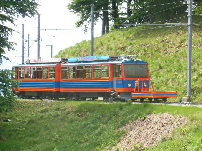
Above Somazzo it turns into a forest road - very narrow in places, full of curves and hairpins, on good asphalt - and almost every kilometer sits between 7% and 9.6%. It's the only road on the mountain, so you share it with residents, forestry vehicles and day-trippers driving up to Bellavista, where the road ends at a car park, the Osteria La Peonia and a station on the rack railway that climbs from Capolago to the summit.
The 1701 m summit and Mario Botta's Fiore di pietra restaurant are another 500 m up - a hike from Bellavista, or a ride on the train. On a clear day the view from the top takes in Lake Lugano, the Alps and the Po plain all at once.
PLAN YOUR ROUTE
 We've partnered with Sherpa-Map.com to bring you the best route planning tool. With a PRO Membership you can use this climb as a reference when creating your route.
Monte Generoso from Mendrisio is 9.1 km (5.7 mi) long and climbs 750 m (2461 ft) from 431 m (1414 ft) to 1181 m (3875 ft) at Bellavista, an average of 8.2%, with no descending at all.
It starts with the steepest section: the steepest 500 m (15.1%) and the steepest kilometer (11.2%) both begin at the bottom, in the streets of Salorino. Km 2 to 4 settle to 6.8-7.8% as the road climbs past Somazzo into the forest, and then the second half steepens again - 9.6% for km 5, 8.5% and 8.6% for km 6 and 7, and 7.9% for km 8 - before 6.6% for the last full kilometer to Bellavista.
The steepest mile (1.6 km) averages 9.9%, the steepest 2 km 9.5% and the steepest 5 km 8.6%. Short pitches hit 17.0% over 100 yards.
Roadway: Good asphalt from Mendrisio to Bellavista, but narrow - very narrow in places, with blind hairpins through the forest. It's the only road up the mountain and carries forestry, residents' and visitors' traffic, so ride the bends assuming something is coming down.
Traffic: Quiet on weekday mornings, busier on sunny weekends and in autumn, when mushroom hunters and day visitors drive up to Bellavista and leave their cars along the roadside between Somazzo and the top. Watch for doors and people stepping out on that stretch.
Parking: Park in Mendrisio rather than in Salorino's narrow streets; the station and town center are a short ride from the start. At Bellavista there's a pay car park at the end of the road by the Osteria La Peonia - the meters are switched off from September to May.
Gear: The 15% at the very bottom comes before you're warm, so start in your easiest gear and spin; a compact with a 32 or 34 cog makes the rest comfortable. The forest shades much of the road, which helps on hot Ticino afternoons.
Provisions: Fill bottles in Mendrisio. At the top, the Osteria La Peonia sits right at the finish, and up at the summit the Fiore di pietra has both a self-service restaurant and an à la carte one serving regional food with Ticino wines.
Before heading out on any cycling adventure check out our Things to Bring on a Cycling Trip and use our interactive check list to ensure you don't forget anything.
Mendrisio's big date is Holy Week, when its historic processions - on UNESCO's list of intangible cultural heritage since 2019 - fill the old town. The rest of the year it's Merlot country, and the grotti of the Mendrisiotto are where to eat after the ride.
For a rest day, Monte San Giorgio across the valley is a UNESCO World Heritage Site for its Triassic marine fossils, with a fossil museum in Meride. The Monte Generoso railway from Capolago has been running since 1890 and is the easy way to the summit; on one Saturday a month in summer the railway has also run a historic steam train.
Italy is a few minutes away. Our Rifugio Venini page starts at Osteno on the Italian end of Lake Lugano and climbs into the Val d'Intelvi, and the Sormano climbs are a short drive further east toward Lake Como.
ROUTE MAP

MEMBER RATING
CURRENT WEATHER
PJAMM TRIPS ADVENTURE STARTER BUNDLES
Check out PJAMM Adventure's prepackaged (self-guided) cycling trips. They will help you plan, document and conquer your next adventure.
NEARBY CLIMBS (0) RADIAL PROXIMITY
FROM No Climbs Found
MEMBER REVIEWS & COMMENTS
Let us know what you thought of this climb. Signup for our FREE membership to write a review or post a comment.
Already have an account?
LOG IN HERE
