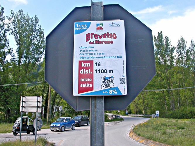
Brevetto del Nerone (BIG 795) ![]()
In case you find cycling up the Monte Nerone not enough, then here's your chance to earn the Brevetto di Monte Nerone, offered by Giordano CASTAGNOLI (621). To earn this Brevetto, one has to cycle three different sides of Monte Nerone, (1,500m) starting from the Italian cities of Apecchio, Piobbico and Pianello di Cagli: - Apecchio (Pian di Molino)/Monte Nerone: 1,500 m .s.m.; km = 16, elevation at start = 420 msm; elevation increase during ride = 1,080 m .; average slope 7% to max. 10%.
Characteristics – Wide roadway at bottom for a good stretch (until Pian di Trebbio) that will help you with the second stretch where the road gets rougher ( 8.5 km . At 8.33%). - Piobbio/Monte Nerone: 1,500 msm; km = 13.7; elevation at start = 320 slm; elevation increases during ride = 1,180 m .; average slope 8.76% to max. 12%.
![]()
Characteristics – This is the 25th ascent from Italy , and is constant between 8 and 10% with ample and good roads where your breathing can recover. At Acquanera, the road narrows and is sometimes in ruins, until the crossroad Rifugio Corsini. In this part the road coils into the woods, with winding and long straights and then the ride becomes rough and brutal and traffic is almost nonexistent. - Pianello/Monte Nerone: 1,500 msm; elevation increase during ride = 1,100 m .; average slope 7.5% to max. 11%.
Characteristics - Narrow road, very panoramic, exposed to sun and wind, with 20 turns that leave the area of Cerreto. This magical alpine ascent from the quaint village of Pianello passes through woods, tiny hamlets, then beautiful open pastures in which roam freely magnificent horses and cows. The climb is ever pleasant with some challenges, and presents spectaular views of the valley you leave behind then into the grand valley to the northeast with a remarkable sight of Gola del Furlo. Arriving at Montagnola then ultimately at the top, you are rewarded with a fantastic 360 degree panorama. Cover 3,600m height difference in 45km (8% on average). Cover 3,600m height difference in 45km (8% on average). Quite a challenge similar or perhaps even tougher than the Cinglé du Mont-Ventoux one! If one stays in the same area for a longer period one can cycle also the following BIGs: 766 Passo La Calla
767 Passo dei Mandrioli
768 Valico Monte Fumaiolo
769 San Marino
770 Abbazia La Verna
787 Monte Carpegna
771 Bocca Trabaria Aand with a car ride of one - two hours, you can also reach the following BIGs: 772 Monte Amiata
775 Sella di Leonessa
776 Forca Canapine
777 Forcola di Presta
778 Gran Sasso d’Italia. For more information and instructions for the Brevetto del Nerone you can contact Giordano CASTAGNOLI (giordano.eekhoorn@libero.it) | 
 We've partnered with Sherpa-Map.com to bring you the best route planning tool. With a PRO Membership you can use this climb as a reference when creating your route.

