17.8
PDI
16.7 mi
DISTANCE
3,696 ft
GAINED
4.2 %
AVG. GRADE
FULL CLIMB STATS
INTRO
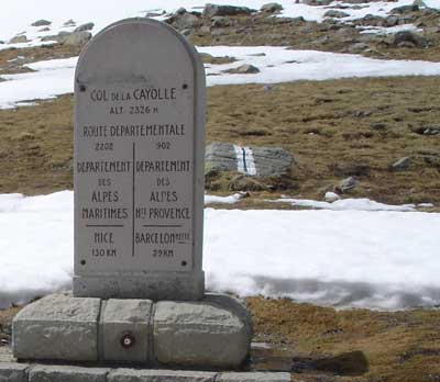
Col de la Cayolle (2326 m / 7631 ft) is the gentle giant of the Trois Cols. From the D902/D908 junction just outside Barcelonnette, our route climbs 26.8 km (16.7 mi) and gains 1127 m (3696 ft) at a 4.2% average - the longest of the three passes on the classic Cayolle-Allos-Champs loop, and the easiest by average gradient. It ranks #236 in France and #1261 in the world in our database.
The numbers hide a climb of two halves. The first 18 km (11.2 mi) to the hamlet of Bayasse average just 3.4%, threading the Gorges du Bachelard on a narrow road squeezed between the walls of the gorge, with single-lane sections, passing places and engineering works dating from around 1910. At Bayasse the road crosses the Bachelard and turns south, and the real climbing begins: the final 8.8 km (5.5 mi) average 5.8%, with the last 4.8 km (3.0 mi) at close to 7% on hairpins through larch forest and high meadow, past the Refuge de la Cayolle just below the col. The pass sits inside the Mercantour National Park, with Mont Pelat (3051 m / 10,010 ft) rising to the west, and marmots and chamois are regular company near the top.
Before the road, only a mule track linked the Ubaye with the upper Var. Most of the road on the Entraunes side was built between 1907 and 1914, and its planned opening on 10 August 1914 was cancelled by the outbreak of war. The Tour de France has crossed the col three times (1950, 1955 and 1973). The pass is snowbound and closed from roughly December to May, so check conditions at the top with our Weather tool before you go.
PLAN YOUR ROUTE
 We've partnered with Sherpa-Map.com to bring you the best route planning tool. With a PRO Membership you can use this climb as a reference when creating your route.
Our route covers 26.8 km (16.7 mi) from 1170 m (3837 ft) to the col, gaining 1127 m (3696 ft) at a 4.2% average. The steepest kilometer averages 7.0%, the steepest 2 km 7.0%, the steepest 5 km 6.8% and the steepest 10 km 5.3%.
The opening 6 km (3.7 mi) are a gentle 2-4% drag out of the Ubaye valley through Uvernet-Fours. Through the Gorges du Bachelard and on up the valley the grade sits mostly at 4-6%, with a near-flat stretch of about 3 km (1.9 mi) around km 15-18 on the approach to Bayasse (about 1780 m / 5840 ft).
From Bayasse the climb changes character. The last 8.8 km (5.5 mi) average 5.8%, and from km 22 to the top the road holds 6.5-7.0% for 4.8 km (3.0 mi) without a break - the steadiest, hardest part of the climb, and where most of the hairpins are.
Roadway: The D902 is paved all the way, but it is an old-fashioned mountain road: narrow throughout, single-lane with passing places through the Gorges du Bachelard, and rider reports describe potholes and uneven asphalt on this north side, while the upper hairpins are in better shape. The col is not cleared of snow in winter and is closed from roughly December to May, so check the Alpes-de-Haute-Provence road information before riding early or late in the season.
Traffic: Light by Route des Grandes Alpes standards, since most through traffic picks the Bonette or the Col d'Allos. The gorge is where you need to concentrate - a single car or camper van can fill the road on the narrow single-lane sections, and summer weekends bring more motorcycles. Above Bayasse the road is quiet.
Parking: The start is a short roll from the center of Barcelonnette, and the Col d'Allos starts from the very same junction, so most riders leave the car in town (see our Col d'Allos page). For a shorter outing on the steeper upper half, the Refuge-Hôtel de Bayasse at about km 18 has a car park, and it's also a handy meeting point for a support car before the final 8.8 km (5.5 mi).
Provisions: Fill up in Barcelonnette or Uvernet-Fours before the gorge. On the climb, the Refuge-Hôtel de Bayasse at about km 18 is open year-round with a restaurant, and the Refuge de la Cayolle (2266 m / 7434 ft), run by the Mercantour National Park just below the col, serves lunch in season - a welcome stop before the descent or before carrying on to Entraunes.
Gear: Gearing isn't the issue on a climb that rarely tops 7% - a standard compact is plenty. Length and altitude are: you'll be on this climb for a long time, and it finishes above 2300 m (7546 ft), so carry a wind layer and gloves for the top and enough food for the full 26.8 km (16.7 mi). Lights are a sensible extra for the shaded gorge.
Before heading out on any cycling adventure check out our Things to Bring on a Cycling Trip and use our interactive check list to ensure you don't forget anything.
This page covers the Bachelard valley - for Barcelonnette itself and its Mexican-style villas, see our Col d'Allos page. Bayasse is a tiny hamlet at about 1783 m (5850 ft), deep in the valley, and its refuge-hotel, open all year with rooms and dormitories, makes a much quieter overnight base than town.
At the col, the Refuge de la Cayolle is the trailhead for one of the area's classic hikes: about 7.2 km (4.5 mi) one way, roughly three hours, over the Col de la Petite Cayolle (2634 m / 8642 ft) and down past the Lac de la Petite Cayolle to the Lac d'Allos and its refuge. Mont Pelat, above 3000 m (9843 ft), is also climbed from here.
Every year on the first Sunday of August, the Club Cycliste Ubaye runs Les 3 Cols from the Parc de la Sapinière in Barcelonnette: a 124 km (77.1 mi) route over the Cayolle, Champs and Allos with about 3300 m (10,827 ft) of climbing, plus a 74 km (46.0 mi) option built around the Cayolle alone, with feed stops at the passes. For the other side of the pass see Col de la Cayolle from Saint-Martin-d'Entraunes, and for the full loop our Cayolle-Allos-Champs page.
ROUTE MAP

MEMBER RATING
CURRENT WEATHER
PJAMM TRIPS ADVENTURE STARTER BUNDLES
Check out PJAMM Adventure's prepackaged (self-guided) cycling trips. They will help you plan, document and conquer your next adventure.
NEARBY CLIMBS (0) RADIAL PROXIMITY
FROM No Climbs Found
MEMBER REVIEWS & COMMENTS
Let us know what you thought of this climb. Signup for our FREE membership to write a review or post a comment.
Already have an account?
LOG IN HERE