21.1
PDI
7 mi
DISTANCE
2,990 ft
GAINED
7.3 %
AVG. GRADE
FULL CLIMB STATS
INTRO
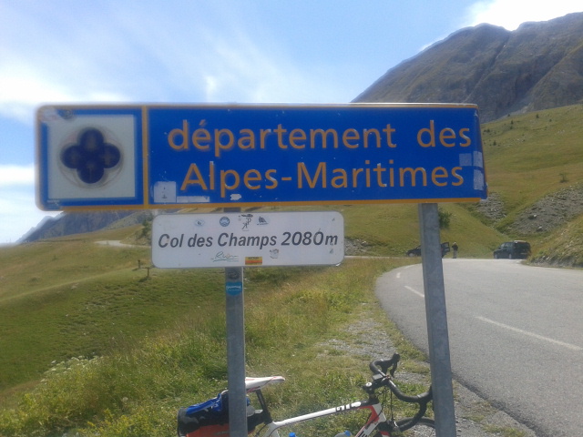
Col des Champs (2,087 m / 6,847 ft) is the middle pass of the classic Trois Cols loop from Barcelonnette - Cayolle, Allos, Champs - and this approach from Colmars is the shorter and steeper way up. The climb covers 11.3 km (7.0 mi) and gains 911 m (2,990 ft) at a 7.3% average on the D2, and of the three passes it ranks lowest by difficulty, though it is no pushover.
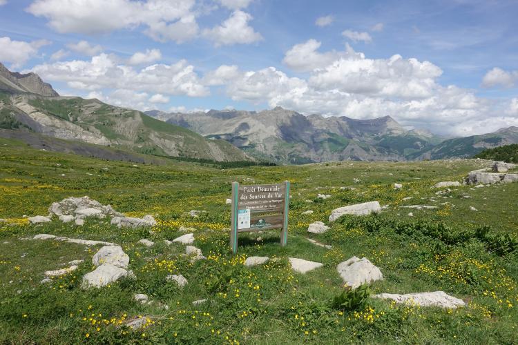
The road leaves Colmars on a narrow strip of asphalt and winds through larch and pine forest, with hairpins early on and few views on the lower slopes. The climb is a rolling one, with short steep pitches separated by easier stretches, and the steepest kilometer averages 12.0%. In the second half the trees thin and views open toward the high summits, before the road tops out on a broad, open pasture at the pass, with Dent du Lièvre (2,667 m / 8,750 ft) nearby.
The 1975 Tour de France crossed the Col des Champs on the stage to Pra-Loup, where Bernard Thévenet's repeated attacks set up the day he took the yellow jersey from Eddy Merckx. For the Trois Cols as a whole, see our Cayolle-Allos-Champs page.
PLAN YOUR ROUTE
 We've partnered with Sherpa-Map.com to bring you the best route planning tool. With a PRO Membership you can use this climb as a reference when creating your route.
 The climb covers 11.3 km (7.0 mi) and gains 911 m (2,990 ft) at an average of 7.3%. It is a rolling climb rather than a steady one: short pitches over 10% are followed by easier stretches, and the grade nearly flattens in a couple of spots in the upper half before a final ramp to the pass.
The steepest kilometer averages 12.0%, the steepest 2 km 11.0% and the steepest 5 km 9.0%, and even the steepest 10 km averages 8.1%, so there is little real recovery. The road levels off across the pasture just below the col.
Roadway: Paved the whole way, narrow, with hairpins low on the climb. The Colmars side has been resurfaced in recent years, but drainage gullies can still cross the road, so keep your speed in check on the descent. The pass is closed by snow in winter, so check conditions before riding in early or late season.
Traffic: Light. A few cars and motorcycles pass in summer, but it is rarely a steady flow, and this is a quiet road by Alpine standards.
Parking: Colmars-les-Alpes is a small fortified village, so park considerately at the edge of town rather than in the narrow old-town streets and roll out to the D2. Colmars is also the start of the Col d'Allos, so one parking spot covers two climbs.
Provisions: Restaurants and cafés are in Colmars; there is nothing at the summit but a marker and parking, so fill your bottles in the village. This is the most southerly pass above 2,000 m (6,562 ft) in the Alps, and the forested lower slopes can be hot in summer, so carry plenty of water.
Gear: Compact gearing is welcome for the 10-12% pitches. Pack a wind layer for the summit and the long descent, which is exposed above the treeline.
Before heading out on any cycling adventure check out our Things to Bring on a Cycling Trip and use our interactive check list to ensure you don't forget anything.
Colmars-les-Alpes is a fortified village well worth an hour before or after the ride. Vauban strengthened it with two 17th-century forts, Fort de Savoie and Fort de France, which guard either end of the town. Fort de Savoie opens seasonally, and you can walk around Fort de France along a fortified walkway. Narrow cobbled streets, larch-shingled roofs and open-attic souleiades give the town its character, a house museum includes a 1647 apothecary garden, and a Provençal market fills the village on Fridays. A 45-minute round-trip hike leads to the Lance waterfall.
Colmars is the start of two big climbs: the Col d'Allos, which reopened in summer 2025 after a two-year closure for landslides, and this one. On the other side of the pass, Col des Champs from Saint-Martin-d'Entraunes is the longer, more gradual approach. Before you head out, check conditions at the summit with our Weather tool.
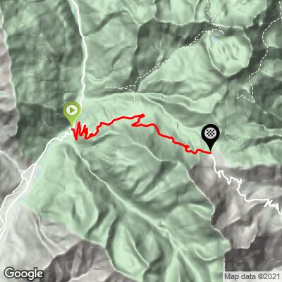
ROUTE MAP
MEMBER RATING
CURRENT WEATHER
PJAMM TRIPS ADVENTURE STARTER BUNDLES
Check out PJAMM Adventure's prepackaged (self-guided) cycling trips. They will help you plan, document and conquer your next adventure.
NEARBY CLIMBS (0) RADIAL PROXIMITY
FROM No Climbs Found
MEMBER REVIEWS & COMMENTS
Let us know what you thought of this climb. Signup for our FREE membership to write a review or post a comment.
Already have an account?
LOG IN HERE