
20.1
PDI
8.9 mi
DISTANCE
3,254 ft
GAINED
6.5 %
AVG. GRADE
FULL CLIMB STATS
INTRO
Puerto de Ancares from Murias is a 14.3 km (8.9 mi) climb from the Rao valley in Galicia to the Ancares pass on the Cantabrian crest, gaining 992 m (3,254 ft) at a 6.5% average from 752 m (2,467 ft) to 1,672 m (5,486 ft). The average is misleading: the first couple of kilometers are flat to slightly downhill, and the steepest 10 km (6.2 mi) average 8.4%, with the steepest kilometer at 11.9% and the steepest 91 m (100 yd) at 14.1%.
From Murias de Rao the LU-P-3508 follows the valley, then the road crosses into León near Balouta and climbs the LE-4211 to the pass. This is the road the Vuelta a España has used for its Ancares passages: in 2011 the stage from Sarria to Ponferrada climbed through Navia de Suarna, Murias de Rao and Balouta, and in 2012 the race finished 2.6 km (1.6 mi) below the summit. The 2024 stage 13 summit finish, won by Michael Woods, used the last 7.7 km (4.8 mi) from Balouta, at about 9% with ramps up to 15%.
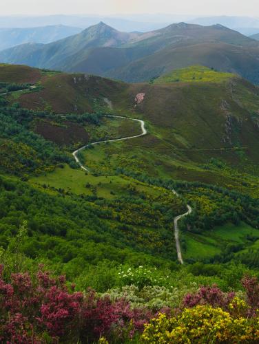
The climb sits in the Ancares biosphere reserve, where valleys below 300 m (984 ft) rise to nearly 2,000 m (6,562 ft) within a few kilometers, so a ride that starts at 752 m still finishes among bare ridgelines. The steeper route used by the 2014 Vuelta starts almost beside this one - see our Puerto de Ancares (Pan do Zarco) page.
PLAN YOUR ROUTE
 We've partnered with Sherpa-Map.com to bring you the best route planning tool. With a PRO Membership you can use this climb as a reference when creating your route.
Puerto de Ancares from Murias climbs 992 m (3,254 ft) over 14.3 km (8.9 mi) for a 6.5% average, from 752 m (2,467 ft) to 1,672 m (5,486 ft), with 72 m (236 ft) of descent along the way. That net figure hides two very different halves: the first 2 km (1.2 mi) drift slightly downhill, and the real climbing starts around km 3.
The steepest 0.4 km (0.25 mi) averages 13.1%, the steepest 0.8 km (0.5 mi) 12.1%, the steepest kilometer (0.6 mi) 11.9%, and the steepest 2 km (1.2 mi) 10.3%. The steepest 5 km (3.1 mi) average 9.5% and the steepest 10 km (6.2 mi) 8.4%, and the steepest 91 m (100 yd) reaches 14.1%.
Pacing matters more than gearing here. Use the flat opening as a warm-up, then expect long stretches of 8-9% through the middle, a brief easing near km 8 (about 5%), a sharper kilometer of roughly 11-12% near km 10, and a final kilometer that kicks back up to about 10%.
Roadway: The climb is paved from Murias de Rao to the pass, starting on the LU-P-3508 in the Rao valley and continuing on the LE-4211 after the road crosses into León near Balouta. The upper road is the one the Vuelta a España has used, but this is still a mountain road at roughly 1,670 m (5,479 ft), so snow and fog can linger outside the summer months - check conditions before riding in spring or autumn.
Traffic: Expect light traffic. The road serves a handful of small Ancares villages and the pass rather than a through route, so you will often have long stretches to yourself.
Parking: Murias de Rao is a small village with no dedicated cyclist lot, so use roadside spots at its edge and keep farm tracks clear. The council seat of Navia de Suarna (A Proba) is the practical base if you need lodging, food or a shop.
Bring everything you need from the valley: the climb passes only small hamlets such as Balouta, so fill both bottles before you start and carry food.
The steepest 10 km (6.2 mi) average 8.4% with a steepest kilometer near 12%, so a compact crankset with a 30-34 tooth cassette is the sensible setup. The pass is exposed and can be cool and foggy even when the valley is warm, so pack a wind layer and arm warmers for the top and the descent.
Before heading out on any cycling adventure check out our Things to Bring on a Cycling Trip and use our interactive check list to ensure you don't forget anything.
The pass and its surroundings reward a longer stay. A track from the top leads to the Mirador de Balouta for wide views over the valleys, and two summit walks start near the pass: Pico Miravalles (1,966 m / 6,450 ft, about 4.2 km / 2.6 mi) and Pico Cuiña (1,992 m / 6,535 ft, about 3.5 km / 2.2 mi). The Ermita de la Magdalena sits a few kilometers from the pass near Tejedo; the pass was once known as the Puerto de la Magdalena, and a Latin document from 572 already mentions it as Portum Ancares. The exact province of the summit has been disputed between Lugo and León since 2014.
On the Galician side, the Ancares Lucenses biosphere reserve covers about 53,664 hectares across Cervantes, Navia de Suarna and part of Becerreá, and its thatched stone pallozas can still be visited; Balouta, on this climb, has one in the village. For the steeper Lugo-side alternative see our Pan do Zarco page, and the Tejedo approach comes up from the León side.
Before you ride, check conditions at the top with our Weather tool.
ROUTE MAP

MEMBER RATING
CURRENT WEATHER
PJAMM TRIPS ADVENTURE STARTER BUNDLES
Check out PJAMM Adventure's prepackaged (self-guided) cycling trips. They will help you plan, document and conquer your next adventure.
NEARBY CLIMBS (0) RADIAL PROXIMITY
FROM No Climbs Found
MEMBER REVIEWS & COMMENTS
Let us know what you thought of this climb. Signup for our FREE membership to write a review or post a comment.
Already have an account?
LOG IN HERE
