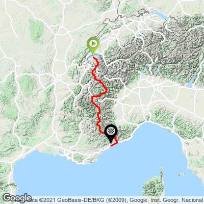
176.3
PDI
449.2 mi
DISTANCE
65,679 ft
GAINED
-0.06 %
AVG. GRADE
FULL CLIMB STATS
INTRO
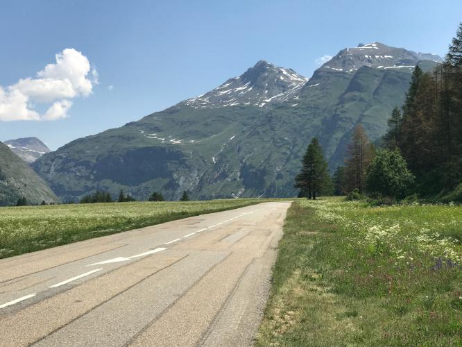
Known as the most beautiful alpine cycling route - Route des Grandes Alpes travels between Thonon-les-Bains and Menton and includes the Col de l'Iseran (2,770 m (9,090 ft), Col du Galibier (2,642 m (8,668 ft)), Col du Lautaret, Col d'Izoard (2,361 m (7,746 ft), Col de Vars (2,111 m (6,926 ft),Col de la Bonette (2,802 m (9,193 ft), and Col de la Cayolle (2,327 m (7,635 ft).
PLAN YOUR ROUTE
See more details and tools regarding this climb's grade via our interactive Profile Tool.
Information Not Available
If you have any information regarding this climb, we'd like to hear from you. Click the CONTRIBUTE button to share your thoughts with us.
Information Not Available
If you have any information regarding this climb, we'd like to hear from you. Click the CONTRIBUTE button to share your thoughts with us.
Before heading out on any cycling adventure check out our Things to Bring on a Cycling Trip and use our interactive check list to ensure you don't forget anything.
Information Not Available
If you have any information regarding this climb, we'd like to hear from you. Click the CONTRIBUTE button to share your thoughts with us.
ROUTE MAP
MEMBER RATING
CURRENT WEATHER
PJAMM TRIPS ADVENTURE STARTER BUNDLES
Check out PJAMM Adventure's prepackaged (self-guided) cycling trips. They will help you plan, document and conquer your next adventure.
NEARBY CLIMBS (0) RADIAL PROXIMITY
FROM No Climbs Found
MEMBER REVIEWS & COMMENTS
Let us know what you thought of this climb. Signup for our FREE membership to write a review or post a comment.
Already have an account?
LOG IN HERE