11.9
PDI
7.2 mi
DISTANCE
2,199 ft
GAINED
5.8 %
AVG. GRADE
FULL CLIMB STATS
INTRO
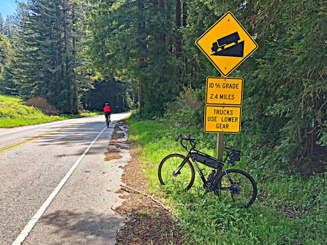
Bonny Doon is a very nice and popular climb rising out of Panther Beach just north of Santa Cruz into the Santa Cruz Mountains. The first half of the climb is the most difficult with a 2.3 mile stretch early on weighing in at 9.4%. This climb has been included three times in the Tour of California. This climb is ranked #3 in Santa Cruz County.
PLAN YOUR ROUTE
 We've partnered with Sherpa-Map.com to bring you the best route planning tool. With a PRO Membership you can use this climb as a reference when creating your route.
 Average grade is 5.8%. 44% of the climb is at 0-5% grade, 36% is at 5-10%, and 18% is at 10-15%. The steepest quarter-mile is 12.4%.
See more details and tools regarding this climb's grade via the “Profile Tool” button.
Roadway: Two lane road in good condition with a narrow shoulder you could ride in most of the climb.
Traffic: Light.
Parking: On the road across Highway 1 from the start of the climb - Map; Street View.
Provisions: None on the route. A nice option for fruit and beverages is Frabrini's Farm Produce, half a mile south of the Bonny Doon on Highway 1, or Santa Cruz 10 miles south (Map).
Before heading out on any cycling adventure check out our Things to Bring on a Cycling Trip and use our interactive check list to ensure you don't forget anything.
Be sure to visit Santa Cruz on your trip - the Boardwalk and Natural Bridges State Beach are fun places to spend time at. See our climb area page at Santa Cruz County.
There are many scenic and moderately challenging bike climbs in the Santa Cruz Mountains. Use the “Routes in Area” button on the menu bar above to see other bike climbs in this area.
ROUTE MAP

MEMBER RATING
CURRENT WEATHER
PJAMM TRIPS ADVENTURE STARTER BUNDLES
Check out PJAMM Adventure's prepackaged (self-guided) cycling trips. They will help you plan, document and conquer your next adventure.
NEARBY CLIMBS (0) RADIAL PROXIMITY
FROM No Climbs Found
MEMBER REVIEWS & COMMENTS
Let us know what you thought of this climb. Signup for our FREE membership to write a review or post a comment.
Already have an account?
LOG IN HERE
golmstead
Bonny Down is a nice challenging ride. It peels off from Hwy 1, just north of Santa Cruz. After you make the turn the road twists and turns before settling into the 10% grade. There's no real break for a couple miles, but it eventually eases up. Most of the ride is in the forest, so even if it were hot everywhere else it'd be cool and in the shade on the climb.

