Page Contributor(s): Dan Razum, Campbell, CA, USA
INTRO
PLAN YOUR ROUTE
 We've partnered with Sherpa-Map.com to bring you the best route planning tool. With a PRO Membership you can use this climb as a reference when creating your route.
 ROUTE MAP


Page Contributor(s): Dan Razum, Campbell, CA, USA
 We've partnered with Sherpa-Map.com to bring you the best route planning tool. With a PRO Membership you can use this climb as a reference when creating your route.
Cycling Zayante Road
Ride 4.8 miles gaining 1,568’ at 5.5% average grade.
Climb summary by PJAMM’s Dan Razum.
Zayante goes from Graham Hill Road in Felton up to Summit Road. Near Felton, Zayante is fairly flat with
some traffic. The climb starts at the intersection with Kingham Ranch Road, about 6 miles from Felton and
traffic mostly disappears by this point so the climb feels quite safe.
Beginning of the climb
We climb for about a mile and a half and then we reach an intermediate high point. At this point the road
changes name from East Zayante to Upper Zayante and it's flat/downhill for about a mile before it starts
climbing again.
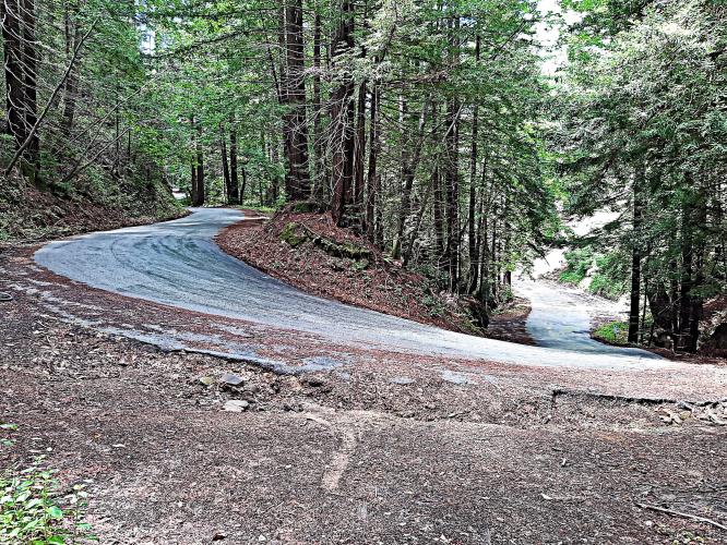
There are some steep sections but they aren't too long and there is plenty of shade.
The lower slopes are mostly pine trees and as we get near the top the pines give way to oak. Due to all
the trees there really aren't any long range views on this climb. Still, the forest is beautiful and serene
and it is nice to bike through it.
The road condition is pretty rough in places and there are several areas that are very narrow because of
old landslides that took out some of the road. However, there is road construction scheduled for summer 2020.
It looks like the construction will be patching, not a full repavement, but it should still help a lot.
As of May 2020, due to the condition of the road, Zayante is much better as a climb than a descent but maybe
after the construction is completed it will be nicer as an out and back ride.
Dan’s January, 2021 roadway update:
They were supposed to complete construction in the fall, I checked it out a couple of weeks ago and the construction is indeed finished. However, it isn't all good...
They worked on the road starting a few miles before the climb begins and went all the way to the top of the climb. The first part of the road work, including about the first 3 miles of the climb, are terrible quality. They put a very thin layer of rough chipseal on the surface and there is a lot of loose gravel. The loose gravel will eventually wear away, but in my opinion the thin, rough chipseal is worse than the surface that was there previously. So the first 3 miles of the climb are rough surface with lots of loose gravel. The last two miles are better, they actually patched the road and didn't put on the rough chipseal. They didn't repave the entire last 2 miles but they did repave some rough sections and they patched the holes and there is no loose gravel. So I would say that now the first 3 miles are in worse condition than before and the last 2 miles are pretty good.