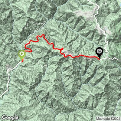
7.9
PDI
4.6 mi
DISTANCE
1,431 ft
GAINED
5.9 %
AVG. GRADE
FULL CLIMB STATS
Page Contributor(s): Dan Razum, Campbel, CA, USA
INTRO
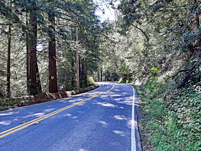
The climb starts a few miles from the intersection of Bear Creek Road and Highway 9 in Boulder Creek. The portion of Bear Creek Road between Boulder Creek and the start of the climb is rolling hills with light climbing. The start of the climb isn't immediately obvious, but it is where the road stops undulating and just keeps climbing.
PLAN YOUR ROUTE
This climb has a 5.9% average grade (6.4% climb only). 25% of the climb is at 0-5% grade and 64% is at 5-10%. The steepest quarter-mile is 9.5%.
See more details and tools regarding this climb's grade via the “Profile Tool” button.
Roadway: Two lane road with center stripe in good condition and narrow to no shoulder.
Traffic: Mild.
Parking: On the left side of the road just after passing Moonrise Road (on the right), and just before the start of the climb (Map; Street View).
Provisions: None on the route. The closest provisions are either to the southwest 4.5 miles on Boulder Creek Road to Boulder Creek (Route Map) or 8.6 miles east in Redwood Estates (Route Map).
Before heading out on any cycling adventure check out our Things to Bring on a Cycling Trip and use our interactive check list to ensure you don't forget anything.
Try some of the many other climbs in the area by referring to our Santa Cruz County climb page.
Use the “Routes in Area” button on the menu bar to see other bike climbs in this area.
ROUTE MAP
MEMBER RATING
CURRENT WEATHER
PJAMM TRIPS ADVENTURE STARTER BUNDLES
Check out PJAMM Adventure's prepackaged (self-guided) cycling trips. They will help you plan, document and conquer your next adventure.
NEARBY CLIMBS (0) RADIAL PROXIMITY
FROM No Climbs Found
MEMBER REVIEWS & COMMENTS
Let us know what you thought of this climb. Signup for our FREE membership to write a review or post a comment.
Already have an account?
LOG IN HERE