
16.2
PDI
6.8 mi
DISTANCE
2,544 ft
GAINED
7.1 %
AVG. GRADE
FULL CLIMB STATS
INTRO
Prat d'Albis is Foix's backyard mountain. The road leaves the edge of town, climbs hard through the forest and comes out on open grazing land where horses and cattle wander across the tarmac. It was a local's climb until 2019, when the Tour de France finished up here for the first time: Simon Yates won the stage, Thibaut Pinot attacked the favorites on the final climb and took second, and Julian Alaphilippe lost 1:49 but held on to the yellow jersey.
It's 10.9 km (6.8 mi) at 7.1%, gaining 775 m (2544 ft), and it doesn't ride like a 7% climb. The first 2 km out of Raygnac are a warm-up. Then the road leaves the houses behind and kicks up, and the next 4 km average 9.5%, with the steepest kilometer at 11.3% and short ramps steeper still. It's narrow and twisting in there, and there's not much to look at but the next bend.
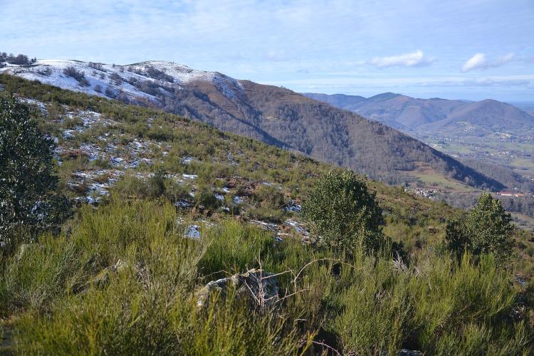
Above km 6 you come out of the trees and it settles to 5-6% for the rest of the way. Foix and the Ariège valley open up below, and the main chain of the Pyrenees lines up to the south. The road finishes on the open grass of the plateau, with the antennas of the Bout de Touron above you - the only hard decision left is whether to sit down for a while before the descent.
PLAN YOUR ROUTE
 We've partnered with Sherpa-Map.com to bring you the best route planning tool. With a PRO Membership you can use this climb as a reference when creating your route.
Overall: 10.9 km (6.8 mi) from 454 m (1490 ft) to 1230 m (4034 ft), gaining 775 m (2544 ft) at an average of 7.1%.
The shape: 2 km at about 6% out of Foix, then 4 km (2.5 mi) at 9.5% through the forest from km 2 to km 6 - this is the climb. Riders report short pitches of 12-13% inside that stretch. The last 4.9 km on the open plateau average 5.5%.
Kilometer by kilometer: 5.1%, 7.3%, 9.9%, 8.5%, 10.8%, 8.9%, 6.4%, 5.8%, 6.4%, 4.6%, and 4.3% for the final 0.9 km.
Steepest sections: 0.5 km at 12%, 1 km at 11.3%, 2 km at 10.1%, 5 km at 9.3%.
Roadway: Paved to the finish. The Route du Prat d'Albis is a narrow, twisting mid-mountain road, resurfaced not long before the 2019 Tour, and riders still describe the surface as good. On the open upper section expect three cattle grids and loose horses and cows on the road - give the cows room and keep your speed down on the way back through. Snow can close the upper road in winter, so check Ariège's Inforoute09 road information before riding between late autumn and spring.
Traffic: Light. Apart from the first kilometer on Foix's outskirts, the road serves a few houses and farms and the plateau itself, so most of the cars you'll meet are walkers and, on flyable days, paragliders heading for their car park near the top.
Parking: Park in Foix and ride out to the start - the car parks along the Allées de Villote, by the tourist office in the town center, are a short ride from Raygnac. Up top there's a paragliders' car park and some space on the plateau, where walkers leave their cars.
Gear: Gear for km 2 to 6, not the average. Four kilometers at 9.5% with ramps over 12%, starting almost straight out of town, goes a lot better on a 34x30 or 34x32. The plateau is open and exposed, so carry a wind layer for the descent.
Provisions: Everything you need is in Foix - bakeries, supermarkets and cafes. There's nothing on the climb or at the top, so fill both bottles before you leave town.
Before heading out on any cycling adventure check out our Things to Bring on a Cycling Trip and use our interactive check list to ensure you don't forget anything.
Foix makes an easy base: it's the prefecture of the Ariège, with trains from Toulouse, and the Château de Foix sits on its rock right above the old town. The castle is open to visitors and makes a good post-ride walk if your legs still manage stairs.
Péguère is the obvious partner. The D17 heads west out of Foix up the Arget valley to the Col de Péguère - the gentle side - and our Mur de Péguère page covers the steep side up from Massat, so you can do both from one base in Foix. Port de Lers and Les Dadels start further up the Ariège valley, beyond Tarascon-sur-Ariège, which is a short train hop from Foix.
The plateau is exposed and can be a lot cooler and windier than town - our Weather tool gives the forecast for the top, worth a look before a spring or autumn ride.
ROUTE MAP

MEMBER RATING
CURRENT WEATHER
PJAMM TRIPS ADVENTURE STARTER BUNDLES
Check out PJAMM Adventure's prepackaged (self-guided) cycling trips. They will help you plan, document and conquer your next adventure.
NEARBY CLIMBS (0) RADIAL PROXIMITY
FROM No Climbs Found
MEMBER REVIEWS & COMMENTS
Let us know what you thought of this climb. Signup for our FREE membership to write a review or post a comment.
Already have an account?
LOG IN HERE
MethowBiker
A challenging mid distance out and back climb, unless you have a gravel bike. Kilometers 3-6 get your attention, averaging over 9%. A few hairpins in those section allow you to go wide and get a few pedal strokes of flattish terrain before it tips up again
After 6-7 k though, it backs off to about 6-7%, and the views open up too. No services on this climb. I warmed up my legs first by pedaling a few flat miles I’m town.
This climb has been featured in the Tour de France a few times.
