
42.4
PDI
23.6 mi
DISTANCE
7,171 ft
GAINED
5.7 %
AVG. GRADE
FULL CLIMB STATS
INTRO
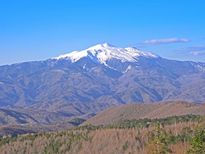
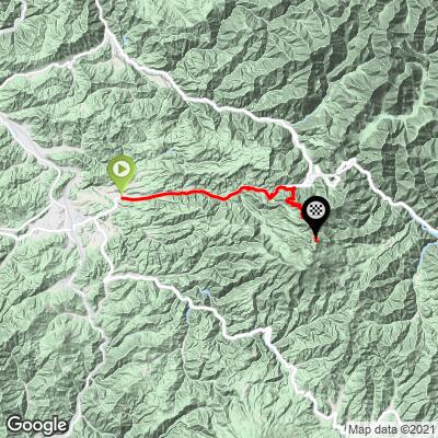
Mt. Norikura West climbs from Takayama, Gifu Prefecture, up the Norikura Skyline - the highest paved road in Japan - to 8,940 ft (2,725 m) near Tatamidaira, just below Mt. Norikura's 3,026 m summit. At 23.6 miles with 7,171 ft of gain, it's one of the longest and highest climbs in Japan, averaging 5.7% - world rank #82.
The route runs from Takayama through Hirayu Onsen to the Hirayu-toge gate, where the Norikura Skyline itself begins. This last stretch is one of Japan's cycling landmarks: motor vehicle traffic is banned outright on the Skyline during its open season, so cyclists share the switchbacks only with the shuttle buses ferrying hikers to the Tatamidaira trailhead. Above treeline, the road climbs through alpine tundra with views of perennial snowfields even in midsummer.
The Skyline is open seasonally - the Gifu side runs mid-May through October 31, closed the rest of the year for snow - and the Hirayu-toge gate opens at 6 a.m. in July-September and 7 a.m. the rest of the season. The Norikura Hill Climb race on the Nagano-side Echo Line (run since 1986) and a separate Gifu-side Skyline hill climb (since 2004) have made this whole mountain one of Japan's best-known cycling pilgrimages.
PLAN YOUR ROUTE
 We've partnered with Sherpa-Map.com to bring you the best route planning tool. With a PRO Membership you can use this climb as a reference when creating your route.
 Mt. Norikura West averages 5.7% over its 23.6 miles, but as one of Japan's longest continuous climbs the grade builds steadily rather than staying flat throughout. Our data shows 14.7% over the steepest 100 yards, 13.6% over the steepest quarter-mile, 11.9% over the steepest half-mile, and 11.8% over the steepest full mile - concentrated in the switchbacks of the Norikura Skyline section above Hirayu-toge, where the road gains most of its 7,171 ft above treeline. Use our free Profile tool to break the climb into manageable sections, kilometer by kilometer, before you go.
Roadway: Paved the entire way. Route 158 through Hirayu Onsen is a normal, well-maintained two-lane highway; above the Hirayu-toge gate, the Norikura Skyline is a smooth mountain road built for hiking-bus traffic, with numerous switchbacks in its upper miles. If you descend toward Takayama afterward, note the 2.4 km Hirayu Tunnel on Route 158 - lit but narrow, worth a rear light.
Traffic: The Route 158 approach carries normal highway traffic. Above the gate, the Norikura Skyline is closed to private motor vehicles for its entire open season (mid-May through October 31 on the Gifu side) - only shuttle buses, taxis, and bicycles are permitted, making this one of the lowest-traffic high-mountain climbs in Japan. The Hirayu-toge gate opens at 6 a.m. in July-September and 7 a.m. the rest of the season; the road closes for winter around November 1 and reopens the following May.
Parking: There's no need to drive past the gate since private cars aren't allowed on the Skyline - park in Takayama or near Hirayu Onsen and ride from there. Drivers who want to see the upper mountain without riding it can park at the Hoo-no-ki-daira lot near the gate and take the shuttle bus.
Hirayu Onsen, roughly the midpoint, has the last reliable food, water, and lodging before the Skyline begins - it's also a well-known hot spring town worth a soak on the way back. Above the gate there are no services until the Tatamidaira bus terminal near the top, which has a small shop and restrooms when open. Given the climb to nearly 2,725 m, pack real layers - temperatures at the summit can be dramatically colder and windier than Takayama, even in August.
Before heading out on any cycling adventure check out our Things to Bring on a Cycling Trip and use our interactive check list to ensure you don't forget anything.
Takayama, with its well-preserved old town, is the natural base and a worthwhile destination on its own. Plan your trip within the Gifu-side season (mid-May through October 31) and note the gate opening times - 6 a.m. in July-September, 7 a.m. otherwise - if you want an early start ahead of the shuttle buses.
If you're continuing over to the Nagano side via the Norikura Echo Line, plan your descent carefully: reaching Takayama requires the Hirayu Tunnel, while reaching Matsumoto requires climbing over Abo Pass (1,792 m), since the toll-road section of Route 158 doesn't allow bicycles. Use our Sherpa Map tool to plan a custom multi-day route linking both sides of the mountain.
ROUTE MAP
MEMBER RATING
CURRENT WEATHER
PJAMM TRIPS ADVENTURE STARTER BUNDLES
Check out PJAMM Adventure's prepackaged (self-guided) cycling trips. They will help you plan, document and conquer your next adventure.
NEARBY CLIMBS (0) RADIAL PROXIMITY
FROM No Climbs Found
MEMBER REVIEWS & COMMENTS
Let us know what you thought of this climb. Signup for our FREE membership to write a review or post a comment.
Already have an account?
LOG IN HERE
