![Cycling Benbradagh, Ireland PJAMM Cyclist rides up one-lane country roadway surrounded by green hillsides and pastures]()
Cycling Benbradagh, Ireland
Ride 1.9 kilometers gaining 256 meters at 13.4% average grade.
This climb is in the Sperrin Mountains of Northern Ireland and is the northernmost Ireland Top 10 bike climb.
![Cycling Benbradagh, Ireland photo collage shows a lot of green views along the route; PJAMM Cyclist stands with bike in tall grass on roadside; sheep graze on hillside; road sign for Curragh Road]()
Climb summary by PJAMM Cycling’s Brad Butterfield:
As we came to learn during our time in Ireland, most climbs start in fairly remote farm lands and end at radio towers. The Benbradagh climb was one of the few exceptions to this rule. Although she does start in farmlands, the road doesn't end at a radio tower, at least not that we could see in the dense fog that we entered on the day we rode. Instead, the steep incline of the road brings riders to a retired USA military base. We’d have had no idea that it was there, except that we got lost down a dirt road while looking for the start point and ended up on a dead end road. A friendly farmer came out to help direct us out. When we told him our aim was to ride to the summit he said, “Ah, you want to ride where the Yanks had a base eh?” The base was exactly where he told us it’d be. Over two gates down a well groomed dirt road. There isn’t much of it left to see though. It was retired from use in the 1970s but was apparently integral to the D-Day invasion of Normandy.
![Cycling Benbradagh, Ireland Google satellite view of the old USA Military base st Bernbradagh; PJAMM Cyclist standing in tall grass looking down over remains of base]()
Left image is Google satellite view of the old military base.
![Cycling Benbradagh, Ireland PJAMM Cyclist rides through ruins of abandoned US Military base]()
Ride 600 meters from the finish on gravel to the abandoned US military base.
![Cycling Benbradagh, Ireland bike parked in grass on roadside next to white street sign for Curragh Road]()
The climb begins by riding up Curragh Road just east of Dungiven, County Londonderry, Northern Ireland.
![Cycling Benbradagh, Ireland photo collage shows views along climb, including tall green pastures, white sheep grazing, foggy overcast day with pastures below]()
Views along the first part of the climb.
Climb summary by PJAMM Cycling’s Tayler Hockett:
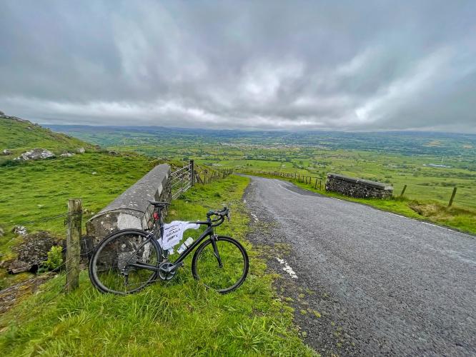
This short, steep road starts on a country road and you can see the road zigzag up the mountain from the bottom. It’s pretty basic and the grade is pretty steady. You get really amazing views of the valley full of northern Ireland farms below. The coolest part of this is at the top where you can take the foot path, hop the gate, and take the gravel path with a great view of rolling hills and windmills. This takes you to an old US military base. Unfortunately we had a proper Irish morning with rain and fog so not the best views at the top, but lower on the climb the weather was clear and views were fantastic.
![Cycling Benbradagh, Ireland PJAMM Cyclists ride through rolling green pastureland on an overcast Irish day]()
![Cycling Benbradagh, Ireland views looking down the green Irish hillside on overcast day]()
Benbradagh is Irish for Thief’s Peak.
![Cycling Benbradagh, Ireland bike parked in green grass on hillside looking down over the 17% grade of the steepest 500 meter segment of the climb]()
End of the steepest 500 meters of the climb - 17%.
![Cycling Benbradagh, Ireland Irish farmland, overcast day]()
![Cycling Benbradagh, Ireland bikes parked against gate at climb's end, Dungiven Viewpoint; writing on metal box near gate reads "Jesus is Risen"]()
The climb ends at the gate near Dungiven Viewpoint with wonderful views on a clear day.

 We've partnered with Sherpa-Map.com to bring you the best route planning tool. With a PRO Membership you can use this climb as a reference when creating your route.

