![DSC01278.JPG]()
This is one of the two monster out-and-backs in California’s Sonoma-Napa-Lake counties (Geysers Road being the other). At 72 miles and nearly 11,000’ of climbing, this route will challenge the heartiest of climbers. The route consists of six main climbs – three on the way out and three on the way back. The mightiest of the climbs is the infamous Rancheria Wall (segment three heading towards the coast). The Wall averages 12% and has several 20%+ stretches on it. See PJAMM’s Skaggs Loop Climb Page for more details regarding the full route.
If you are looking for a remote and nearly private ride through rural Sonoma county, this is it – but be prepared because it is quite challenging.
We begin at Warms Springs Dam and climb through isolated terrain that transitions from grazing land, to oak studded hillside, to a stretch that follows the Wheatfield Fork of the Gualala River, past Annapolis Road (to Sea Ranch), over one of the handful of truss bridges in remote areas of Sonoma County, through redwood forest, and ending at Stewarts Point Store on the rugged Sonoma County Coast. . . . AND BACK!
SKAGGS-STEWARTS POINT WEST (THE “OUT”)
![DSC01248.JPG]()
Start Skaggs Springs West 1 (Warm Springs Dam)
Ride 7.9 miles gaining 2,320’ at 4.5% average grade.
![DSC01260.JPG]()
Some views of Lake Sonoma along this segment.
![]()
![DSC01260.JPG]()
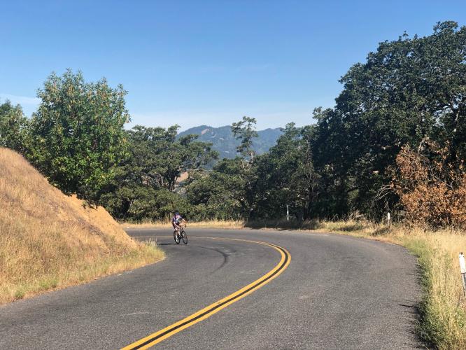
Curves along the steepest mile (9.5%).
![]()
![DSC01260.JPG]()
Finish -- Mt. St. Helena in the background photo center top.
Aerial drone photo.
![]()
Mt. St. Helena to the southeast -- ground level photo.
Rarely do we see cyclists on any portion of this route (other than the first mile before the turn off from for the lake), and you will likely never encounter more than 20 vehicles over a six to eight hour ride outing. Generally, the scenery is pasture, oaks, and heavily forested hillsides for the first 25 miles, and redwoods and ferns for the next 10. For the first eight miles we have intermittent views of Lake Sonoma to the right (north).
SKAGGS-STEWARTS POINT WEST #2
![]()
Start just past the bridge over Warm Springs Creek at mile 12.
2.8 miles gaining 1,070’ at 6.8% average grade.
![DSC01320.JPG]()
![DSC01320.JPG]()
Footbridge at Camp Liahona Redwoods (mile 28).
![]()
Annapolis Bridge -- 200 yards before start of Rancheria Wall.
SKAGGS-STEWARTS POINT WEST #3 (RANCHERIA WALL)
![]()
Start of THE WALL
30 miles into the Skaggs-Stewarts Point ride.
![DSC01340.JPG]()
A mere 1.3 miles . . . but . . .
12.5% average grade + steepest ¼ mile = 16%! 😓
![]()
![DSC01348.JPG]()
. . . or rot in the wilderness. 👍👍
![DSC01320.JPG]()
STEWARTS POINT-SKAGGS SKAGGS SPRINGS ROAD (EAST 1)
![DSC01374.JPG]()
Cycling Stewarts Point-Skaggs Springs Road West 1.
Ride 1.6 miles gaining 885’ at 10.6% average grade.
Ride to Stewarts Point for provisions, then head back towards the lake. Two and a half miles from Stewarts Point (mile 38.6 of the full out-and-back), we begin our climb up the west side Rancheria Wall. Those 2.5 miles from Stewarts Point to the beginning of West #1 are very pleasant, traveling along a very narrow and little used road surrounded by redwoods.
![DSC01320.JPG]()
![DSC01320.JPG]()
The climb begins just past the bridge.
STEWARTS POINT-SKAGGS SKAGGS SPRINGS ROAD (EAST 2)
![]()
Start at the cattle guard - this one is a long grinder.
This climb begins at the 52.4 mile mark of the out and back and is 16 miles from Stewarts Point.
![]()
Ride 4.5 miles gaining 1,480’ at 6.1% average grade.
![]()
STEWARTS POINT-SKAGGS SKAGGS SPRINGS ROAD (EAST 3)
![]()
Road is center of photo, coming up from the bridge eastbound.
The last of six tough climbs on this brutal 76 mile route.
Ride 4.3 miles gaining 1,520’ at 5.4% average grade.
![]()
That’s a wrap!
TIPS
This climbing test is best undertaken in the cooler months, as this area is very hot during the summer – normally in the 90s, although after clearing the Rancheria Wall at about mile 30, the temperatures are always cooler as we are on the coastal section of the journey at this point.
As of April 2015, there is water at mile 27.5 at Camp Liahona and Kashia elementary school at Stewarts Point Rancheria mile 31.5. At the turn around point (Stewarts Point Store) there is a deli and market that has most anything you need, including Advil!
![DSC01326.JPG]()
![DSC01367.JPG]()
Water at Camp Liahona left; Kashia Elementary School right.
Roadway surface and traffic: The road is called Skaggs Springs Road for the first 13 miles, changing to Stewarts Point/Skaggs Springs Road at mile 13 (beginning just after the intersection of Skaggs Road and Old Stewarts Point-Skaggs Road – a dead end, by the way). The road for these first 13 miles is wide and generally has a bike lane/wide shoulder. For the next 20 miles, the majority of the road is narrow with no bike lane, although there is not much traffic so the ride has been completely safe on our many times out and back. The roadway surface is excellent, except for some rough sections over the 20 miles from mile 13 to the coast.
![DSC01374.JPG]()

 We've partnered with Sherpa-Map.com to bring you the best route planning tool. With a PRO Membership you can use this climb as a reference when creating your route.

