Wheeler Peak Bike Climb - PJAMM Cycling

30.8
PDI
15.9 mi
DISTANCE
4,892 ft
GAINED
5.8 %
AVG. GRADE

FULL CLIMB STATS

Page Contributor(s): Ron Hawks, Las Vegas, NV, USA; Stacy Topping, Tacoma, WA, USA; Bruce Hamilton, LaQuinta, CA, USA

INTRO

The Wheeler Peak cycling climb is in a very remote area in Great Basin National Park and starts about 5 miles from Nevada's border with Utah in the tiny town of Baker. You climb 15.9 miles and 4,892' at a 5.8% average grade, finishing at 10,162' near Wheeler Peak Campground at the end of the Wheeler Peak Scenic Drive. Wheeler Peak itself is the second tallest peak in Nevada and the tallest independent mountain in the state.

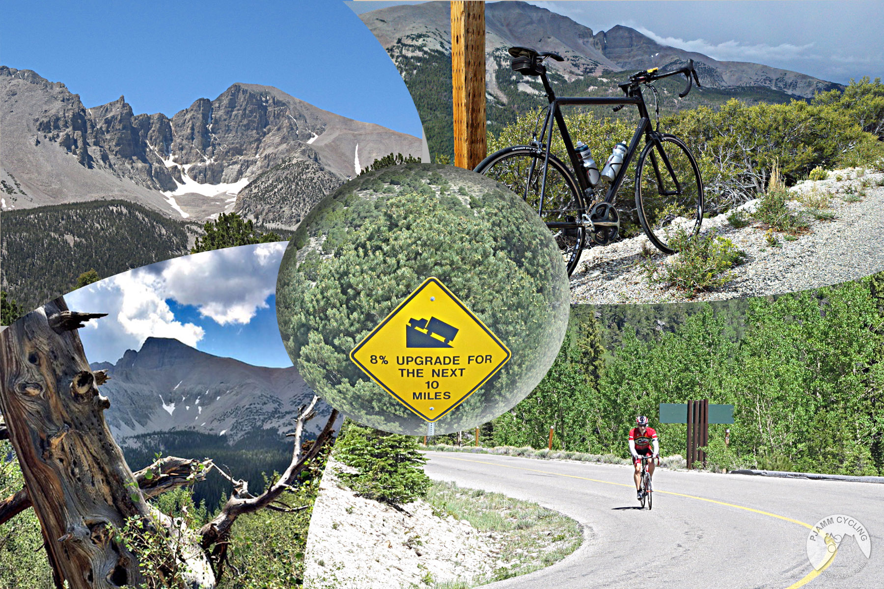
The first 6 miles run nearly straight up Highway 488 through sagebrush, where cars move fast. At the T-intersection the Scenic Drive begins and the climb gets serious - a sign warns of 8% grades for the next 10 miles, and the park posts elevation markers every 500'. As contributor Matt Dupree describes it, you follow Lehman Creek, then a spectacular ridge with views east to Notch Peak in Utah, before a hard left around mile 10.5 into a steep, closed-in stretch of mountain mahogany. At mile 14.6 you pass through a "gate" of rocks, and Wheeler Peak fills the view. Along the way you climb through sagebrush, pinyon-juniper, mixed conifer and aspen - the park likens it to driving from Baker to the Yukon.

"One of the most isolated of America's great climbs, Wheeler Peak is also one of the most difficult in Nevada and perhaps its most spectacular..." (This quote is presented with the approval of John Summerson, from his book, The Complete Guide to Climbing (by Bike), 2nd Edition, pg. 194.)

PLAN YOUR ROUTE

We've partnered with Sherpa-Map.com to bring you the best route planning tool. With a PRO Membership you can use this climb as a reference when creating your route.
Average grade of 5.8%, gaining 4,892' in 15.9 miles, from 5,320' in Baker to 10,162' at the finish - 65% of the climb is at a grade of 5-10%.

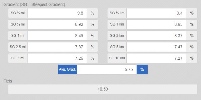
The first 6 miles on Highway 488 are the gentlest part of the ride; the real work starts on the Scenic Drive. The steepest mile (8.4%) begins around mile 6.3, just after the turn onto the Scenic Drive, and the steepest quarter mile (9.9%) comes around mile 11.1 in the mountain mahogany section. The steepest 5 miles average 7.3%, and there's only 49' of descent on the entire climb.
Roadway: The pavement is good throughout the climb, but there are expansion cracks (ruts across the road) at the upper levels which can be irritating. The Scenic Drive is a narrow two-lane road with a center stripe, no shoulder and frequent blind curves - the Park Service allows bikes but urges extra caution and visibility. It's closed in winter and after snowfall, and the upper road typically opens in late June or early July once the snow is cleared and stays open into October; when a park road is closed, bikes are not allowed past the closure. The NPS listed the Scenic Drive as open as of late September 2026 - check current conditions before you go. There is no entrance fee for Great Basin National Park.

Traffic: Minimal - Great Basin is one of the least visited national parks in the country. Cars on the straight lower miles of Highway 488 can move fast, so wear something bright. On the Scenic Drive, traffic is light and slow, and vehicles over 24 feet aren't allowed beyond Upper Lehman Creek Campground.

Parking: In the small town of Baker at the start of the climb - Map; Street View.
Provisions: In Baker at the start of the climb - the Stargazer Inn's Bristlecone General Store is open year-round. Water is available year-round at the Lehman Caves Visitor Center, a short detour from the turn onto the Scenic Drive about 6 miles up, but not at the park's campgrounds, including Wheeler Peak Campground at the top, so fill up before the Scenic Drive. There's essentially no cell coverage on the climb, so ride self-sufficient.

Gear and Weather: You climb from about 5,300' to over 10,000', so check our Weather tool for the time you expect to arrive at the finish to decide what clothing to bring, and pack a layer for the long descent.
Before heading out on any cycling adventure check out our Things to Bring on a Cycling Trip and use our interactive check list to ensure you don't forget anything.
Stay in Baker and visit the National Park - Things to do in Great Basin National Park. Baker's options include the Stargazer Inn, whose Kerouac's restaurant is open seasonally, and the Border Inn sits right on the Nevada-Utah line on US-6/50.

Book a Lehman Caves tour while you're here - reservations are strongly recommended, and park operations are cashless. From the end of the Scenic Drive, trails lead on foot to ancient bristlecone pines and toward Wheeler Peak itself (bikes aren't allowed on park trails). And stay up late: Great Basin has been an International Dark Sky Park since 2016, and its night skies are exceptionally dark.

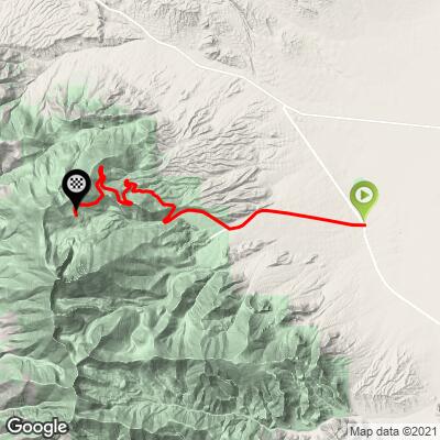
ROUTE MAP
MEMBER RATING

Difficulty: Challenging
4/5
Road
5/5
Traffic
5/5
Scenery

CURRENT WEATHER

PJAMM TRIPS ADVENTURE STARTER BUNDLES

Check out PJAMM Adventure's prepackaged (self-guided) cycling trips. They will help you plan, document and conquer your next adventure.
ALL TRIPS
Browse all of our prepackaged trips and find your next adventure!
Death Valley
United States (CA)
21 ROUTES
34 POIs
ROUTE STATS (TOTAL)
553.3
mi
DISTANCE
55,125
ft
ELEV. GAIN
Lake Tahoe
United States (CA,NV)
18 ROUTES
32 POIs
ROUTE STATS (TOTAL)
245.7
mi
DISTANCE
35,240
ft
ELEV. GAIN

NEARBY CLIMBS (0) RADIAL PROXIMITY

FROM
No Climbs Found

MEMBER REVIEWS & COMMENTS

Let us know what you thought of this climb. Signup for our FREE membership to write a review or post a comment.
Already have an account?

Jul 13, 2023
difficulty: Challenging
scenery: 5
traffic: 5
road: 4
Jul 13, 2023
scenery: 5
traffic: 5
road: 4
July 8, 2023 From baker (92°) up to the visitors center then a short cool down decent to the Wheeler Peak rd. A nice gradual climb through gorgeous scenery and fantastic views. No steep sections but there are some moderate, stand-up sections for sure. Nice and cool at the top with a short decent to a campground with water and restrooms. Fast decent on a good road but pay attention - some dips and bumps in the tree shadows will get your attention.
Oct 2, 2022
difficulty: Challenging
scenery: 5
traffic: 5
road: 4
Oct 2, 2022
scenery: 5
traffic: 5
road: 4
Definitely a "hidden gem". Relatively consistent grade made it easy to drop into a groove. The ride was challenging but not overly so, and so it was very fun. I've ridden harder climbs with lower FIETS ratings. :shrug: Traffic was light and I had the road to myself most of the time. Drivers gave plenty of space. Road surface is good chip-n-seal. Fall is a great time since the foliage is beautiful and temps are cooler. Also, I wouldn't recommend this ride for agoraphobics; lots of very expansive views.
Mar 16, 2021
Did this one back in sept 2015, really fantastic. Aspens were gold, air was crisp to start, but hot back at base at end. Reminded me of some of the Eastside of Sierra climbs
ROUTE MAP
PROFILE TOOL
Route Data
S.G. (%)
hide
Segment Data
hide
CLIMB SUMMARY

Cycling Wheeler Peak - Top 50 US Bike Climb at Nevada-Utah border.

Ride 16 miles gaining 4,970’ to 10,171’ at 5.8% average grade. 

The Wheeler Peak bike climb is in a very remote area in Great Basin National Park and starts just 4.5 miles from Nevada's border with Utah in the small town of Baker, NV (pop. 68 as of 2010).  Wheeler Peak is the second tallest peak in Nevada and the tallest independent mountain in the state.   We enter Great Basin National Park (77,180 acres, established 1986) at mile 5.  The park’s name derives from the Great Basin between the Sierra Nevada Mountains in western Nevada and Utah’s Wasatch Mountains.

Great Basin NP is home to groves of bristlecone pines (like White Mountain, Big Pine, Owens Valley, CA), the oldest known non-clonal tree (i.e., each tree is the original organism, it is not a clone of a parent organism).  The National Park also offers tour of the Lehman Caves - https://www.nps.gov/grba/planyourvisit/lehman-caves-tours.htm 

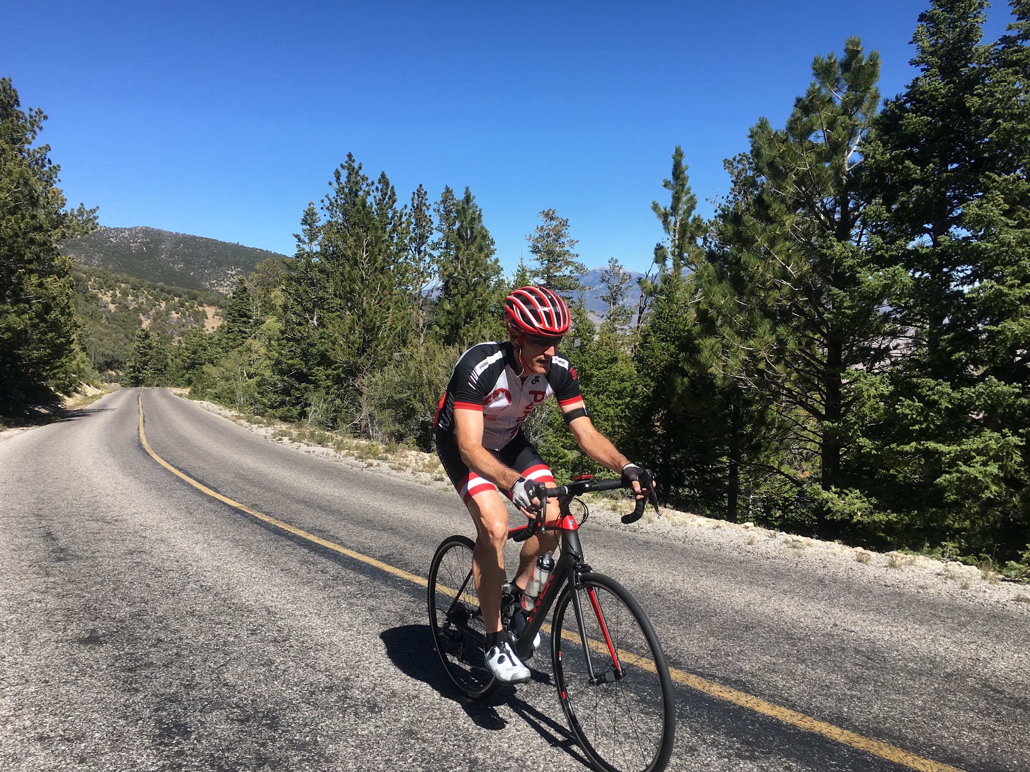
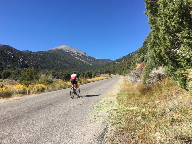
Bike climb of Wheeler Peak - cyclist on road

Top 100 US charter member Ron Hawks bringing it strong up Wheeler.

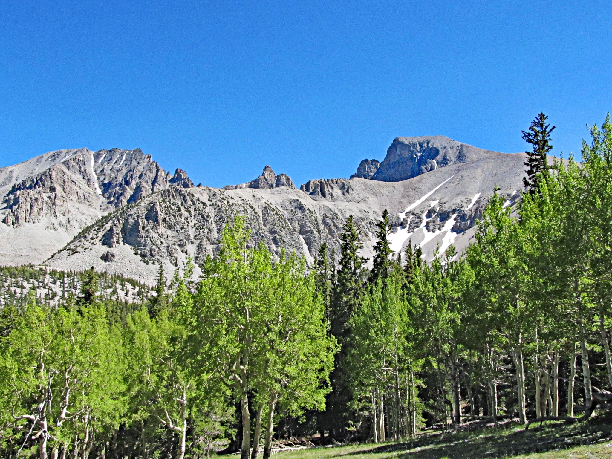
Climbing Wheeler Peak by bike - granite mountain

Beautiful scenery on this climb.

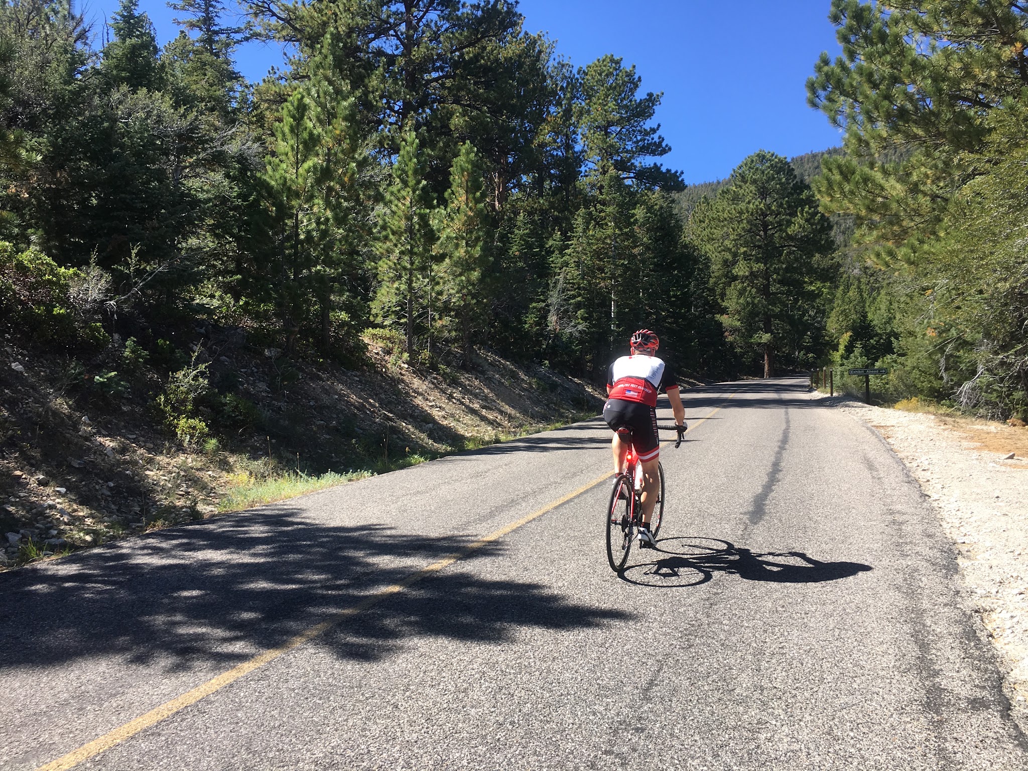
Bicycle climb up Wheeler Peak - cyclist on road with snow covered peak in background

Lonely but safe climb.


Steepest ¼ mile begins at mile 11.2 (9.8%) and steepest mile at mile 6.3 (8.5%)

An excellent summary of this ride is found in the blog of Jason White, Garrison, UT along with great photos along the climb.

PJAMM contributor Matt Dupree, Denver, CO provides an exceptional summary of the ride:  

     Wheeler begins in the morning rush hour traffic of downtown Baker, Nevada at the intersection of NV487 and NV488.  As soon as you turn up Lehman Cave Rd, (NV488), the climb begins.  You’re in the sage and grassland here at about 5,000’, and the sun is trying to cut you in half.  This first part is about 5 miles and 1200’ of climb, much like Lookout Mountain in Golden, CO, or Flagstaff Mtn in Boulder, CO, except it’s more or less straight and deliriously sunny.  Even starting early, you’ll be drenched in sweat by the time you get to the turnoff at mile 6.  Don’t worry, you’ll cool off soon enough.  You’ll pass a ranching exhibit and a lot of charming local displays--Baker has a lot of charm and it extends up this road.  At about mile 4 you begin to leave the sage and transition into the juniper and pinon forest.  The only thing not charming is that a straight road invites fast traffic, and you’ll get passed by cars going 70, easy.  They are courteous and will give you room, but they are moving fast.  Wear a red jersey or something to give them a heads up.  At mile 6 there is a T-intersection and a right turn and the climb really begins.  If you didn’t notice, a sign informs you that you’re looking at 8% grades for the next 10 miles.  The park service helpfully provides elevation signs every 500’.  You’re going to 10,000.  The road here is chipseal but generally well maintained, with very little gravel on the turns because the roadbed is raised up a bit and gravel doesn’t wash across the road much.  It’s narrow with no marked shoulder but very lightly trafficked—starting early on a weekday, you’ll be able to count the cars on your two hands.  For cars, the road is slow and drivers are awed by the scenery and very courteous.  The total lack of cell coverage ensures attentive drivers but means you need to be totally self-sufficient.  Looking up from here you’ll see the general lie of the road.  Even though the peak is to the south, you’ll see that the road winds its way north quite a bit.  From mile 5 to 7.5 or so, you’ll follow Lehman Creek and climb about 1,000’.  At mile 7.5ish there is a hard switch and a solid climb away from Wheeler and the creek.  You’ll ride along the ridge for 3 spectacular miles and climb about 1,000’.  Wheeler and the Snake Range are an “island in the sagebrush ocean” and it really shows along this stretch.  The Snake Range is so isolated that it doesn’t have bears—they never made it across that desert.  From here you can clearly see Notch Peak to the east in Utah, 95 miles away.  Mt Moriah towers to the north across US 50.  This is where Wheeler really rewards—you feel like you are in an airplane high above the sage plain.  The first washed-out picture is from this section looking down the hill toward Baker. At mile 10.5 or so (about a mile past Osceola Ditch), you encounter a hard left switch and now you’re closed in a bit, climbing toward the south.  It’s very steep here, and the only views are of the road far above you to your right.  You’re in a forest of mountain mahogany.  Psychologically, this is a very hard stretch even though it’s only about 1,300’ of climb to the next section at mile 14.6.  At mile 13.3 there is a tiny downhill portion that feels like a huge relief.  At mile 14.6 you cross a ridge that is like a gate of rocks.  There is a hard right and then you see Wheeler.  

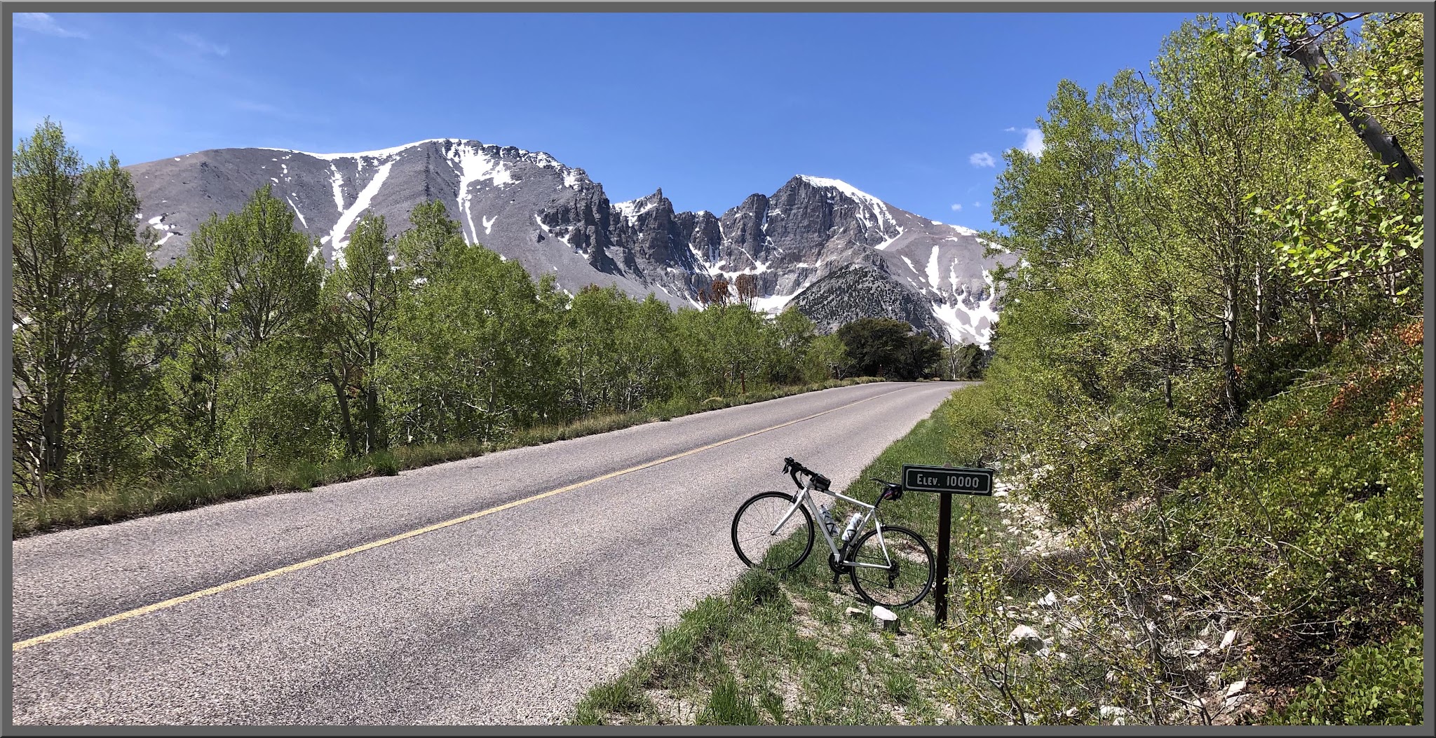
     You will be knocked out by that view.  Stop and take a picture!  Strava can wait.  You are not going to the peak, but to the campground at the base of Wheeler.  In the picture of the peak with my bike, it’s roughly at the top of the thicker pine forest right about where the end of my right brake lever is pointing.  Pay attention now to the peak.  You might see some sinister clouds at 10AM.  Take them very seriously.  I have never been on Wheeler in the July-August summer when it didn’t rain in the afternoon.  Not once.  As the clouds gather it’s beautiful, but it’s also nature’s way of telling you it’s time to go for a PR.  You’re very close to the top now and the climb lessens, so gun it. The next 1.5 miles hugs the mountain side with the peak always in view.  Now you are in aspen, pine and spruce forest, with some bristlecones.  It’s probably getting cool and humid.  The road curves to the left and summits at the trailhead, but keep going, why not?  It’s another half mile to the campground and about 200’ of descent.  Enjoy that little relief and that hint at what you get to enjoy going back to Baker.  The campground parking area is the end of the road.  There are bathrooms, water, and friendly tourists.  Returning to Baker, this descent is not the screamer you might think.  First off, the weather may be threatening and you’re a 30 minute descent from Baker.  The road is rugged chipseal, isn’t really as forgiving as smooth blacktop on the turns, and it’s pretty technical.  You may be shivering from cold, too.  Since your heart rate won’t be redlined, enjoy the view.  Remember the steep, steep part south of the “gate” at mile 14.6.  Remember those hard switches at miles 13.5, 11.5 and 7.5.  Once you get past the stop sign down at mile 5.0, you have 5 miles of straight road all the way to Baker, and if you’re one of those people who like to get serious speed this is the place to do it.  Downhill cars seem even more courteous than the uphill traffic.

The Strava Segment  for the Wheeler Peak bike climb tracks our route precisely, but shows it .7  longer at 16.6 than our MapMyRide and RideWithGPS plots.  ​​Note also the outlier nature of this climb - it is THE Top Climb in Nevada, yet has only 7 Strava Attempts.