![]()
Cycling Bealach Rattagan
Ride 2.6 miles gaining 1,108’ at 8.2% average grade.
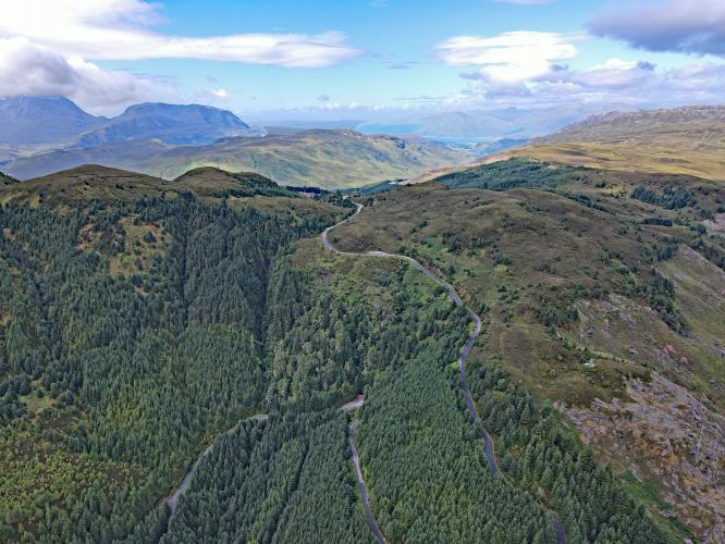
Bealach Ratagan climbs up a mountain just east of the Isle of Skye and overlooks the amazing network of waterways that surrounds this area. Imposing green mountains encircle the Loch below and -on a clear day- create a magnificent view visible for most of the climb. Our route is shared by loggers and on a weekday you're sure to encounter at least a few logging rigs. With how narrow the road is, I dismounted and pulled over for the big trucks to pass. Other traffic will be tour buses and cars. The road pitches up to double digit grades in sections as it takes you out of the forested areas of the road and onto the upper slopes. The view from the top is tough to beat…however that can be said for so many of these incredible Western Scotland climbs.
![]()
Bealach Rattagan is ranked as the 7th most difficult bike climb in Scotland.
![]()
Climb begins at the gate and cattle guard on Old Military Road past the bridge over River Shiel.
“Without doubt this is as close to an Alpine pass that I have found in Britain, it’s the spitting image of Col du Télégraphe - shorter, but easily as steep, if not steeper.” Simon Warren, Another 100 Greatest Cycling Climbs, A Road Cyclist’s Guide to Britain’s Hills, p. 121.
![]()
Loch Duich is designated a Nature Conservation Marine Protected Area.
![]()
We always say that a rolling bike gathers no moss . . . but gradient signs . .
. . . that’s a different story, apparently.
![]()
This climb is a brute and a beaut at once.
![]()
Last turning before the finish - mile 2.
![]()
Unmarked finish.
![]()
That’s a wrap!!

 We've partnered with Sherpa-Map.com to bring you the best route planning tool. With a PRO Membership you can use this climb as a reference when creating your route.

