![]()
Cycling Keys View Road, Joshua Tree National Park
Ride 21 miles gaining 2,593’ at 2.1% average grade.
Joshua Tree National Park is 1 of 8 national parks in California and is the 53rd established (1994) making it one of the newer (Yellowstone #1 in 1872) national parks. The park is in the mid-range for size (790,636 acres) and visitors (2,942,382 (2018).
Cycling is welcome in the park and there are actually 3 camp sites designated exclusively for cyclists (Joshua Tree NP Cycling page).
Summary by PJAMM friend and contributor Bruce Hamilton, La Quinta, CA, USA.
![]()
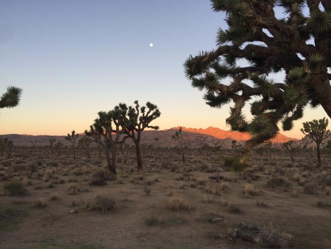
This ride starts in the town of Joshua Tree at the Northwest entrance to the park. It’s a good climb right out of the gate – no warmup and uphill steady 5% or so for several miles. The road continues uphill once inside the park but with some breaks (2 miles from 7.5 to 9.5 averages less than 1%).. This climb ultimately takes you to the highest point in the park. Keys View is also one of the nicest viewpoints in the park. It’s a pretty easy out and back (about 45 miles total) and takes you through (in my opinion anyway) the most scenic part of the park. Joshua trees grow only at a specific elevation and this ride takes us through several sections dense with the trees.
![]()
This section of the park contains more rock formations than the rest. Beware that this ride can be hot in summer although it can be equally chilly in December or January as the high desert comes with large temperature swings. In warmer months starting early (even before sunrise under a full moon) is a great time to ride - with the benefit of absolutely zero traffic.
No water along this route so take care if it’s warm.
![]()
USClimbateData.com
![]()
Thank you Bruce!!!

 We've partnered with Sherpa-Map.com to bring you the best route planning tool. With a PRO Membership you can use this climb as a reference when creating your route.

