Snake Creek Canyon Bike Climb - PJAMM Cycling

5.7
PDI
3.2 mi
DISTANCE
965 ft
GAINED
5.8 %
AVG. GRADE

FULL CLIMB STATS

Page Contributor(s): Bruce Hamilton, La Quinta, CA, USA; Stacy Topping, Tacoma, WA, USA.

INTRO

This 3.2 mile bike climb is located in UT, USA. The average gradient is 5.8% and there is a total elevation gain of 965 ft, finishing at 6,753 ft.

Use the profile tool, route map, and weather forecast to conquer this cycling climb.

PLAN YOUR ROUTE

We've partnered with Sherpa-Map.com to bring you the best route planning tool. With a PRO Membership you can use this climb as a reference when creating your route.

See more details and tools regarding this climb's grade via our interactive Profile Tool.
Information Not Available

If you have any information regarding this climb, we'd like to hear from you. Click the CONTRIBUTE button to share your thoughts with us.

Information Not Available

If you have any information regarding this climb, we'd like to hear from you. Click the CONTRIBUTE button to share your thoughts with us.

Before heading out on any cycling adventure check out our Things to Bring on a Cycling Trip and use our interactive check list to ensure you don't forget anything.
Information Not Available

If you have any information regarding this climb, we'd like to hear from you. Click the CONTRIBUTE button to share your thoughts with us.

ROUTE MAP

MEMBER RATING

Not Yet Rated
-
Road
-
Traffic
-
Scenery

CURRENT WEATHER

PJAMM TRIPS ADVENTURE STARTER BUNDLES

Check out PJAMM Adventure's prepackaged (self-guided) cycling trips. They will help you plan, document and conquer your next adventure.
ALL TRIPS
Browse all of our prepackaged trips and find your next adventure!
The American Southwest
United States (AZ,NM,UT)
18 ROUTES
27 POIs
ROUTE STATS (TOTAL)
215.4
mi
DISTANCE
34,866
ft
ELEV. GAIN
Utah: Moab, Arches & Canyonlands
United States (UT)
19 ROUTES
21 POIs
ROUTE STATS (TOTAL)
325.3
mi
DISTANCE
32,871
ft
ELEV. GAIN
Utah: Zion National Park
United States (UT)
20 ROUTES
32 POIs
ROUTE STATS (TOTAL)
256.5
mi
DISTANCE
39,649
ft
ELEV. GAIN

NEARBY CLIMBS (0) RADIAL PROXIMITY

FROM
No Climbs Found

MEMBER REVIEWS & COMMENTS

Let us know what you thought of this climb. Signup for our FREE membership to write a review or post a comment.
Already have an account?
ROUTE MAP
PROFILE TOOL
Route Data
S.G. (%)
hide
Segment Data
hide
CLIMB SUMMARY

Cycling Snake Creek Canyon

Ride 3.2 miles gaining 970’ to 6,760’ at 5.8% average grade.

This climb begins at the entrance to Wasatch Mountain State Park (est. 1961, 21,592 acres).near the start of US Top 100 bike climbs Guardsman Pass and Empire Pass. This bike climb is into the Wasatch Mountains which are the western edge of the Rocky Mountains.


BUSTED!!!

Climb summary by PJAMM friend and contributor Bruce Hamilton, La Quinta, CA.

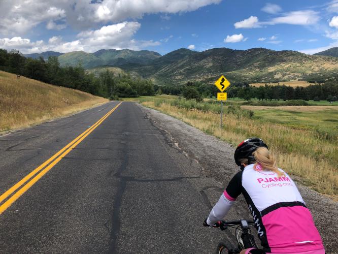
We start this bike climb in the town of Midway Utah at Wasatch Mountain State Park. It heads northwest from town up into the Wasatch Range. This climb is an out-and-back on a quiet road gaining about 1000 feet from the start to the end of the pavement. The paved part has a couple of short sections over 10% (the steepest ½ mile is 9.3%) but the climb is not difficult. The official climb ends after four miles where the road turns to dirt but if you ride a mountain bike you can continue up to many more miles of dirt roads and trails.

The climate in the Midway-Park City area is mild during the summer, so this is a nice climb that can be done during the Spring, Summer or Fall.

US Climate Data

Thank you Bruce and Stacy!!