Monte Cristo Summit West Bike Climb - PJAMM Cycling

16.4
PDI
22 mi
DISTANCE
3,764 ft
GAINED
3.2 %
AVG. GRADE

FULL CLIMB STATS

Page Contributor(s): Bruce Hamilton and Stacy Topping, Midway, Utah

INTRO

This 22 mile bike climb is located in UT, USA. The average gradient is 3.2% and there is a total elevation gain of 3,764 ft, finishing at 8,835 ft.

Use the profile tool, route map, and weather forecast to conquer this cycling climb.

PLAN YOUR ROUTE

We've partnered with Sherpa-Map.com to bring you the best route planning tool. With a PRO Membership you can use this climb as a reference when creating your route.

See more details and tools regarding this climb's grade via our interactive Profile Tool.
Information Not Available

If you have any information regarding this climb, we'd like to hear from you. Click the CONTRIBUTE button to share your thoughts with us.

Information Not Available

If you have any information regarding this climb, we'd like to hear from you. Click the CONTRIBUTE button to share your thoughts with us.

Before heading out on any cycling adventure check out our Things to Bring on a Cycling Trip and use our interactive check list to ensure you don't forget anything.
Information Not Available

If you have any information regarding this climb, we'd like to hear from you. Click the CONTRIBUTE button to share your thoughts with us.

ROUTE MAP

MEMBER RATING

Not Yet Rated
-
Road
-
Traffic
-
Scenery

CURRENT WEATHER

PJAMM TRIPS ADVENTURE STARTER BUNDLES

Check out PJAMM Adventure's prepackaged (self-guided) cycling trips. They will help you plan, document and conquer your next adventure.
ALL TRIPS
Browse all of our prepackaged trips and find your next adventure!
The American Southwest
United States (AZ,NM,UT)
18 ROUTES
27 POIs
ROUTE STATS (TOTAL)
215.4
mi
DISTANCE
34,866
ft
ELEV. GAIN
Utah: Moab, Arches & Canyonlands
United States (UT)
19 ROUTES
21 POIs
ROUTE STATS (TOTAL)
325.3
mi
DISTANCE
32,871
ft
ELEV. GAIN
Utah: Zion National Park
United States (UT)
20 ROUTES
32 POIs
ROUTE STATS (TOTAL)
256.5
mi
DISTANCE
39,649
ft
ELEV. GAIN

NEARBY CLIMBS (0) RADIAL PROXIMITY

FROM
No Climbs Found

MEMBER REVIEWS & COMMENTS

Let us know what you thought of this climb. Signup for our FREE membership to write a review or post a comment.
Already have an account?
ROUTE MAP
PROFILE TOOL
Route Data
S.G. (%)
hide
Segment Data
hide
CLIMB SUMMARY

Cycling Monte Cristo West

Ride 22 miles gaining 3,764’ at 3.2% average grade.

Climb summary by PJAMM uber ambassador, Bruce Hamilton:

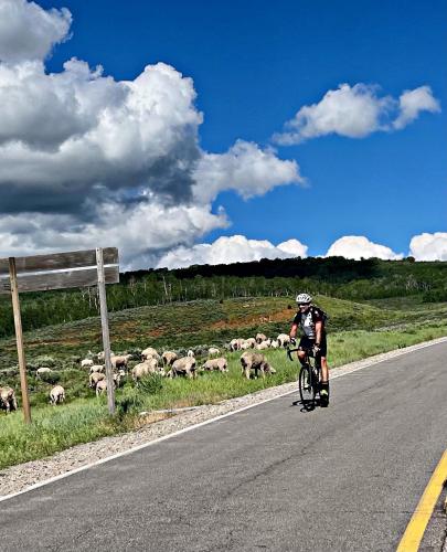
This climb begins in the town of Huntsville and proceeds east up into the Uinta Mountain Range. It’s a long steady climb that’s never steep but climbs up to 9000 feet (our devices showed 8988 at the high point). Like most of these climbs into the Uinta range it starts out at river grade and then climbs to the top of a pass. There is no sign/marker at the top – you just reach a flat area atop the plateau. The first 8 miles or so are just barely uphill - after 8 miles you’ve ascended only about 1000 feet. Beautiful farmland and valley scenery early in the climb. Over the next 15 miles the grade increases and it’s a steady uphill for the remainder. The foliage is different than the Wasatch climbs and this climb in particular would be spectacular in autumn. At the top you finally reach some evergreen trees but the entire climb is heavy in aspen/birch trees. Wide open views most of the way up and almost no traffic. Definitely one you’ll want to do if you’re chasing other climbs in Utah. Nice bonus of a screaming fun descent where you never need to use your brakes.

This climb starts very close to the Snow Basin climb and one could easily do both the same day.