Snow Basin Road Bike Climb - PJAMM Cycling

9
PDI
7.9 mi
DISTANCE
1,897 ft
GAINED
3.8 %
AVG. GRADE

FULL CLIMB STATS

Page Contributor(s): Bruce Hamilton and Stacy Topping, Midway, Utah.

INTRO

This 7.9 mile bike climb is located in UT, USA. The average gradient is 3.8% and there is a total elevation gain of 1,897 ft, finishing at 6,524 ft.

Use the profile tool, route map, and weather forecast to conquer this cycling climb.

See more details and tools regarding this climb's grade via our interactive Profile Tool.
Information Not Available

If you have any information regarding this climb, we'd like to hear from you. Click the CONTRIBUTE button to share your thoughts with us.

Information Not Available

If you have any information regarding this climb, we'd like to hear from you. Click the CONTRIBUTE button to share your thoughts with us.

Before heading out on any cycling adventure check out our Things to Bring on a Cycling Trip and use our interactive check list to ensure you don't forget anything.
Information Not Available

If you have any information regarding this climb, we'd like to hear from you. Click the CONTRIBUTE button to share your thoughts with us.

ROUTE MAP

MEMBER RATING

Not Yet Rated
-
Road
-
Traffic
-
Scenery

CURRENT WEATHER

PJAMM TRIPS ADVENTURE STARTER BUNDLES

Check out PJAMM Adventure's prepackaged (self-guided) cycling trips. They will help you plan, document and conquer your next adventure.
ALL TRIPS
Browse all of our prepackaged trips and find your next adventure!
The American Southwest
United States (AZ,NM,UT)
18 ROUTES
27 POIs
ROUTE STATS (TOTAL)
215.4
mi
DISTANCE
34,866
ft
ELEV. GAIN
Utah: Moab, Arches & Canyonlands
United States (UT)
19 ROUTES
21 POIs
ROUTE STATS (TOTAL)
325.3
mi
DISTANCE
32,871
ft
ELEV. GAIN
Utah: Zion National Park
United States (UT)
20 ROUTES
32 POIs
ROUTE STATS (TOTAL)
256.5
mi
DISTANCE
39,649
ft
ELEV. GAIN

NEARBY CLIMBS (0) RADIAL PROXIMITY

FROM
No Climbs Found

MEMBER REVIEWS & COMMENTS

Let us know what you thought of this climb. Signup for our FREE membership to write a review or post a comment.
Already have an account?
ROUTE MAP
PROFILE TOOL
Route Data
S.G. (%)
hide
Segment Data
hide
CLIMB SUMMARY

Cycling Snow Basin

Ride 7.9 miles gaining 1,894’ at 3.8% average grade (5.6% climb only) to 6,522’

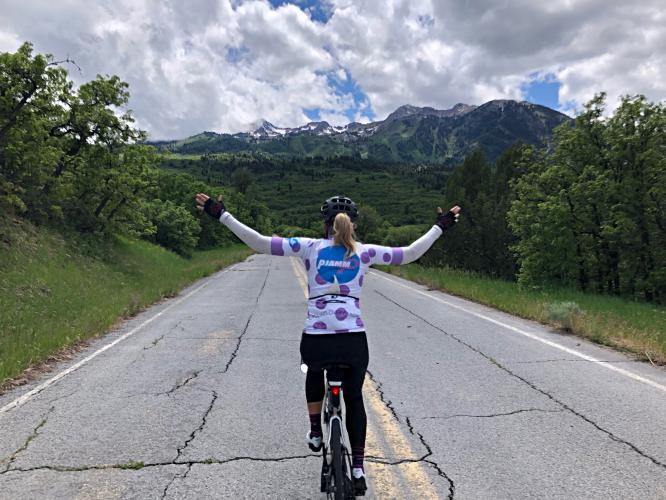
According to PJAMM’s Utah resident and senior (senior as to time contributing to PJAMM, not chron age  😊)   ambassadors Stacy Topping and Bruce Hamilton, this is a beautiful climb akin to many in the French Pyrenees.

Climb summary by Bruce:

This is a beautiful and quiet climb just over the mountain from Ogden. It feels as if it’s very isolated even though the city is just over the hill and it felt similar to remote climbs in the Pyrenees. There is now a new road to get to Snow Basin and this old road is essentially unused and it’s even closed to cars about halfway in. So the first four miles has almost no traffic and the next four miles behind the gate closure are only bikes. I’d rate this one as beautiful and secluded and highly recommended. Not a difficult climb by PJAMM standards but high up on the scenic/enjoyment list. You can return the same way you climbed or make a loop by coming down the new road – beautiful and smooth descent on the new road as well.

The climb begins by riding south up Hwy 226 near the southern shores of Pineview Reservoir and finishing near Snowbasin Ski Resort (host to the 2002 Olympic downhill, combined and super-G events.

The steepest ½ mile is 7.2% and steepest mile 6.4%.  There is also a 1.1 mile -5.5% descent beginning at mile 2.7 and a .4 mile flat to slightly descending segment from mile 4.3 to 4.7.

The incomparable Powder Mountain bike climb (#11 US / 152 World) is just about 10 miles to the north and a must-do Utah and US climb.