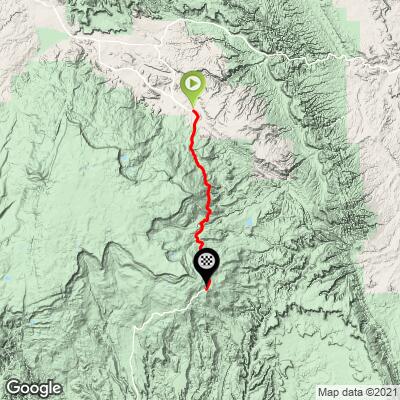
Boulder Mountain North Bike Climb - PJAMM Cycling

12.9
PDI
16.2 mi
DISTANCE
2,925 ft
GAINED
2.9 %
AVG. GRADE

FULL CLIMB STATS

Page Contributor(s): Bruce Hamilton and Stacy Topping, Midway, UT

INTRO

Boulder Mountain North is a spectacular cycling climb along Scenic Byway 12, offering exceptional views and pristine, smooth pavement. This 16.2-mile ascent gains 2,925 feet to reach an elevation of 9,600 feet, with an average grade of 2.9% (4.3% for climbing sections only). Located just west of Capitol Reef National Park, this ride offers outstanding views of the Park's colorful rock formations throughout the entire climb, making it a must-do for cycling enthusiasts visiting the area.

PLAN YOUR ROUTE

We've partnered with Sherpa-Map.com to bring you the best route planning tool. With a PRO Membership you can use this climb as a reference when creating your route.

See more details and tools regarding this climb's grade via our interactive Profile Tool.
Information Not Available

If you have any information regarding this climb, we'd like to hear from you. Click the CONTRIBUTE button to share your thoughts with us.

Information Not Available

If you have any information regarding this climb, we'd like to hear from you. Click the CONTRIBUTE button to share your thoughts with us.

Before heading out on any cycling adventure check out our Things to Bring on a Cycling Trip and use our interactive check list to ensure you don't forget anything.
Information Not Available

If you have any information regarding this climb, we'd like to hear from you. Click the CONTRIBUTE button to share your thoughts with us.

ROUTE MAP

MEMBER RATING

Difficulty: Challenging
4.5
Road
4.5
Traffic
4
Scenery

CURRENT WEATHER

PJAMM TRIPS ADVENTURE STARTER BUNDLES

Check out PJAMM Adventure's prepackaged (self-guided) cycling trips. They will help you plan, document and conquer your next adventure.
ALL TRIPS
Browse all of our prepackaged trips and find your next adventure!
The American Southwest
United States (AZ,NM,UT)
18 ROUTES
27 POIs
ROUTE STATS (TOTAL)
215.4
mi
DISTANCE
34,866
ft
ELEV. GAIN
Utah: Moab, Arches & Canyonlands
United States (UT)
19 ROUTES
21 POIs
ROUTE STATS (TOTAL)
325.3
mi
DISTANCE
32,871
ft
ELEV. GAIN
Utah: Zion National Park
United States (UT)
20 ROUTES
32 POIs
ROUTE STATS (TOTAL)
256.5
mi
DISTANCE
39,649
ft
ELEV. GAIN

NEARBY CLIMBS (0) RADIAL PROXIMITY

FROM
No Climbs Found

MEMBER REVIEWS & COMMENTS

Let us know what you thought of this climb. Signup for our FREE membership to write a review or post a comment.
Already have an account?

Jul 23, 2023
difficulty: Challenging
scenery: 4
traffic: 4
road: 5
Jul 23, 2023
scenery: 4
traffic: 4
road: 5
July 21, 2023 A wonderful climb on a great road with light, courteous traffic. Numerous "false" summits before you reach the summit sign 9600ft. This is a long, moderate grind climb with some short decents and gentle climbing sections. Nice scenery and views. 4 cattle guards to cross - all in good shape. There are several campgrounds along the way with water and restrooms. I started the climb in Torrey and biked up through Teasdale (very scenic, adds a few miles and some extra climbing) then joined hwy12 to start the climb.
May 21, 2021
difficulty: Challenging
scenery: 4
traffic: 5
road: 4
May 21, 2021
scenery: 4
traffic: 5
road: 4
Finished this ride early May, 2021. The traffic was light and the road in good shape. The ride completes at a nice viewpoint that overlooks the desert. Some moderately steep sections to the ride but totally manageable. This is a good option for anyone visiting Capitol Reef.
ROUTE MAP
PROFILE TOOL
Route Data
S.G. (%)
hide
Segment Data
hide
CLIMB SUMMARY

Cycling Boulder Mountain North

Ride 16.2 miles gaining 2925’ to elevation 9,600’ at 2.9% average grade (4.3% climb only).

This climb on Scenic Byway 12 has exceptional views and is just west of Capitol Reef National Park which is to your left (east) the entire climb.

Climb summary by PJAMM’s Bruce Hamilton.

The Boulder Mountain Summit ride from the north is spectacular. We did it in September and it was particularly nice with the gold aspen trees all along the second half of the ride. The climb officially starts in Grover – about six miles south of Torrey on Highway 12 – but we started our ride in Torrey. The miles between Torrey and Grover were rolling with excellent views of the rock formations of the area and of Capital Reef National Park. The road starts uphill after you leave Grover and the entire climb is beautiful. Pristine perfectly smooth pavement with a wide shoulder for most of it only added to the beauty. Very little traffic on this route and the traffic we encountered was courteous. As we climbed we encountered cows in and along the road (it’s all ‘open range’) and as we got higher the autumn aspen trees were glowing yellow.

The PJAMM profile tool averages chunks that show a relatively low average grade but there are a few steeper bursts within some of the lower sections. Not a difficult climb by PJAMM standards but we did see 9-10% on our devices sometimes.

PJAMM Profile Tool

It would be easy to combine both the north side and the south side climbs into one ride. We turned back at the top and rode back to Torrey and the perfect pavement made for a fast descent that was really nice. Not sure how this ride would be on a summer weekend but highly recommended for a weekday ascent in spring or fall.

Thank you Stacy and Bruce!!