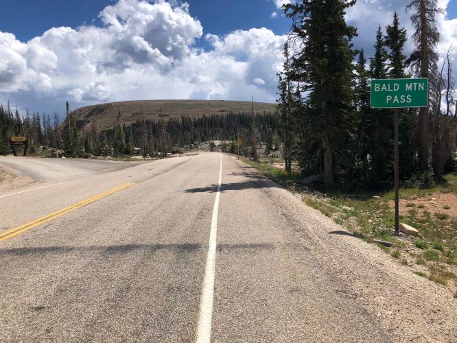
Bald Mountain Pass North Bike Climb - PJAMM Cycling

12.2
PDI
24 mi
DISTANCE
3,143 ft
GAINED
1.8 %
AVG. GRADE

FULL CLIMB STATS

INTRO

This 24 mile bike climb is located in UT, USA. The average gradient is 1.8% and there is a total elevation gain of 3,143 ft, finishing at 10,644 ft.

Use the profile tool, route map, and weather forecast to conquer this cycling climb.

PLAN YOUR ROUTE

We've partnered with Sherpa-Map.com to bring you the best route planning tool. With a PRO Membership you can use this climb as a reference when creating your route.

See more details and tools regarding this climb's grade via our interactive Profile Tool.
Information Not Available

If you have any information regarding this climb, we'd like to hear from you. Click the CONTRIBUTE button to share your thoughts with us.

Information Not Available

If you have any information regarding this climb, we'd like to hear from you. Click the CONTRIBUTE button to share your thoughts with us.

Before heading out on any cycling adventure check out our Things to Bring on a Cycling Trip and use our interactive check list to ensure you don't forget anything.
Information Not Available

If you have any information regarding this climb, we'd like to hear from you. Click the CONTRIBUTE button to share your thoughts with us.

ROUTE MAP

MEMBER RATING

Not Yet Rated
-
Road
-
Traffic
-
Scenery

CURRENT WEATHER

PJAMM TRIPS ADVENTURE STARTER BUNDLES

Check out PJAMM Adventure's prepackaged (self-guided) cycling trips. They will help you plan, document and conquer your next adventure.
ALL TRIPS
Browse all of our prepackaged trips and find your next adventure!
The American Southwest
United States (AZ,NM,UT)
18 ROUTES
27 POIs
ROUTE STATS (TOTAL)
215.4
mi
DISTANCE
34,866
ft
ELEV. GAIN
Utah: Moab, Arches & Canyonlands
United States (UT)
19 ROUTES
21 POIs
ROUTE STATS (TOTAL)
325.3
mi
DISTANCE
32,871
ft
ELEV. GAIN
Utah: Zion National Park
United States (UT)
20 ROUTES
32 POIs
ROUTE STATS (TOTAL)
256.5
mi
DISTANCE
39,649
ft
ELEV. GAIN

NEARBY CLIMBS (0) RADIAL PROXIMITY

FROM
No Climbs Found

MEMBER REVIEWS & COMMENTS

Let us know what you thought of this climb. Signup for our FREE membership to write a review or post a comment.
Already have an account?
ROUTE MAP
PROFILE TOOL
Route Data
S.G. (%)
hide
Segment Data
hide
CLIMB SUMMARY

Cycling Bald Mountain Pass West

Ride 24 miles miles gaining 3,142’’ to 10,579’ at 1.8% average grade.

Climb summary from PJAMM friend and contributor Bruce Hamilton, La Quinta, CA.

This bike climb on State Route 150 (Mirror Lake Highway) ends at the highest paved pass in Utah.  The Bald Mountain Summit climb starts in the town of Kamas, Utah about 45 miles east of Salt Lake City. This climb goes into the Uinta subrange of the Rocky Mountains and these mountains are a bit drier and more exposed than the Wasatch range immediately to the east of Salt Lake City.

Lower portion of the climb.

It’s cowboy country and there may be cows on the road. The day I rode I saw a cowboy herding cows with three border collies.

Bike climb Bald Mountain Summit Utah - cowboy with dogs on horse in meadow

This is a long climb but with the elevation gained over so many miles the grade is not steep. The road follows the Provo River and climbs at river grade for more than half the climb. We pass the northern end of Lost Lake at mile 26.

Climbing Bald Mountain Summit Utah by bike - bike next to Lost Lake

Lost Lake

There are steeper sections toward the top, but nothing difficult.  The steepest ½ mile (7.5%) and mile (6.8%) are in the last quarter of the climb.  This is a beautiful ride with very little traffic and open views. Take a lot of water – there is no water and the entire route is exposed and there is no shade for the entire climb. It can be hot in summer – even in early September it was warm at 10,000 feet.

Bike climb Bald Mountain Summit Utah - bike at summit overlooking valley

View at the summit.

She IS mortal  😉. . .

. . . have not seen that since the top of Mauna Kea circa 2017 . . .

Thank you Bruce and Stacy.