![]()
Cycling a bunch of highways! This patchwork bike climb leads us through some beautiful country.
Ride a whopping 28.4 miles gaining 7,517’ to 7,595 elevation at 4.2% average grade.
The first segment of this climb overlaps the Whittaker Forest Climb. After splitting from Whittaker we ride for a bit on the only unshared segment of road (Hwy 245) before merging with the Hwy 180 climb from the west. We later reconnect with Whittaker Forest climb and ultimately end with it at Big Baldy Ridge Trailhead.
#42 on the U.S. Top 100 list, this climb travels into both the Sequoia National Forest and Kings Canyon National Park and is within 30 miles of 2 other Top 100 climbs, Mineral King Rd (#29) and Hwy 198 (#34).
This Climb shares its first 6 miles with #19 Whitaker Forest and if you have only one option, go for Whittaker - it is a special and bucket list climb. If you have plenty of time, do be sure to cycle the 21-245-180-198 climb because, while not extraordinary, it is an exceptional bike climb.
![IMG_1274.JPG]()
Hwy 21 - start
![IMG_1303.JPG]()
Merge onto Hwy 245 here
![]()
Local ranchers burn their brand into the bar at the Mountain House
![IMG_1441.JPG]()
![IMG_1455.JPG]()
Enter the National Park at mile 20 on Hwy 180
![]()
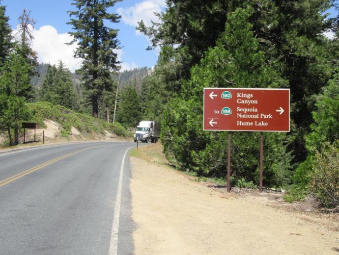
Merge onto Hwy 198 (Generals Hwy) at mile 21.7
![]()
Merge with Whittaker Forest climb just above the drive through tree
![]()
Finish on Hwy 198 at Big Baldy Trailhead.
Hwy 21-245-180-198 takes us into Kings Canyon National Park ($10 required for bicycle entry as of July, 2015) and Sequoia National Forest). The climb is challenging, as this climbs spot in the U.S. Top 50 Climbs will attest. The roadway, while not offering a bike lane or shoulder to speak of, seems safe, both on the narrow section of County Road (J-21) for 6 miles and on State Highways the remainder of the route.
![]()
Steepest ¼ mile begins at mile 3.3 (10.2%); steepest mile 3.8 (8.2%)
Roadway/Traffic: The first 6 miles are on a narrow country road with very little traffic. The remaining 22 miles are on very well-paved and maintained roads. Highway 245 has minimal shoulder but has low traffic. Highways 180 and 198 are more well traveled but we always felt safe on this route.

 We've partnered with Sherpa-Map.com to bring you the best route planning tool. With a PRO Membership you can use this climb as a reference when creating your route.

