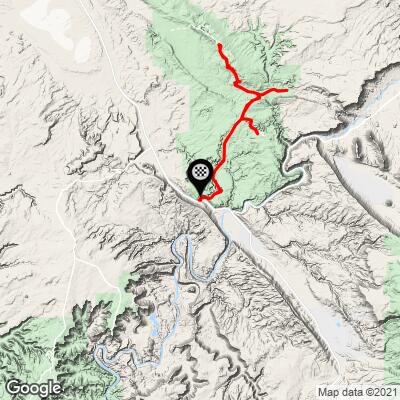
Cycling Arches National Park, Utah.
One of the most extraordinary cycling experiences in the world.
You can stay in Moab and easily ride to the start of this route from town, or park at or just before the visitor center to begin. This is one of our all time favorite bike rides (it does have a lot of climbing, but it is rolling and not continuous).
This is a fairly long ride at 45 miles (4,354’ elevation gain) that is also long in scenery
Contact us (upper right menu drop down) if you would like a GPS download of the route we used for this ride (or download it here).
Arches National Parks Home Page:
“Visit Arches to discover a landscape of contrasting colors, land forms and textures unlike any other in the world. The park has over 2,000 natural stone arches, in addition to hundreds of soaring pinnacles, massive fins and giant balanced rocks. This red-rock wonderland will amaze you with its formations, refresh you with its trails, and inspire you with its sunsets” (More).
START
VISITOR CENTER

HAIRPINS
MILES 0-2

The entrance climb is two miles at 4.7% (PJAMM Climb Page).
The 65 million year old story of Arches National Park as provided on the National Park Service Website follows, indented and in italics throughout this page:
The story of Arches begins roughly 65 million years ago. At that time, the area was a dry seabed spreading from horizon to horizon. If you stood in Devils Garden then, the striking red rock features we see today would have been buried thousands of feet below you, raw material as yet uncarved. Then the landscape slowly began to change. (More at NPS.Gov.)
PARK AVENUE
MILE 3.2

This is a magnificent hike that we highly recommend.
1.8 miles out and back gaining 298’.
First, geologic forces wrinkled and folded the buried sandstone, as if it were a giant rug and someone gathered two edges towards each other, making lumps across the middle called Anticlines. As the sandstone warped, fractures tore through it, establishing the patterns for rock sculptures of the future. (More at NPS.Gov.)

Alltrails writes of this hike, “Park Avenue Trail is a 1.8 mile heavily trafficked out and back trail located near Moab, Utah that features beautiful wild flowers and is good for all skill levels. The trail is primarily used for hiking, walking, running, and nature trips and is accessible year-round.”
LA SAL MOUNTAINS VIEWPOINT
MILE 3.8

Next, the entire region began to rise, climbing from sea level to thousands of feet in elevation. What goes up must come down, and the forces of erosion carved layer after layer of rock away. Once exposed, deeply buried sandstone layers rebounded and expanded, like a sponge expands after it's squeezed (though not quite so quickly). This created even more fractures, each one a pathway for water to seep into the rock and further break it down. (More at NPS.Gov.)

Be sure to stop at this viewpoint -- the views are exceptional.

Amazing views of Three Gossips, Sheep Rock, Tower of Babel and The Organ from miles 4-5.

Views of The Organ and Tower of Babel between.
La Sal Mountains and Courthouse Towers Viewpoints (miles 4-5).
![]()
COURTHOUSE TOWERS VIEWPOINT
MILE 4.8

Keep your eyes out for Sheep Rock (far left of photo upper left) and
Tower of Babel (middle upper photo and bottom photos)
as you approach Courthouse Towers Viewpoint.
Today, water shapes this environment more than any other force. Rain erodes the rock and carries sediment down washes and canyons to the Colorado River. Desert varnish appears where water cascades off cliffs. In winter, snowmelt pools in fractures and other cavities, then freezes and expands, breaking off chunks of sandstone. Small recesses develop and grow bigger with each storm. Little by little, this process turns fractured rock layers into fins, and fins into arches. Arches also emerge when potholes near cliff edges grow deeper and deeper until they wear through the cliff wall below them. In addition to grand arches, water dissolves small honeycomb formations called tafoni. (More at NPS.Gov.)
SHEEP ROCK

Views of Sheep Rock from around miles 4-5.
This rock formation formed by nature is extraordinary.
PETRIFIED DUNES
MILE 7.5

The Petrified Dunes are a series of rock formations produced by the hardening of ancient sand dunes.
Over time, the same forces that created these arches will continue to widen them until they collapse. Standing next to a monolith like Delicate Arch, it's easy to forget that arches are impermanent. Yet the fall of Wall Arch in 2008 reminded us that this landscape continues to change. While some may fall, most of these arches will stand well beyond our lifetime: a lifetime blessed with an improbable landscape 65 million years in the making. (More at NPS.Gov.)
BALANCED ROCK
MILE 10.3

Short hike around the Balanced Rock.
0.3 miles gaining 55’ 360 degree of this 3600 ton boulder atop a spire support.
Alltrails writes of this short hike, “Balanced Rock Loop Trail is a 0.3 mile heavily trafficked loop trail located near Moab, Utah that features beautiful wild flowers and is good for all skill levels. The trail is primarily used for walking, nature trips, and bird watching and is accessible year-round.”
PANORAMA POINT
MILE 11.5

Star gaze at Panorama Point.
This is the designated location in the park for amazing star gazing.
DELICATE ARCH
TURN OFF IS AT MILE 13.1

Three- mile round trip hike gaining 480’.
This is likely the busiest hike in the park.
People come from all over the world to visit Arches National Park, and visiting Delicate Arch is on the top of many visitors' to-do lists. In a park with over 2,000 stone arches, this particular free-standing arch has become a widely recognized symbol of the state of Utah and one of the most famous geologic features in the world. (More at NPS.Gov.)

The light opening beneath the arch is 46 feet high and 32 feet wide, making it the largest free-standing arch in the park. It has had more than a few names in its history, from the colorful ("Cowboy's Chaps", "Old Maid's Bloomers") to the prosaic ("Salt Wash Arch"). The term "Delicate" first appeared in a January 1934 article about the Arches National Monument Scientific Expedition, which described it as "the most delicately chiseled arch in the entire area." (More at NPS.Gov.)
![]()
Utah state license plate since November 19, 2007
Photo: Vehicle Registration Plates
SALT VALLEY OVERLOOK
MILE 15.2

Two short hikes from this overlook:
Sand Dune Arch Trail, 0.4 miles round trip
Broken Arch Trail, 1.2 miles round trip (Alltrails says 1.7, sign says 1.2).
Alltrails writes of Broken Arch Trail: “Broken Arch Trail is a 1.7 mile moderately trafficked loop trail located near Moab, Utah that features beautiful wild flowers and is good for all skill levels.”

Alltrails writes of Sand Dune Arch Trail: “Sand Dune Arch Trail is a 0.3 mile heavily trafficked out and back trail located near Moab, Utah that features beautiful wild flowers and is good for all skill levels.”
FIERY FURNACE
MILE 15.7

1.7 mile round trip hike.
Fiery Furnace hikes are permit or ranger led only hikes -- $16 as of 2020.
Alltrails writes: “Fiery Furnace and Surprise Arch is a 1.7 mile heavily trafficked loop trail located near Moab, Utah that offers scenic views and is rated as moderate.”
SKYLINE ARCH
MILE 18.3

Hike 0.5 miles out and back gaining 42’.
DEVIL’S GARDEN (TURNAROUND POINT)
MILE 18.8

There are several hiking options from this start point.
Our favorite of the seven: Landscape Arch (fifth longest natural arch in the world).
290’ span.
Alltrails writes of the seven arches loop: “Devils Garden Loop Trail with 7 Arches is a 7.8 mile heavily trafficked loop trail located near Thompson, Utah that features beautiful wild flowers and is rated as difficult. The trail offers a number of activity options and is accessible year-round.”