Paso Los Libertadores Bike Climb - PJAMM Cycling

54
PDI
29 mi
DISTANCE
8,481 ft
GAINED
5.4 %
AVG. GRADE

FULL CLIMB STATS

Page Contributor(s): Ard Oostra, Switzerland

INTRO

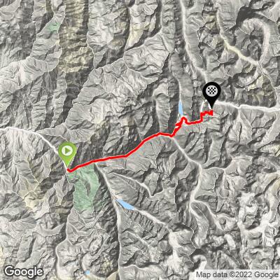
Paso Los Libertadores - also known as Cristo Redentor - is the legendary Andes highway linking Santiago, Chile with Mendoza, Argentina. Climbing from Rio Blanco (about 60 mi/100 km northeast of Santiago) to the border at roughly 12,560 feet (3,829 m). At 29 miles with 8,481 feet of gain, it's one of South America's great paved-to-gravel border-crossing climbs, and currently ranks as the 32nd hardest climb in the world.
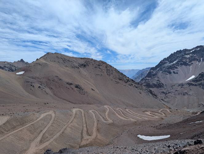
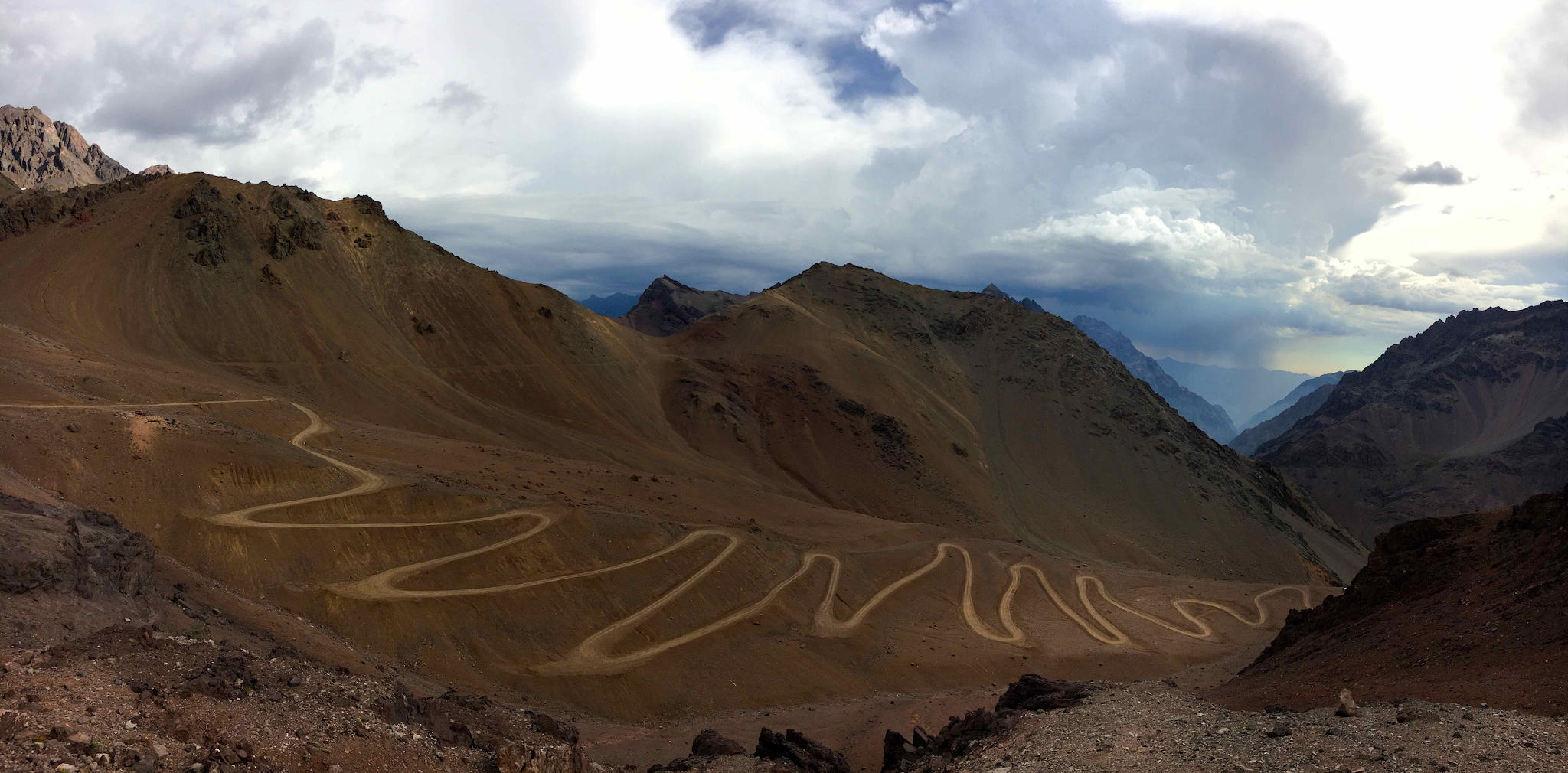
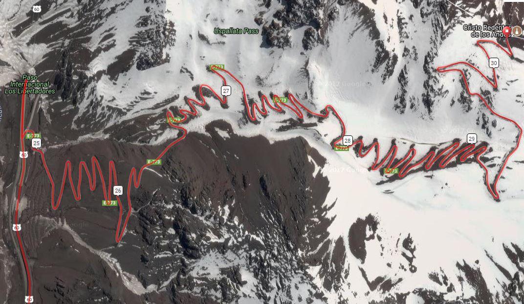
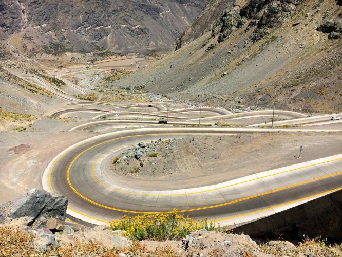
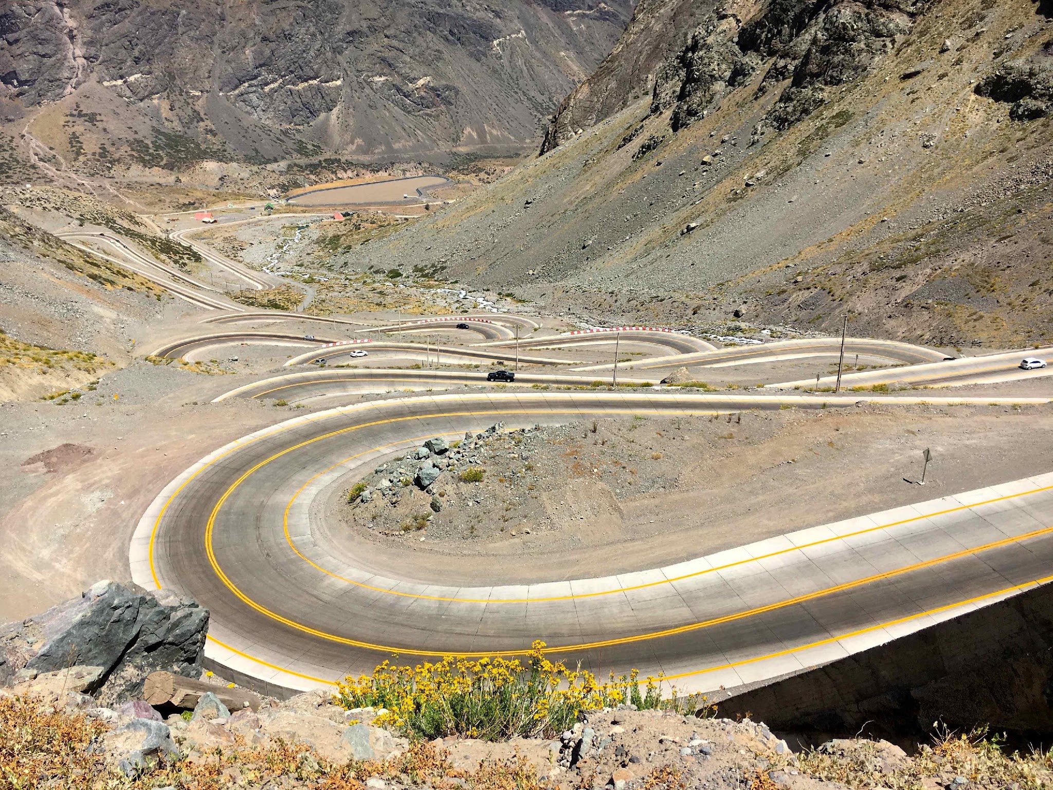
The lower two-thirds follow Ruta 60-CH, a wide international highway, past a series of galleries to the base of "Los Caracoles" ("the snails") - a wall of switchbacks stacked into a barren 400-meter rock face that rivals the Stelvio for spectacle. The road then climbs past the Portillo ski station and a Chilean customs post to the mouth of the Cristo Redentor tunnel, which cyclists can't use. Instead, riders peel off onto an unmarked dirt road about 200 meters before the tunnel and grind up roughly 50 more hairpins on loose gravel - about 600 additional feet in 5 miles - to the true summit at the border.
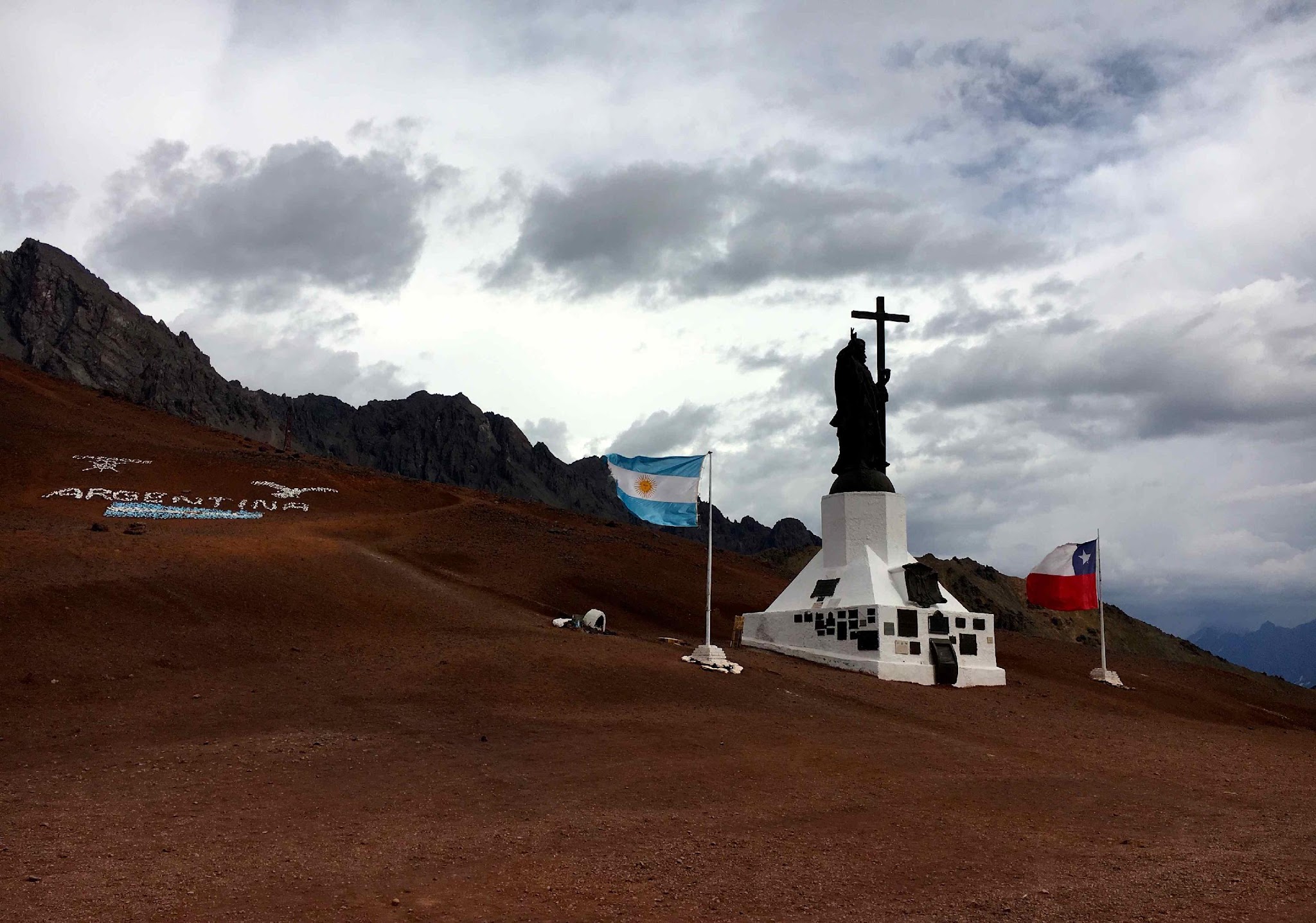
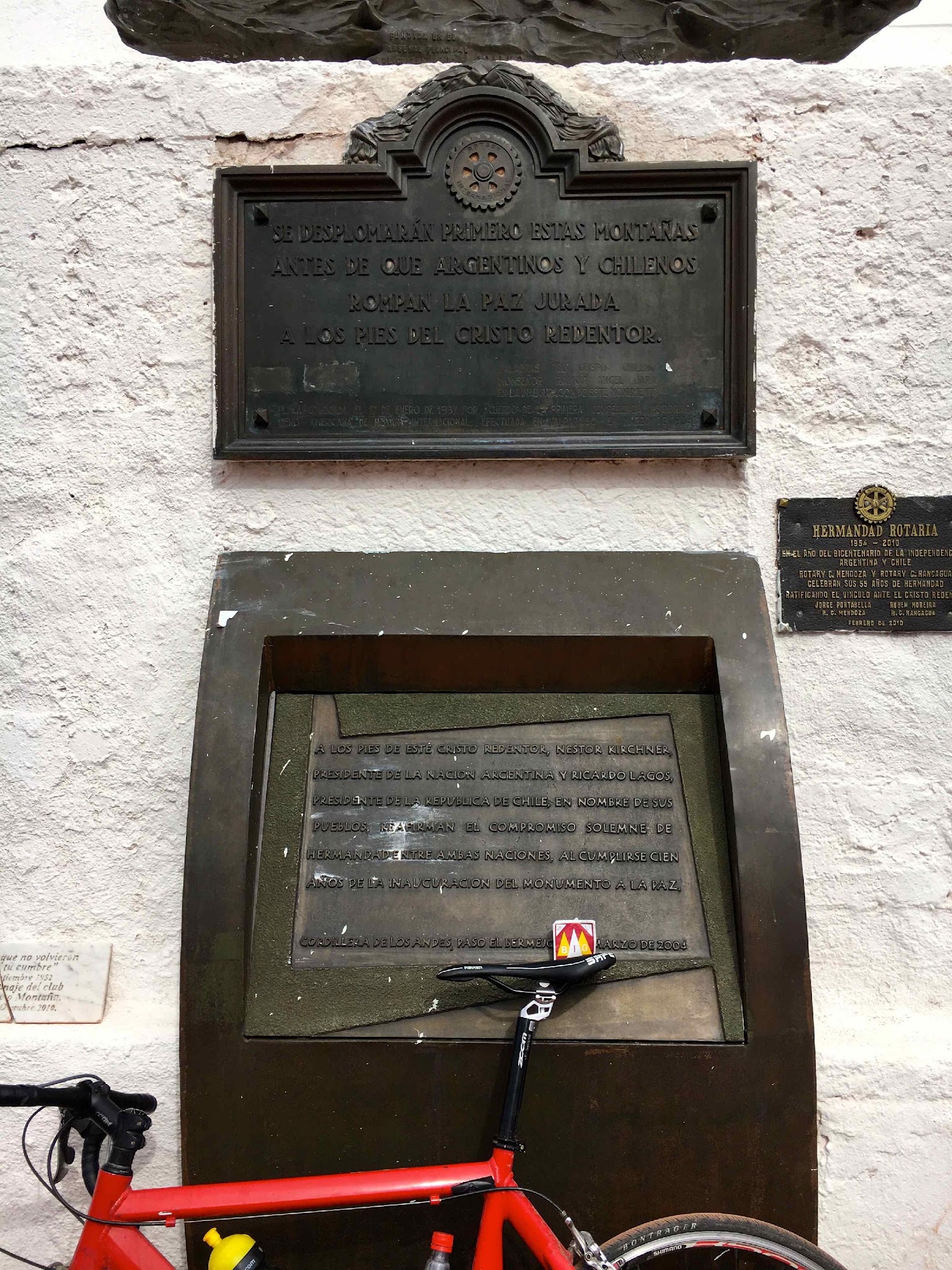
The pass takes its name from the Christ the Redeemer of the Andes statue, a seven-meter bronze cast from melted-down cannons and installed at the summit in 1904 to celebrate the peaceful end of a Chile-Argentina border dispute. It marked the road's highest point until the tunnel opened in 1980 and rerouted traffic 600 meters lower.
The border complex still has a small restaurant, a souvenir shop, and military posts from both countries. The pass regularly closes each winter for snow and rockfall - it was shut over a month in mid-2026 before reopening in August - so check current status before riding.

PLAN YOUR ROUTE

We've partnered with Sherpa-Map.com to bring you the best route planning tool. With a PRO Membership you can use this climb as a reference when creating your route.
The grade is deceptively mild for most of the climb. From Rio Blanco, Ruta 60-CH climbs at a gentle, steady pitch alongside the Rio Juncal for the first 10 miles (16 km) to about 7,200 feet (2,200 m), then continues at a manageable grade through the Los Caracoles switchbacks and on past the Portillo turnoff to the Chilean customs post near mile 25 (km 40) - averaging well under 6% across this whole paved section. 

The character changes completely once the pavement ends. The final unpaved push to the summit packs roughly 50 hairpins into about 5 miles (8.2 km) at an average grade near 7.7%, with the steepest half-kilometer pitching over 12%. Combined with loose gravel and thin air above 10,000 feet, this short final section is the real test of the climb. Overall the climb averages 5.44% over 29 miles with 8,481 feet of gain - a long, gradual grind punctuated by one short, steep, high-altitude gravel sting at the very top.
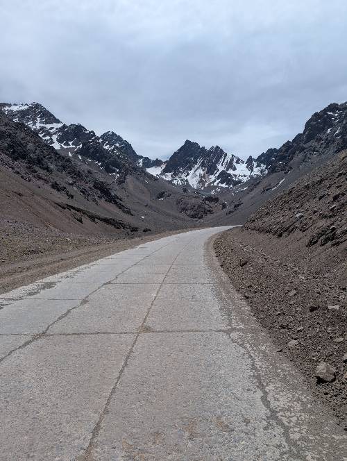
Roadway: Ruta 60-CH is fully paved and in generally good condition from Rio Blanco up through the Los Caracoles switchbacks and past Portillo, though the last few kilometers before Chilean customs can be rough, with some patched or uneven pavement. Cyclists are barred from the Cristo Redentor tunnel; about 200 meters before it, an unmarked dirt road peels off on the south side of the highway and climbs the remaining 8 km (5 miles) to the true summit. This old road is unpaved throughout with loose gravel and stones in the steep hairpin bends - manageable with wider tires (30mm+), but expect to dismount briefly on the loosest switchbacks. As an international pass, the road sees extended winter closures for snow and rockfall; it was closed over a month in mid-2026 before reopening in August, so check current status before riding.
Traffic: Ruta 60 is the main highway linking Santiago and Mendoza, so expect a steady stream of trucks and cars, heaviest near Los Andes at the base. The paved section is wide with good sightlines, and drivers - including truckers, who climb slowly - are used to giving cyclists room. Traffic thins above Rio Blanco and drops to almost nothing on the unpaved summit section.
Parking: There's no formal trailhead. Riders typically stage in Los Andes or the village of Rio Blanco along Ruta 60-CH, both with street parking and services. This is an active international border crossing with a customs checkpoint partway up - carry a passport even if not crossing into Argentina.
Bring a passport or national ID. Chilean customs officials operate a checkpoint partway up the climb, and enforcement of who gets waved through varies by staffing and mood on any given day, even if you're not crossing into Argentina. Tire choice matters more here than on most paved Andes climbs: the final 8 km to the summit is loose dirt and gravel with stones concentrated in the hairpins, so 30mm+ tires are strongly preferable to narrow road slicks for control on the steep switchbacks. 

Temperature swings are significant. Expect summer heat (upper 70s F / mid-20s C) at the Rio Blanco start, dropping to noticeably cooler, thinner air above 10,000 feet, with afternoon clouds, wind, and sudden thunderstorms common near the summit - pack a packable layer and rain shell even on a clear morning. There are no services of any kind between Rio Blanco and the summit, so carry all the food and water needed for the full 29-mile, 8,481-foot climb; a small restaurant and shop operate at the border complex at the top.
Before heading out on any cycling adventure check out our Things to Bring on a Cycling Trip and use our interactive check list to ensure you don't forget anything.
This is a Southern Hemisphere climb, so the riding season runs roughly November through March; outside that window the pass is prone to extended closures for snow and rockfall. In 2026 it was closed for over a month during the Southern Hemisphere winter before reopening in August - check current pass status with Chile's Vialidad or Argentine border authorities before planning a trip. Start early. It's a long day at altitude - 29 miles and 8,481 feet of gain to over 12,500 feet - and afternoon weather near the summit can turn quickly from clear to stormy.

Cyclists cannot ride through the Cristo Redentor tunnel, so budget extra time and effort for the unpaved bypass road to the true summit. Riders who only want the paved Los Caracoles switchbacks can turn around at the tunnel mouth for a shorter, fully paved outing.

The Portillo ski resort, a few miles below the summit, is the last landmark with any facilities and a good mental checkpoint. At the top, the border complex has a small restaurant and souvenir shop where riders can often buy water and warm up before the descent.

ROUTE MAP
MEMBER RATING

Difficulty: Strenuous
2/5
Road
2/5
Traffic
5/5
Scenery

CURRENT WEATHER

PJAMM TRIPS ADVENTURE STARTER BUNDLES

Check out PJAMM Adventure's prepackaged (self-guided) cycling trips. They will help you plan, document and conquer your next adventure.
ALL TRIPS
Browse all of our prepackaged trips and find your next adventure!

NEARBY CLIMBS (0) RADIAL PROXIMITY

FROM
No Climbs Found

MEMBER REVIEWS & COMMENTS

Let us know what you thought of this climb. Signup for our FREE membership to write a review or post a comment.
Already have an account?

Aug 2, 2026
difficulty: Strenuous
scenery: 5
traffic: 2
road: 2
Aug 2, 2026
scenery: 5
traffic: 2
road: 2
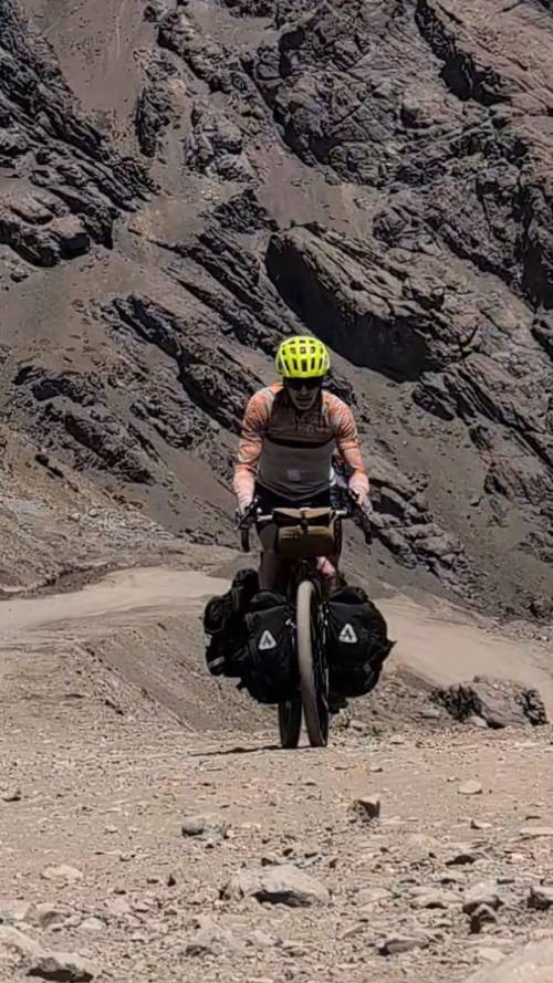
Climbed: November 2025 Rig Weight: ~80 lbs (Fully loaded: tent, sleeping bag, stove, clothes) I tackled Paso Los Libertadores in November 2025 on a fully loaded 80 lb rig. While carrying that much weight made it a serious effort, the gradient on the paved section is consistent enough that I was able to spin through without needing to stop. Scenery: Absolutely stunning. The scale of the Andes here is hard to put into words. Traffic & Safety (Paved Section): Don’t be intimidated by the constant stream of traffic. The road is very wide, sightlines are clear, and driver visibility is excellent. I felt completely safe the entire time I was on the pavement. Gravel Section: Once you hit the dirt, the traffic disappears almost entirely—I only saw one vehicle, and the driver kindly stopped to chat. Be prepared, though: the gravel section is noticeably quieter, but definitely steeper. Important Route Note & Pro-Tip: I had planned to cross over into Argentina, but a glacier/snowpack was blocking
ROUTE MAP
PROFILE TOOL
Route Data
S.G. (%)
hide
Segment Data
hide
CLIMB SUMMARY

Ascension of Cristo Redentor de Los Andes

 (3825m), Chile, Thursday 23-02-2017

Submitted to BIG Cycling by Ard Oostra (published here with his permission)

Among the greatest hairpins in the world

Around noon, with a bright sun and temperature of about 27 Celsius, we began our climb from the village of Rio Blanco (1400m altitude). Our goal is to take Road 60 to the tourist station of Portillo (2800m) then on to the Tunnel Cristo Redentor at 3185m. Depending on the situation, I have this little idea in my mind: Just before the tunnel there must be 8 km long dirt road that winds up to the Cristo Redentor de Los Andes Pass at 3825m altitude.

Of course it is possible to start the climb from a lower altitude, for example at the village of El Huape (900m alt.), which is just east of the city of Los Andes. From El Huape the road climbs gradually, apart from a short downhill, for about 30 km to 1400m altitude.

Since Road 60 is a major artery between Argentina and Chile there is significant traffic, especially trucks in transit. During the first segment, we also contend with the city traffic of Los Andes.

Once past Rio Blanco, about 5kms before the tollgate, the road widens and traffic decreases. Today we are fortunate as road marking work is being performed and traffic is regularly interrupted for up to 30 minutes which is ideal for cyclists permitted to pass through without delay. Generally, we are unimpeded by traffic as the trucks drive uphill at slow speed giving wide berth to cyclists. Further up the climb there is a series of galleries where the road is narrower, especially some kilometres before Portillo and shortly before the Tunnel Redentor.


Cyclists can bypass this last one by taking a northern parallel road. The Tunnel Redentor itself, which leads into Argentina, is prohibited for cyclists.

For the first 16 km after Rio Blanco the road is a nearly straight climb along the Rio Juncal River to 2200m altitude. The mountains surrounding us are impressive and the climate dry. The western valley wind gives us a tail wind at times.

After this start, things become more interesting, the heart of the cyclo climber goes faster and this not only because of the physical effort. In front of us rises a 400m high wall of steep and barren mountain rock, a backdrop to some of the most spectacular hairpins in the world.   The road is wide and the grade mild. Most trucks do not exceed 30km/h. The higher we climb the more breathtaking the view of the extraordinary  hairpins below us.

It is on this section that we receive most encouragements from the motorists passing by. There are few cyclists riding this road. Today we’ll meet only one other crazy cyclist: a Japanese who descends from Argentina on his fully loaded MTB. [photo?]

Arriving at the top of the “wall” a photo stop is mandatory!! This is one of the most spectacular views of a roadway we will ever experience (this rivals Stelvio)  This is where most stop, but all should continue – the next _____ kilometres are an adventure of epic proportions!!!

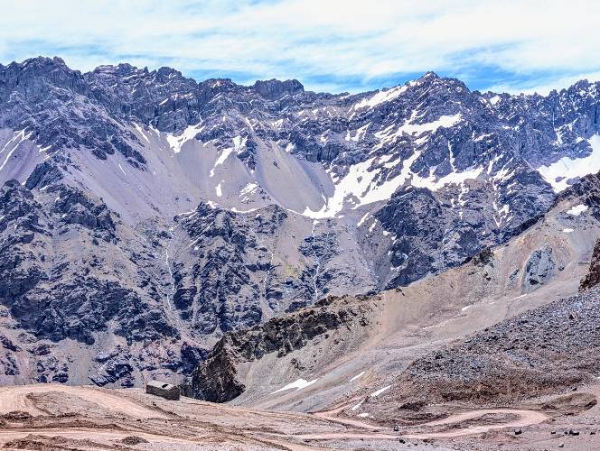
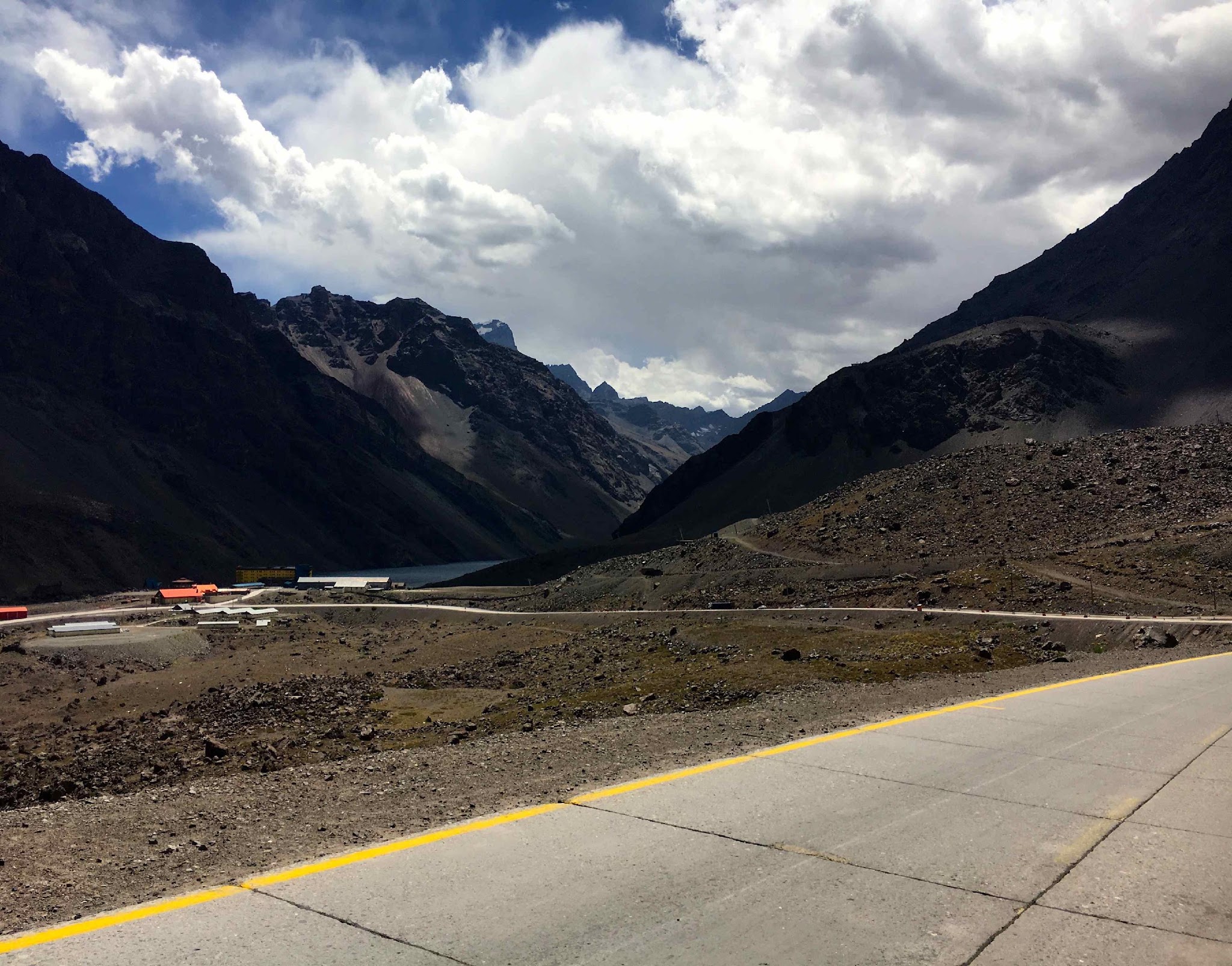
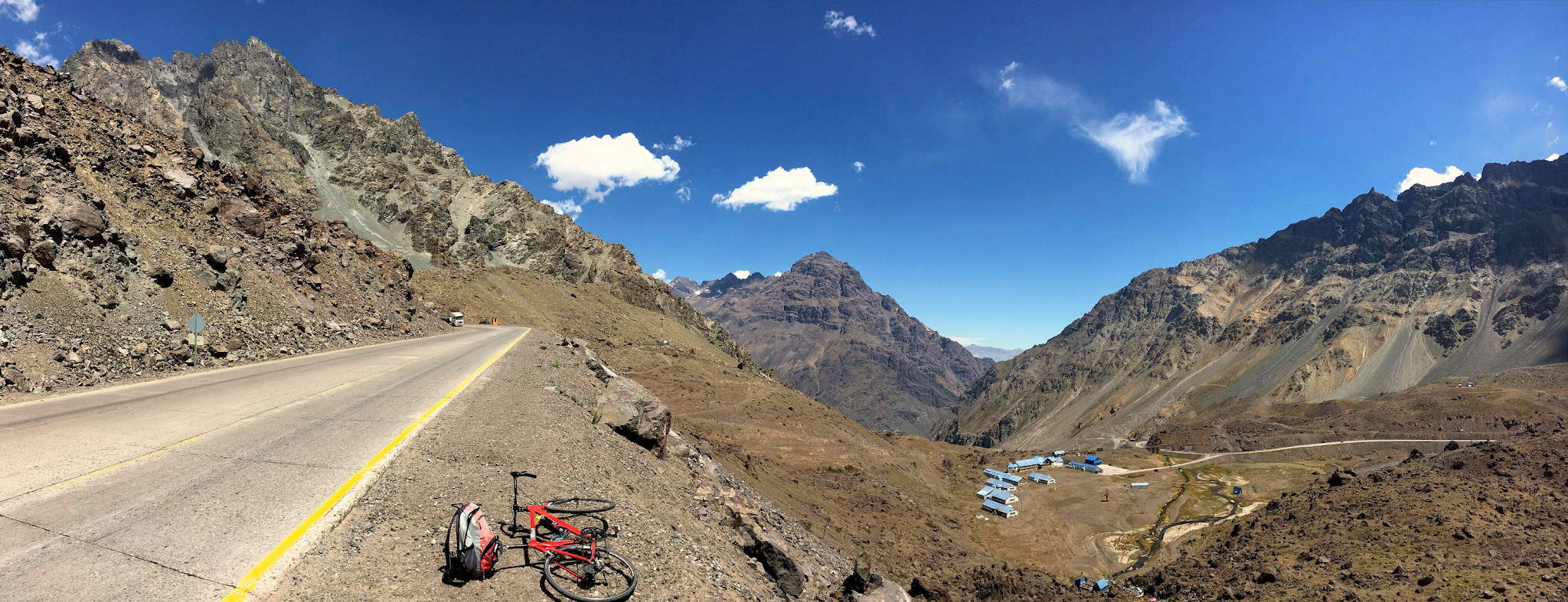
After the hairpins, the road climbs further, some scenic views as well (Photo 2), to the intersection leading to Portillo Ski Station (2800m alt.). No stopping for us as we have some 3 km remaining until the customs office (in the Andes, the customs-check points often are situated miles before the real geographical country border). Some road repair is being done  where the road is in bad condition (as a prelude of what is still to come). Again, we have this magnificent panoramic view of volcanic  shaped mountains, the Portillo Lake and our valley starting point now far below (Photo 3 and 4).


We are fortunate on our way up the mountain to pass customs uneventfully (not so lucky on the way down when we were delayed in spite of  never having put our wheels or feet in Argentina). This said, the frequency of control of tourists on the Andean passes seems variable and depends on the location and mood of the official on duty.

We’ve arrived at an altitude where one can feel the reduced oxygen level and it is important to pace ourselves so as to acclimate as much as possible on our long climb. The one advantage of the altitude is that it is cooler, some 15 Celsius (and we go faster in the thin air?? ). We also get the benefit of clouds forming overhead which offer welcome shade.

After passing customs we continue straight to the last gallery that we bypass. The roadway surface to this point is paved and in generally good condition except for the last kilometres. Vigilance is necessary, especially in the downhill because of irregular concrete slabs and holes.

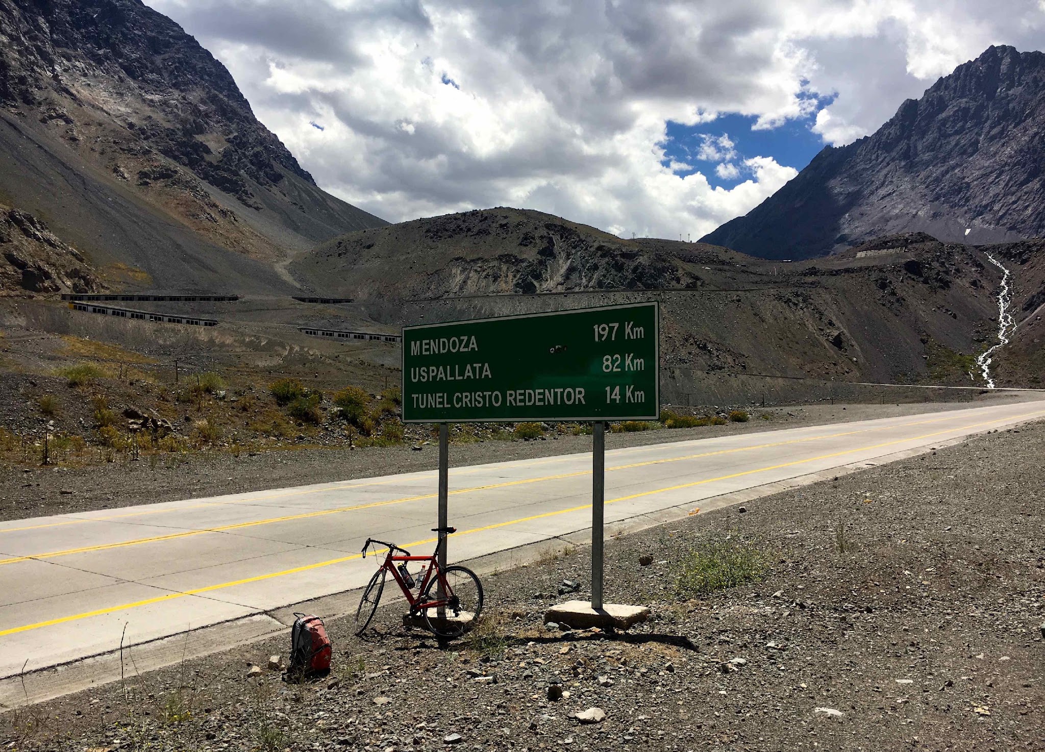
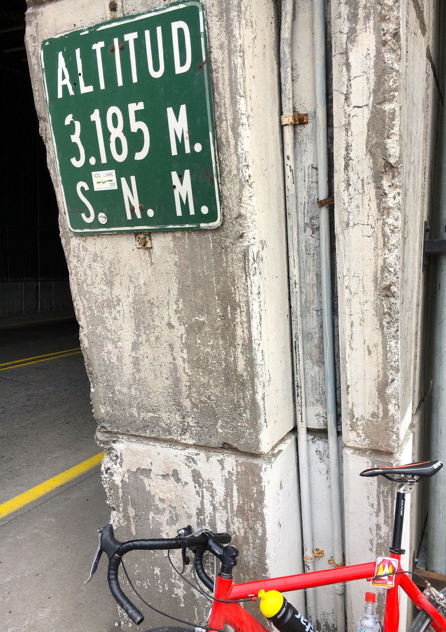
After the last gallery a couple of hundreds of meters are left to reach the entrance of the Cristo Redentor Tunnel. We stop for a photo with the 3185m altitude road sign.

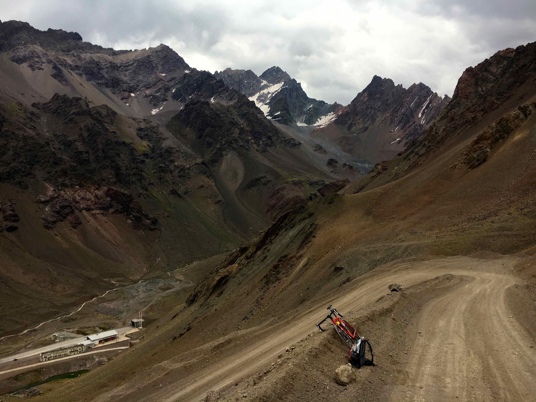
Since I have the time, energy and motivation left I decide to see if my road bike allows me to make my way up on the road old dirt road that leads to the Pass. Beware, the access to this dirt road is not marked or designated and not obvious(the start is situated about 200m before the tunnel on the south side of the main road).

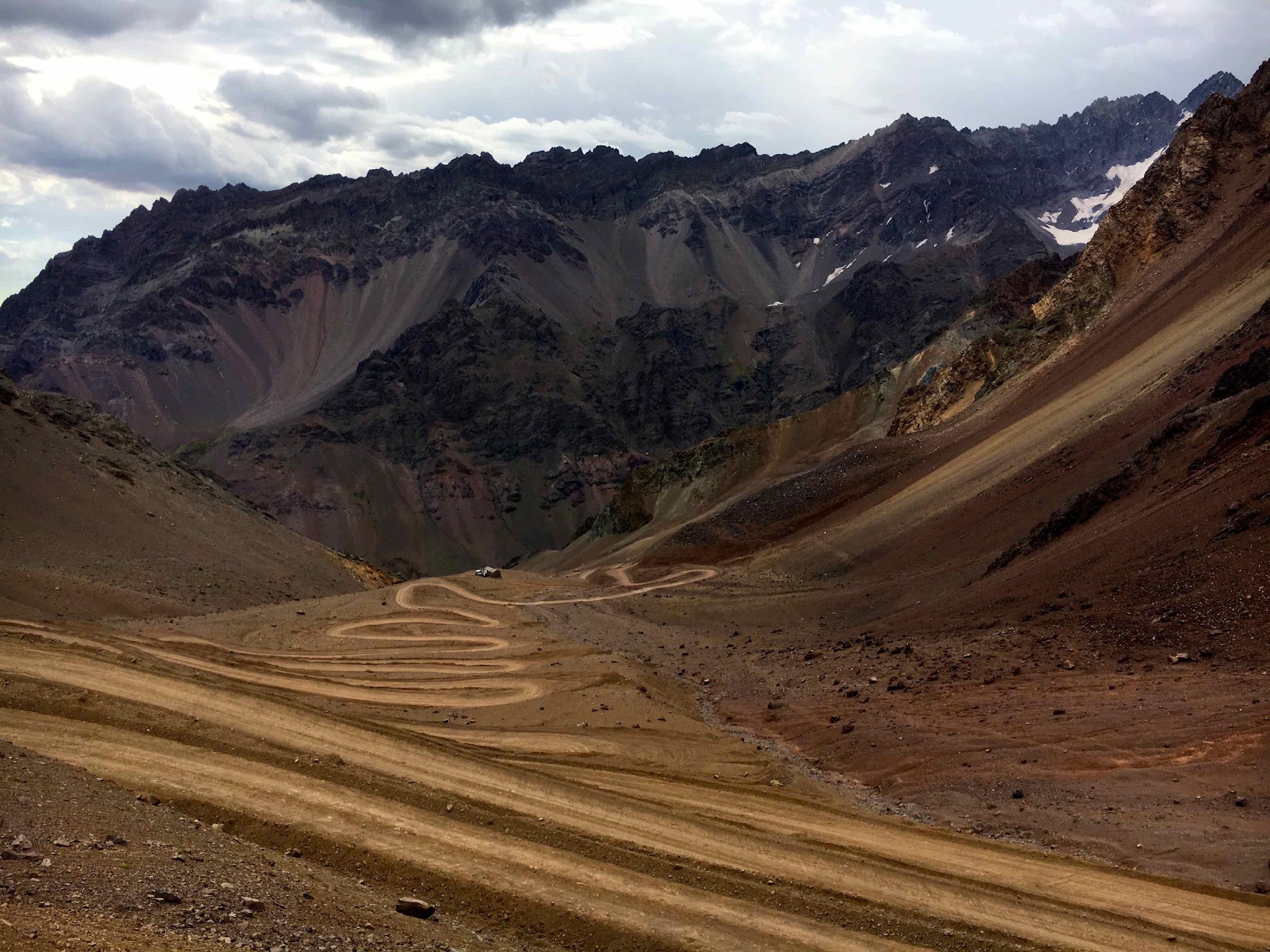
After some hesitation I locate this amazing dirt road that winds up to the sky (Photo 5 to 7).


 With about 600m of altitude gain in 8 km on dirt, I am anticipating quite a challenge, compounded by the inadequate rental bike I am riding [1]and the effects of the high altitude.. But the 25mm tires show their best side and the motivation is there . . . where there is a will . . . well . . . – we shall see! Regardless, ascending to 3,000+ meters here is a good test for my future plan to ascend Atacama, the highest paved pass in the Americas at 4,800m.

Overall, the dirt road would be manageable with a road bike if equipped with wider tires. But there are some parts, often in the steep bends where there is loose gravel and stones, where the rear wheel may slip and its difficult to keep our balance. A couple of times I am forced to dismount and briefly walk.

Surprisingly, I meet in the first kilometres a group of bikers (All terrain motorbikes, with Malaysian license plates!) of which some are unable to keep their bikes up in the narrow and steep curves. I passed the motorbikes (a first!) and later see them abandoning their effort to ascend this segment.However, a few cars, pickups and SUV did pass me on the way up.

Evidently, the higher the altitude, the faster the respiration. The climb is extremely taxing and the hairpins seem to go on for an eternity, but the sense of accomplishment upon sumitting makes it all worthwhile.

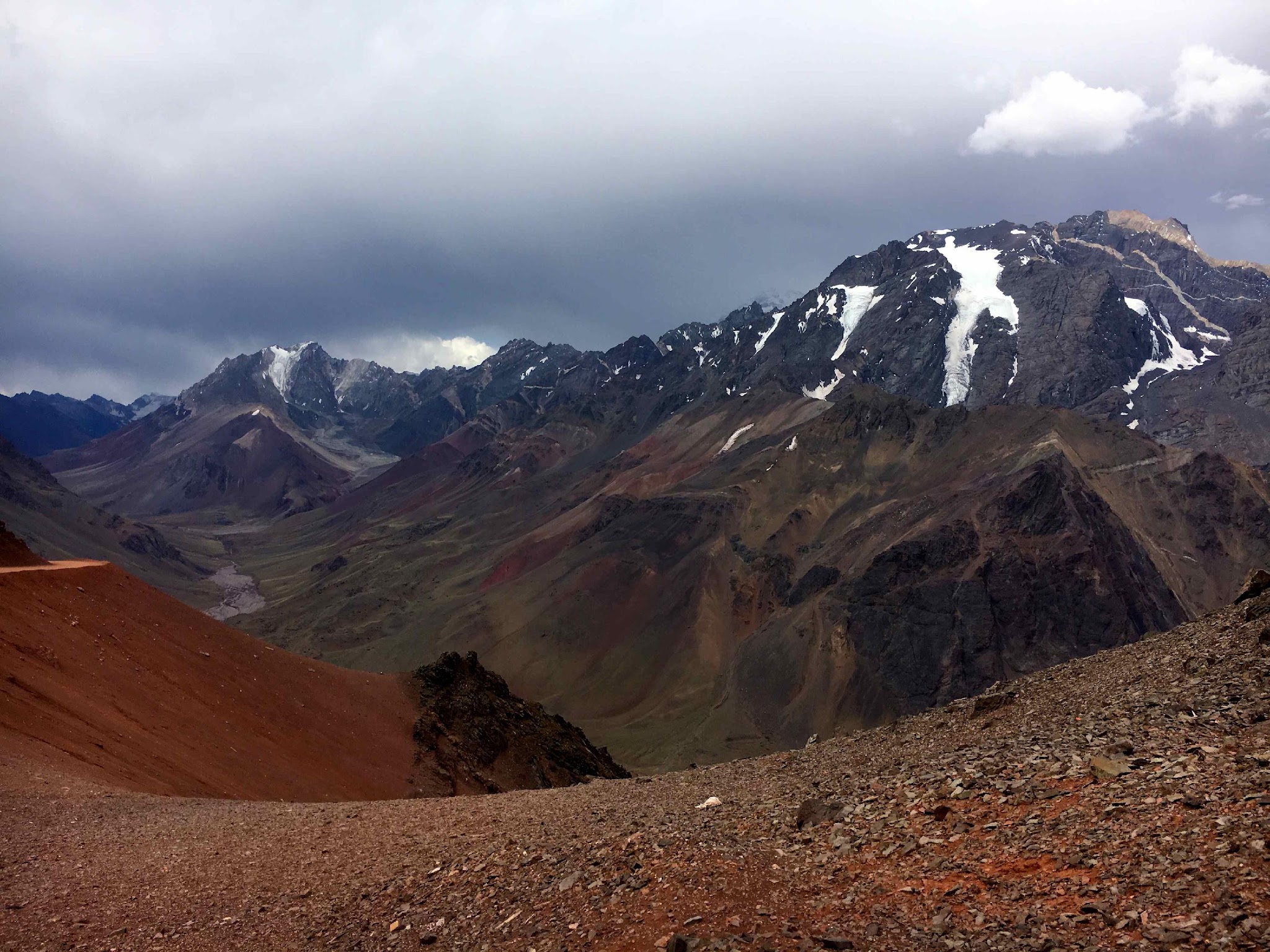
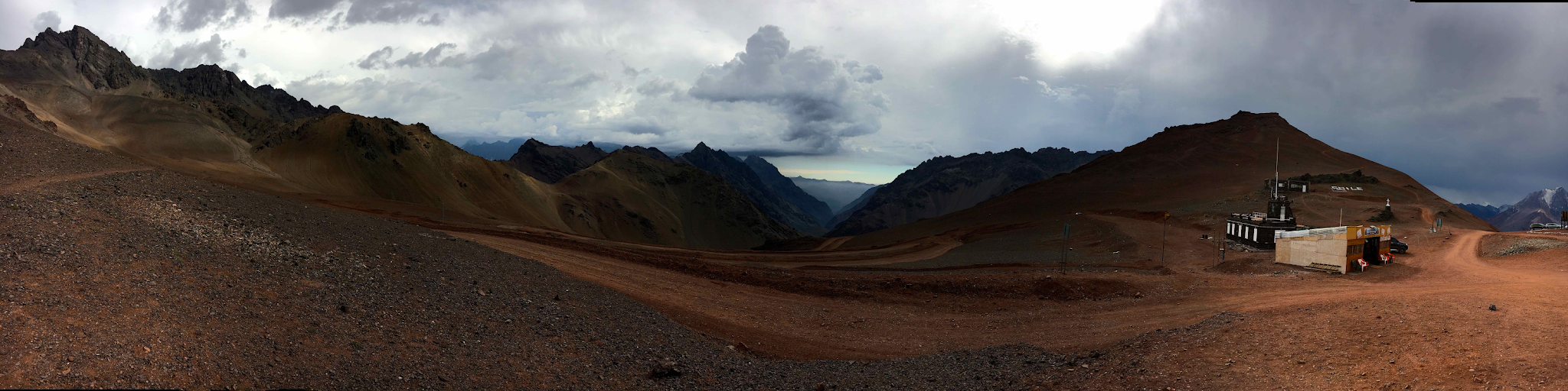
The pass is on the border of Chile and Argentina and from here we have exceptional views (north/northeast to Argentina and south/southeast back to Chile). Of the majestic Andes and the tip of Aconcagua,the highest mountain. The volcanic rocks vary in color from yellow to red and from grey to black, accented by almost vertical glaciers on the highest slopes, here and there with some splashes of green in an overall dry and barren landscape (Photos 8 to 11).

The pass is on the border of the two countries and there are some military buildings, a restaurant and a gift shop at the summit. At this hour in the end of the afternoon there are few visitors and in the distance some dark clouds are developing. A kind Chilean couple that passed with their pick up during the dirt climb offered me a lift which I politely [reluctantly??] declined. I did gratefully accept their offer of water and to photograph me at the summit, thus memorializing this magnificent climbing adventure.

As it is getting late, I briefly enjoy the magnificent summit view and do note that the road on the Argentinian side of the pass seems paved and in excellent shape, my route will take me back down the steep dirt old road and prayers that I do not puncture my tire(s) at this late hour and with bad weather approaching.

The descent is not fast on my rental bike but is blessedly uneventful, other than more of the wonderful views that I experienced many hours before on my ascent. . Some photo stops.

As I descent, the sky becomes black and lightning and thunder begin. The wind picks up and the temperature drops significantly and I begin for the first time (I think anyway) to experience some altitude sickness with the onset of headache and neck pain.

Over 50 hairpins in 8.5km (Stelvio has 48 in 17km)

After what seems (or really was) an eternity, I reach the paved roadway and descend to the customs office where I have a (welcome) delay.  It has begun to rain by now and I observe a beautiful rainbow highlighted against a black sky on the side of the mountain pass. As I finish my business at customs, the rain stops and I descend Just like if the rain had stopped at the customs. Now only the last section of downhill is left in the direction of a nice sunset.

Ard Oostra


[1] Note - the Argentinian side of the pass is better because there is no tunnel to bypass – that side is paved to the top.