6.9
PDI
4.1 mi
DISTANCE
1,273 ft
GAINED
5.8 %
AVG. GRADE
FULL CLIMB STATS
INTRO
This 4.1 mile bike climb is located in VT, USA. The average gradient is 5.8% and there is a total elevation gain of 1,273 ft, finishing at 1,879 ft.
Use the profile tool, route map, and weather forecast to conquer this cycling climb.
Use the profile tool, route map, and weather forecast to conquer this cycling climb.
PLAN YOUR ROUTE
This climb averages 0%. The steepest quarter mile of this climb is 0%. NaN miles of the climb is at or above 10% grade. The gradient on this climb is broken down as follows:
See more details and tools regarding this climb's grade via our interactive Profile Tool.
See more details and tools regarding this climb's grade via our interactive Profile Tool.
Information Not Available
If you have any information regarding this climb, we'd like to hear from you. Click the CONTRIBUTE button to share your thoughts with us.
Information Not Available
If you have any information regarding this climb, we'd like to hear from you. Click the CONTRIBUTE button to share your thoughts with us.
Before heading out on any cycling adventure check out our Things to Bring on a Cycling Trip and use our interactive check list to ensure you don't forget anything.
Information Not Available
If you have any information regarding this climb, we'd like to hear from you. Click the CONTRIBUTE button to share your thoughts with us.
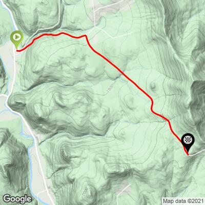
ROUTE MAP
MEMBER RATING
CURRENT WEATHER
PJAMM TRIPS ADVENTURE STARTER BUNDLES
Check out PJAMM Adventure's prepackaged (self-guided) cycling trips. They will help you plan, document and conquer your next adventure.
NEARBY CLIMBS (0) RADIAL PROXIMITY
FROM No Climbs Found
MEMBER REVIEWS & COMMENTS
Let us know what you thought of this climb. Signup for our FREE membership to write a review or post a comment.
Already have an account?
LOG IN HERE
Mikey62481
So i did both Rochester Gaps the same day, made for around 2,800 Ft of good climbing! This side is easier than gap east, but the Road quality is not so good on bethel mountain road after you turn right. The Best views are going down bethel mountain road near Rochester Gap Summit and going down the other side from the top of the gap from the summit point. At times while descending down bethel mountain road, the road quality is not good. This side is shadier than gap east. Not much in the way of views...I parked in Rochester in front of a church across from a park right near Bethel Mountain Road to do this climb.