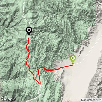
29.9
PDI
18.1 mi
DISTANCE
5,124 ft
GAINED
5.1 %
AVG. GRADE
FULL CLIMB STATS
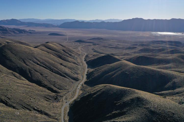
INTRO
An extremely remote section of the climb, but if you're after the US Top 100, sooner or later you've got to knock it off...
PLAN YOUR ROUTE
See more details and tools regarding this climb's grade via our interactive Profile Tool.
Note: Check weather conditions with the Inyo National Forest Service for each climb you intend to do and the Inyo County road conditions website before traveling to Owens Valley to cycle anytime after September or before June.
Information Not Available
If you have any information regarding this climb, we'd like to hear from you. Click the CONTRIBUTE button to share your thoughts with us.
Before heading out on any cycling adventure check out our Things to Bring on a Cycling Trip and use our interactive check list to ensure you don't forget anything.
We would suggest staying in Bishop at the Creekside Inn. Don't miss out on pastries at Schat's next to the Creekside Inn.
ROUTE MAP
MEMBER RATING
CURRENT WEATHER
PJAMM TRIPS ADVENTURE STARTER BUNDLES
Check out PJAMM Adventure's prepackaged (self-guided) cycling trips. They will help you plan, document and conquer your next adventure.
NEARBY CLIMBS (0) RADIAL PROXIMITY
FROM No Climbs Found
MEMBER REVIEWS & COMMENTS
Let us know what you thought of this climb. Signup for our FREE membership to write a review or post a comment.
Already have an account?
LOG IN HERE