![]()
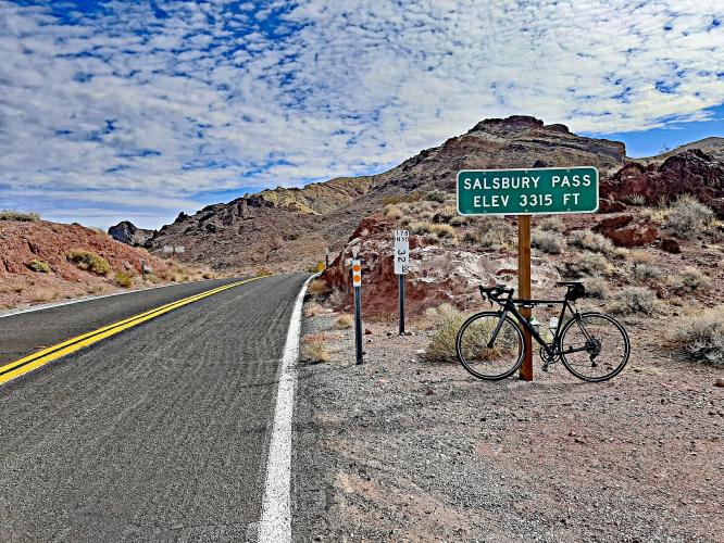
Cycling Salsberry Pass
Ride 16.5 miles gaining 3,619’ at 3.8% average grade (4.7% climb only)
Summary by PJAMM Ambassador Dan Razum, Campbell, CA, USA
![]()
This climb is on the southern end of Death Valley, 44 miles from Furnace Creek. We start at Ashford Mill Ruins, where there is a gravel parking area with a restroom but no water. Coming out of the parking area there is likely to be a headwind for the first couple of miles, as we travel along the valley floor on Badwater Road. As we start climbing out of the valley the
road becomes Jubilee Pass Road and the wind should dissipate somewhat.
![]()
![]()
There are some rocky hills, outcroppings and curves as we climb towards Jubilee Pass, which makes
interesting scenery. Eventually we reach Jubilee Pass and then there is about a mile of downhill
which allows us to recover a little bit.
![]()
![]()
~1 mile downhill.
When we resume climbing again we go around a mountain and then the landscape becomes more open and remains so until we reach the top of the climb. The scenery is deceptive because it looks almost level, but of course it isn't, we continue to climb. However, the gradient is slightly less in the second part, after Jubilee Pass, so the climbing is a little
bit easier. We begin to see some peaks off in the distance in front of us, which is where the pass is located. It's nice to be able to see our destination, but it's best not to focus on how slowly we approach the peaks, they seem to want to remain stubbornly in the distance!
![]()
The road is in good condition but there is no shoulder. However, this part of Death Valley has less
traffic than other parts so there are few vehicles and the ride feels safe. And like all roads in this
area, there is no shade unless you are lucky enough to get a few clouds in the sky. Even if the air
is cool (during winter months, for example) the sunlight is strong and can make you hot so it's always
a good idea to bring plenty of water.

 We've partnered with Sherpa-Map.com to bring you the best route planning tool. With a PRO Membership you can use this climb as a reference when creating your route.

