![]()
Cycling Hwy 49 (Bagby)
Ride 3.8 miles gaining 1,400’ at 7.1% average grade.
Photos and climb summary by PJAMM contributor Dan Razum, Campbell, CA.
The climb starts at the bridge over the Merced River. From the beginning of the climb we can see
the mountain we are about to climb and we can almost see the endpoint, although it is a little too far
away to make out clearly.
![]()
Start
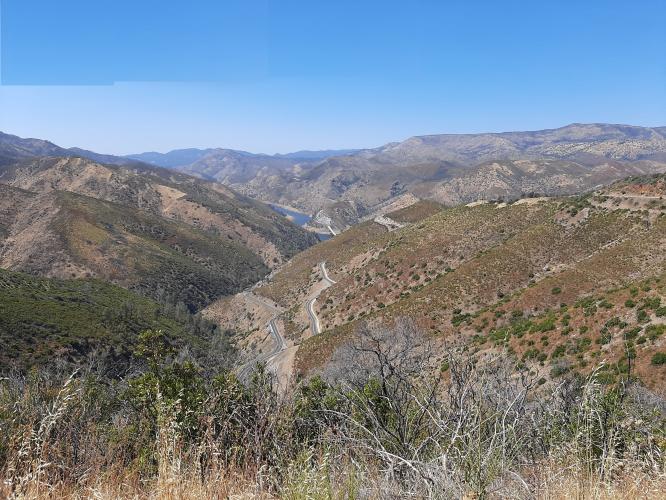
We start out heading south, away from the bridge. After about a mile and a half we come to a large hairpin
curve and we start heading north, which allows us to look back on the bridge where we started.
![]()
Bridge (start) upper middle of photo.
![]()
Hairpin #1
A little less than a mile later we arrive at a second large hairpin curve and we resume heading southwards. After
this second large curve we start to get several views of the mountains and road below.
![]()
![]()
Near the top we arrive at Fremont's Fort lookout with a very nice view, which makes the whole climb worthwhile. A short distance past the lookout is the top of the climb, although there is no view at the top, just a small parking area.
![]()
Just before the finish.
Historical Marker #5999 erected 1994
Inscription:
General John C. Fremont, 1813-1890. A noted military man, explorer, topographer, senator & businessman, Fremont was also a miner. He settled in Mariposa County living just outside Bear Valley.
He operated the Josephine, Pine Tree & Princeton mines and other claims. In 1858 he returned from his travels to operate his mines and found many had been “jumped.” In taking them back a feud developed with several groups, one being the “Hornitas League” which tried to seize one of his mines. After that incident a fort was built to defend the “only” access to the mines.
Afterward his battles were in the courtroom.
![]()
View back to the Merced River and start of the climb from the top.
![]()
Turnout at the right is the finish of the climb.
The road condition is very smooth and the lanes are wide but many parts don't have a shoulder. Instead, there is just a beveled curb with some gravel on the outside. But the traffic is light and the climb felt safe the whole way. The gradient is fairly uniform, so we can get into a good climbing rhythm but there is no shade, we are exposed to the sun the whole way.

 We've partnered with Sherpa-Map.com to bring you the best route planning tool. With a PRO Membership you can use this climb as a reference when creating your route.

