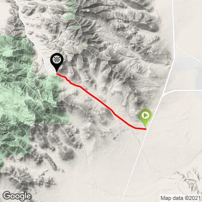
9.4
PDI
8.2 mi
DISTANCE
1,942 ft
GAINED
4.5 %
AVG. GRADE
FULL CLIMB STATS
INTRO
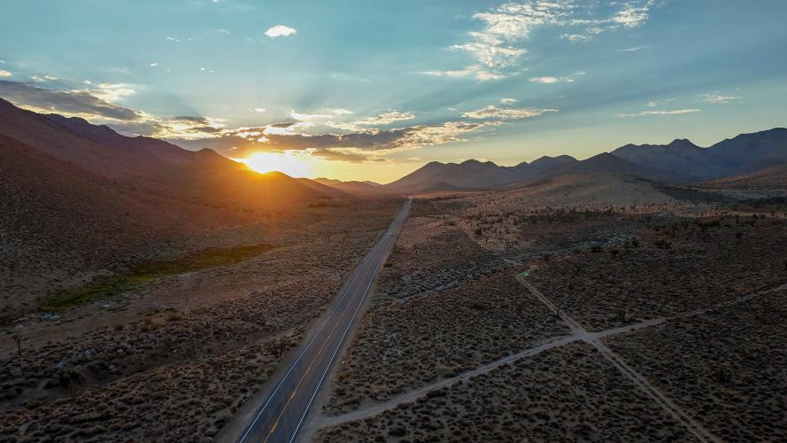
Walker Pass sits almost a mile high in the southern Sierra Nevada, where the high desert meets the mountains along Highway 178. It’s a long, straight road through a dramatic, wide-open desert landscape, meaning no shade, plenty of wind, Joshua trees, and huge skies in every direction.
While the West side has one interesting hairpin curve, this side is, quite literally, pretty straighforward.
PLAN YOUR ROUTE
Like many desert climbs on gently sloping vistas, this one will have you working hard while still feeling like you're not climbing.
This climb averages 4.5%. The steepest quarter mile of this climb is 6.5% and steepest continuous mile is 6.1%. 0 miles of the climb is at or above 10% grade. The gradient on this climb is broken down as follows: 5.7 miles (69.7%) at 0-5% grade; 2.5 miles (30.3%) at 5-10% grade;
See more details and tools regarding this climb's grade via our interactive Profile Tool.
Parking:
Abundant places to pull off and park.
Roadway:
Very well maintained
Traffic:
Very minimal but cars moving at highway speeds. Despite exceptional visibility, we recommend using a rear tail light for extra safety.
No provisions for miles.
Before heading out on any cycling adventure check out our Things to Bring on a Cycling Trip and use our interactive check list to ensure you don't forget anything.
This climb starts at the Freeman Junction/California Historical Landmark No. 766, which includes a little memorial.
The Pacific Crest Trail crosses here, making it a key resupply and transition point for thru-hikers moving between desert and alpine terrain. There's a campground at the top of the pass.
ROUTE MAP
MEMBER RATING
CURRENT WEATHER
PJAMM TRIPS ADVENTURE STARTER BUNDLES
Check out PJAMM Adventure's prepackaged (self-guided) cycling trips. They will help you plan, document and conquer your next adventure.
Death Valley
United States (CA)
21 ROUTES
34 POIs
ROUTE STATS (TOTAL)
553.3
mi
DISTANCE
55,125
ft
ELEV. GAIN
Owens Valley: Bishop
United States (CA)
19 ROUTES
26 POIs
ROUTE STATS (TOTAL)
268.3
mi
DISTANCE
55,531
ft
ELEV. GAIN
NEARBY CLIMBS (0) RADIAL PROXIMITY
FROM No Climbs Found
MEMBER REVIEWS & COMMENTS
Let us know what you thought of this climb. Signup for our FREE membership to write a review or post a comment.
Already have an account?
LOG IN HERE