Page Contributor(s): Dennis M, San Jose, CA, USA.
INTRO
PLAN YOUR ROUTE
 We've partnered with Sherpa-Map.com to bring you the best route planning tool. With a PRO Membership you can use this climb as a reference when creating your route.
 ROUTE MAP


Page Contributor(s): Dennis M, San Jose, CA, USA.
 We've partnered with Sherpa-Map.com to bring you the best route planning tool. With a PRO Membership you can use this climb as a reference when creating your route.
Cycling Highway 33 to Pine Creek Summit -- the longest bike climb in California.
Ride 33.3 miles gaining 6,710’ at 3.5% average grade.
This climb is along Highway 33 for the first 27 miles. The highway runs at 45 to 55 mph, but the ride felt safe to us. The final six miles are along a fun and narrow remote paved roadway, completing the longest climb in California (and the sixth longest in the US).
Note (warning?): There is no water or any provisions for the last 30 miles of the ride.
The following ride summary by PJAMM’s Dennis M. of San Jose, California:
Climb begins as the road ramps up just past the bridge over the Ventura River north of Ojai.
The climb begins just north of Ojai (pop. 7,461 in 2010; nickname Shangri-La) in Ventura County by riding north up Highway 33. We enter the Los Padres National Forest (1,900,800 acres, est. 1936) and in the first mile of the climb ride in the San Emigdio Mountains of the Pacific Coast Range as we climb towards Pine Mountain Summit on Highway 33.
PJAMM Adventure App showing gradient and route progress during our climb.
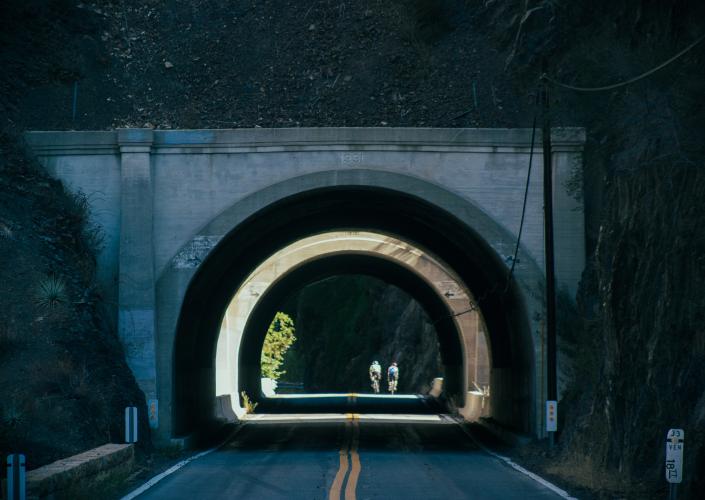
Tunnel at mile 2.6
There are two short tunnels in the first four miles of the climb.
Enter the national forest at mile three.
Water wall and tunnel #2 at mile 3.4.
Visit the Wheeler Gorge Visitor Center at mile 3.7.
Pine Mountain Inn at mile 23.4 -- closed as of December 2020.
Built between 1938 and 1940.
The Pine Mountain Inn was purchased by Tom and Janet Wolf in 1976 and operated it as a restaurant and bar for 25 years until it was closed due to Tom’s heart attack and later prevented from reopening because it was a “non-conforming use” when the Wolf’s attempted to reopen in 2007.
Brush and some rock formations at the lower segment of the climb.
Aerial view of two giant hairpins, ~mile 9.
The first 27 miles of the climb wind from Ojai up through Los Padres National Forest with wide shoulders and a gradual grade. You reach Pine Mountain Summit, and then take a single lane access road to Reyes Peak (which ends in a dirt road).
Top left & center photo:
Turn onto the very narrow and remote Pine Mountain Ridge Road at mile 30.
The final six miles of the climb average 6.5%. At about a mile up Pine Mountain Ridge Road we begin the steepest mile of the climb at 11% average grade.
Finish 33 miles later at 7,140’.
The upper steep section was dirty and single lane, but seems to have been paved in the past five years or so -- some other online ride reports said it was pretty terrible but I did not find it so. You should also be cognizant of two-way traffic. Pine Mountain Ridge Road is a true single lane road -- nice bike path, narrow road.
PJAMM Note: The road was paved and in excellent condition, albeit with some roadway debris, as of December 2020.
Park in Ojai five miles southeast of climb start.