![]()
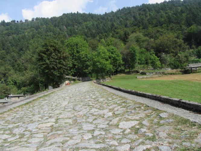
As the #16 ranked road bike climb in Italy, this one is quite a challenge. What it gives up in the breathtaking views offered by many of the other Top 25 Italian Climbs, it makes up for in difficulty! It even gives us a bit of the Flanders Cobblestones up the hill a bit.
![]()
![IMG_8838.JPG]()
![]()
Although our views to the south and west as we climb are brief, they are well worth the effort to enjoy as we make our way up this extremely challenging climb. At mile 1.8 turn right onto an unnamed road (but marked by a “Prato Maslino” sign) and leave the views of Berbenno and its mountains to the south behind us in favor of a VERY STEEP road (the climb past the turnoff is 5 miles, 3,477’/1,060m at an astonishing 13.1% average grade - the first 1.8 miles/2.9 kilometers is a mere 8.7% ![Smiley]() . The last 1.5 miles / 2.4 km ramps up to a quad-busting 14.5%.
. The last 1.5 miles / 2.4 km ramps up to a quad-busting 14.5%.
![IMG_8821.JPG]()
Swithbacks: By our count there are 41 switchbacks on this short climb.
Giro History: Not applicable - the Giro d’Italia has never included Prato Maslino as a finish (it dead ends at the top, so if ever included, it will necessarily be a stage finish).
![]()
![]()
Roadway condition and traffic: The roadway gets rougher as we climb and there are a couple brief stretches of gravel towards the top, but the ascent is easily managed on a road bike. Beware on the descent for loose gravel, jarring bumps (nicely cushioned gloves are recommended for the descent) and the very steep grades, particularly at the switchbacks. Traffic is very mild and not a problem - this is a safe ride.
![]()
![]()
Steepest kilometer begins at km 8.3 (29% is too high - likely about 20%)
CALDENNO FROM BERBENNO
Fabio Ursi: Hello, I'm glad that you have interest in this climb. This climb is little known but very respectable! The climb starts from the main road, turn left, just hard .. 3 km you pass in Polaggia, then many tight corners. Climb quickly .. halfway there the toughest stretch (about 400m) and from here the climb is slightly less steep, but it is always difficult. "The road is paved up to" meadows gaggio ", then cemented to" Isio grass "(cin passable road bikes), from here until Caldenno gravel (not passable by road bike).
Eros Forenzi - Hello John. The road is paved for 10 km from Berbenno until Prati Gaggio, 9% slope. Then cemented for 3 km up to 10-12% in Prato Isio. Then continue for another 4 km dirt until Caldenno, gradient 8-10%. I go right tomorrow, if not raining and not snowing :-) OK with road biking, relationship 34x25 or 34x28 in hard pieces (there are 3-4 of about 300 meters each, where the slope is 15-17%). You can continue on the concrete road for another 4km. " / And, the follow up from Eros when we asked whether you can use a road bike to get to Caldenno: "Hello John. Asphalt up to Prati Gaggio, then cement to Prato Isio, then dirt road until Caldenno. With road bike it is OK to Prato Isio. Until Caldenno you can do with road bikes but be careful (the slope is not high, the wheels do not slip but there is a high risk of puncture because of sharp stones. We need reinforced tires, Vredestein Fortezza es) "
Giuliano Gusmeroli - "The road over Berbenno is unique and you can continue until you reach the Isio grass and Caldenno where you will find the pasture and you can continue only on foot but you abundantly exceeded 1750m above sea level." Strava segment: http://www.strava.com/activities/375997358

 We've partnered with Sherpa-Map.com to bring you the best route planning tool. With a PRO Membership you can use this climb as a reference when creating your route.

