
18.8
PDI
5.9 mi
DISTANCE
2,614 ft
GAINED
8.3 %
AVG. GRADE
FULL CLIMB STATS
INTRO
Col de Bagargi (Bagargui in French, and signed for cyclists as the Col d'Iraty) climbs 9.4 km (5.9 mi) from the valley below Larrau, gaining 797 m (2,614 ft) at an 8.3% average from 517 m (1,697 ft) to 1298 m (4,260 ft) at the Chalets d'Iraty. The D19 links Larrau, the Basque village at the foot of the Port de Larrau, with the high Iraty plateau and its huge beech forest.
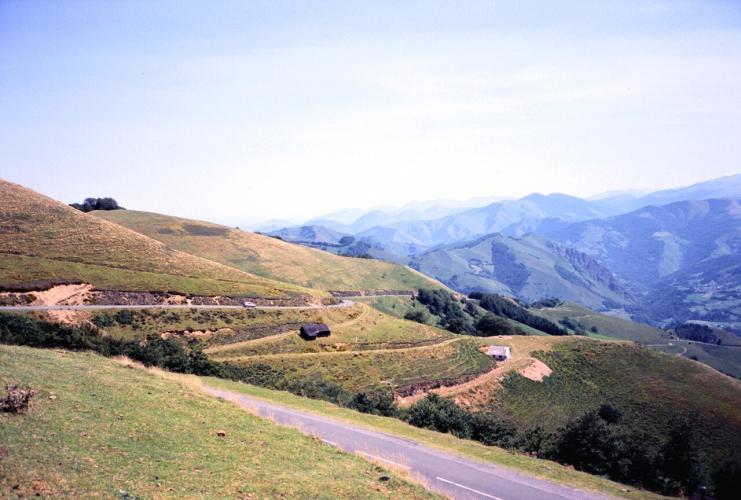
The average is misleading. The first 4 km (2.5 mi) are gentle, following a stream up the valley at 3-6%, and then the road turns uphill and doesn't let go: the next 5 km (3.1 mi) average 11.5%, with a kilometer at 14.0% and a 500 m stretch at 15.2%. It's one of the steepest pass roads in the Pyrenees, and the reward is a wide-open finish on high pasture, with views back toward the Pic d'Orhi and the Pic d'Anie.
The Tour de France came this way on Stage 16 of the 2003 race, from Pau to Bayonne. Tyler Hamilton, riding with a collarbone broken in a crash during the first week, attacked on the Bagargi, crossed the summit alone and held his lead through the fog over the Burdincurutcheta to win the stage in Bayonne.
PLAN YOUR ROUTE
 We've partnered with Sherpa-Map.com to bring you the best route planning tool. With a PRO Membership you can use this climb as a reference when creating your route.
Col de Bagargi climbs 9.4 km (5.9 mi) from 517 m (1,697 ft) to 1298 m (4,260 ft), gaining 797 m (2,614 ft) at an 8.3% average - but almost all of that climbing is packed into the second half. The first 4 km (2.5 mi) along the valley run at roughly 5-6%, easing to about 3% in the fourth kilometer.
Then the wall begins. The steepest 5 km average 11.5%, the steepest 2 km 13.0% and the steepest kilometer 14.0%; the steepest mile averages 13.4%, the steepest 500 m 15.2% and the steepest 100 yards 16.6%. From the 4 km mark, the kilometers read roughly 9.8%, 13.9%, 12.0%, 11.2% and 10.3%, before the last few hundred meters ease to about 3% at the col.
Roadway: The D19 is paved the entire way, but it's narrow, very steep and winding, and rider reports on the surface are mixed - some describe the steep section as rough and bumpy, so take the descent carefully. Livestock graze the open upper slopes, and riders report droppings on the road after rain. At around 1300 m (4,265 ft), the upper road can see snow and ice outside summer, so check the Pyrénées-Atlantiques road information before an early- or late-season ride.
Traffic: Light on weekdays. Riders report much busier weekends, with motorcyclists in particular, since the Chalets d'Iraty and the forest are a popular day trip.
Parking: The practical base is Larrau itself - park in the village (covered on our Port de Larrau page) and ride about 2 km (1.2 mi) down the D19 to the start. At the top, the Chalets d'Iraty, with a reception, shop and restaurant, are the obvious meeting point for a support car.
Provisions: Fill up in Larrau before you start - there's nothing on the climb itself until the Chalets d'Iraty at the col, which have a restaurant and a grocery selling local products, open year-round (the reception and grocery are open daily from 8:30 am to 5:30 pm).
Gear: Gear for the wall, not the average: 5 km (3.1 mi) at 11.5% with a kilometer at 14% calls for a compact crankset and a 32-34 tooth low cog. Weather on the Iraty plateau changes quickly - riders report rain, fog, heat and cold here - so pack a rain or wind layer for the steep descent.
Before heading out on any cycling adventure check out our Things to Bring on a Cycling Trip and use our interactive check list to ensure you don't forget anything.
Just below the col, the D19 passes the Col d'Organbidexka, where the LPO, France's bird protection league, has counted migrating birds every year since 1979. From 15 July to 15 November, volunteers record thousands of birds crossing the Pyrenees - raptors such as black kites and honey buzzards, plus black storks, cranes and pigeons - and visitors are welcome free of charge from sunrise to sunset. The observation site is reached on foot from the Chalets d'Iraty.
The Chalets d'Iraty themselves are a small mountain hamlet of 35 chalets, walkers' gîtes and a natural campsite spread between 1300 and 1500 m (4,265-4,921 ft), surrounded by the Iraty beech forest, one of the largest in Europe, and they make a good overnight base for riding the plateau. From the col, the road continues west toward the Col de Burdincurutcheta and Saint-Jean-Pied-de-Port - the direction the 2003 Tour took toward Bayonne. For Larrau village, the Holzarte footbridge and the Port de Larrau, see our Port de Larrau page. See other climbs nearby, or build a custom route from here, with our Routes in the Area tool.
For those looking to stay in the area we would recommend the Pyrenees Cycling Lodge. Located in the beautiful medieval village of Saint Savin and hosted by Mark & Niamh, the Lodge is run by cyclists for cyclists. It is a great location for any cycling adventure in the Pyrenees with several renowned climbs within 100km of the property and 6 Tour de France climbs within 15km. Visit their website or contact them directly at pyreneescyclinglodge@gmail.com .
ROUTE MAP

MEMBER RATING
CURRENT WEATHER
PJAMM TRIPS ADVENTURE STARTER BUNDLES
Check out PJAMM Adventure's prepackaged (self-guided) cycling trips. They will help you plan, document and conquer your next adventure.
NEARBY CLIMBS (0) RADIAL PROXIMITY
FROM No Climbs Found
MEMBER REVIEWS & COMMENTS
Let us know what you thought of this climb. Signup for our FREE membership to write a review or post a comment.
Already have an account?
LOG IN HERE
