![Cycling Lake Tahoe, California/Nevada PJAMM Cyclist rides on two-lane mountain roadway surrounded by alpine forest; sign for Emerald Bay State Park]()
Cycling around beautiful Lake Tahoe
Ride 74.3 miles gaining 4,050’.
![Cycling Lake Tahoe, California/Nevada photo collage, PJAMM Cycling's John Johnson on Lake Tahoe ride; sign for Emerald Bay State Park, John stands with bike in front of deep blue Lake Tahoe, john stands with bike in front of Harvey's]()
Climb summary by PJAMM Cycling’s John Johnson.
Lake Tahoe is one of the jewels of California and Nevada - there are not many more beautiful places in California and Nevada than Lake Tahoe.
I have done the loop three times and consider it a bucket list ride for anyone willing to travel for their cycling experience. This is a very mild ride in relation to grade - the steepest quarter-mile segment is only 8%, located just after the second big hairpin leading to Emerald Bay.
Some of the scenes along the way:
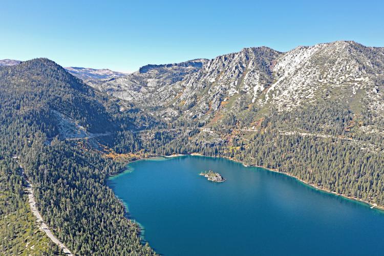
![Cycling Lake Tahoe, California/Nevada view looking down on Emerald Bay]()
My favorite spot on the ride is Emerald Bay, located at the southern tip of the lake.
![Cycling Lake Tahoe, California/Nevada photo collage shows scenes at Emerald Bay: bike parked against railing overlooking deep blue lake surrounded by alpine forest]()
Scenes around Emerald Bay.
You will encounter the following points of interest as you ride clockwise around the lake, beginning at Emerald Bay. We recommend doing the ride clockwise so that the lake is closest to you as you ride.
![Cycling Lake Tahoe, California/Nevada photo collage, signs for Emerald Bay State Park; old stone building at state park, view from the beach]()
Viking Holm is just past Emerald Bay on the right - ride down about half a mile to the lake from here.
![Cycling Lake Tahoe, California/Nevada bike parked in front of Homewood resort]()
Homewood is between Emerald Bay and Tahoe City.
![Cycling Lake Tahoe, California/Nevada bike parked on Fanny Bridge]()
Fanny Bridge crosses over the Truckee River as you enter Tahoe City from the south.
![Cycling Lake Tahoe, California/Nevada PJAMM Cyclist John Johnson stands with bike in front of Harvey's; crossing the state line into Nevada]()
We enter Nevada at State Line just past Kings Beach at the north end of the lake.
![Cycling Lake Tahoe, California/Nevada sign for Incline Village]()
Incline Village and the road to Mt. Rose is a few miles past Stateline at the northern part of the lake.
![Cycling Lake Tahoe, California/Nevada informational signs at Memorial Point Scenic Overlook]()
Memorial Point Scenic Overlook is past Incline Village at the northeastern part of the lake.
![Cycling Lake Tahoe, California/Nevada bike parked on roadside at start of four mile descent]()
Start of the four mile descent towards South Lake Tahoe on Highway 50.
This is my least favorite part of the ride.
![Cycling Lake Tahoe, California/Nevada group of PJAMM Cyclists pose with bikes at base of ski runs on snowy hillsides]()
If you don’t want to ski or board, bring your bike . . .

 We've partnered with Sherpa-Map.com to bring you the best route planning tool. With a PRO Membership you can use this climb as a reference when creating your route.

