![]()
Cycling SR 259 North
Ride 4.2 miles gaining 1,199’ at 5.4% average grade.
Climb summary by PJAMM ambassador Dan Razum, San Jose, California.
We started the ride at Big Cedar, which in the map looks like it might be a small town, but in reality it is just the intersection of Route 259 and Route 63.
![]()
Perhaps there was a small town here at one time, but not any more. There is about a half mile of flat road
after Big Cedar before the climb actually starts.
![]()
However, it is worthwile to start at Big Cedar because there is a small memorial there to John F Kennedy, apparently President Kennedy dedicated this road in 1961. Interesting little factoid that makes the ride more memorable.
![]()
After crossing the Kiamichi River the climb starts. It is a fairly uniform gradient and not too steep, despite a sign proclaiming otherwise. The road is in good condition with a good shoulder at the beginning. Partway up the shoulder disappears, but it is replaced with an extra climbing lane for traffic, so it's just as good, plenty of space. We didn't encounter much traffic along the way, so no concerns there. The climbing lane doesn't last all the way until the top, it ends just after the 180 degree turn around mile 2.5, but the shoulder comes back, so it's ok.
![]()
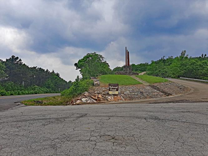
After the 180 degree turn, we have a few glimpses of the valley below through the trees and we can even see the intersection at Big Cedar. Then it's a straight ride to the top, where we arrive at Three Sticks Monument. The monument is interesting but there are no restrooms or water, although there is a large parking area.
![]()
![]()
Three Sticks Monument - these sticks symbolize land, wood and water.
The monument is at the top and finish of the climb and recognizes U.S. Sentors Robert Kerr, U.S. Sen. Mike Monroney, U.S. Rep. Carl Albert, Gov. Raymond Gary and R.G. Miller for their contributions to conservation in southeastern Oklahoma

 We've partnered with Sherpa-Map.com to bring you the best route planning tool. With a PRO Membership you can use this climb as a reference when creating your route.

